File:頭城濱海森林公園.jpg
Jump to navigation
Jump to search

Size of this preview: 800 × 533 pixels. Other resolutions: 320 × 213 pixels | 640 × 427 pixels | 1,024 × 683 pixels | 1,280 × 853 pixels | 2,560 × 1,707 pixels | 7,488 × 4,992 pixels.
Original file (7,488 × 4,992 pixels, file size: 20.31 MB, MIME type: image/jpeg)
Captions
Captions
Add a one-line explanation of what this file represents
Summary
[edit]
| Description |
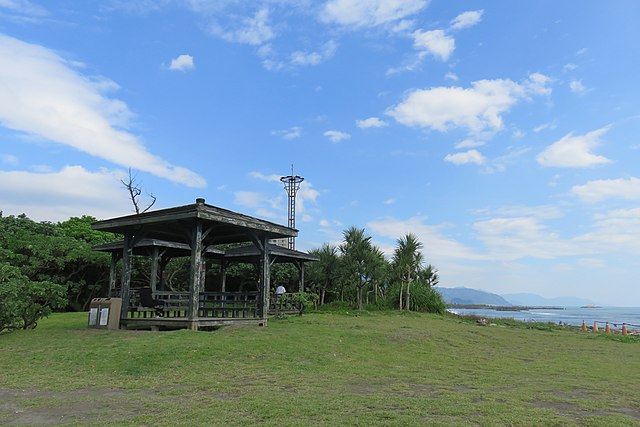
中文(臺灣):頭城濱海森林公園前身為頭城海水浴場,位於頭城鎮大坑里海濱,頭城車站東南方2公里處。其沙平灣緩、背山面水,1958年6月闢為海水浴場,夏日弄潮遊客極多,是早年北台灣重要的戲水勝地,亦是宜蘭縣內重點風景區之一。近年因氣候變遷以及人類不當活動之影響,海岸續遭侵蝕,廣闊的沙灘逐漸流失;後又因興建烏石港,產生突堤效應,港堤攔住了漂沙,更加速了沙灘的消逝,讓原本長達200公尺的美麗海灘,如今只能擱置防止海岸侵蝕的大石頭與消波塊,短短十數年的時間,海水浴場功能消失殆盡。宜蘭縣政府為顧及遊客水上活動之安全,於民國2002年間即公告禁止海域活動,又於2014年斥資修復損壞的堤岸,並於隔年將頭城海水浴場改名為頭城濱海森林公園,開放陸域供遊客休憩和露營,嚴禁遊客戲水、游泳及從事水上活動。園內存有一座緊鄰海岸五層樓高、中間為鏤空的八角瞭望台廢墟,由於外表斑駁的建築搭配紅色磚牆特別的美,每層樓的窗格還能眺望藍天大海,以及風情萬種的龜山島,如今卻意外成為了網路熱門的打卡景點。 |
| Source | https://memory.culture.tw/Home/Detail?Id=282837&IndexCode=Culture_Place |
| Author | 創作者:莊文生;鄭文嵐;謝淑娟。貢獻者:宜蘭縣政府文化局 |
| Camera location | | View this and other nearby images on: OpenStreetMap |
|---|
Licensing
[edit]
This file is licensed under the Creative Commons Attribution 3.0 Taiwan license.
- You are free:
- to share – to copy, distribute and transmit the work
- to remix – to adapt the work
- Under the following conditions:
- attribution – You must give appropriate credit, provide a link to the license, and indicate if changes were made. You may do so in any reasonable manner, but not in any way that suggests the licensor endorses you or your use.

File history
Click on a date/time to view the file as it appeared at that time.
| Date/Time | Thumbnail | Dimensions | User | Comment | |
|---|---|---|---|---|---|
| current | 08:12, 13 April 2022 | | 7,488 × 4,992 (20.31 MB) | Muyueh Bot (talk | contribs) |
You cannot overwrite this file.
File usage on Commons
There are no pages that use this file.