File:廍後仁愛新村.jpg
Jump to navigation
Jump to search
Size of this preview: 800 × 533 pixels. Other resolutions: 320 × 213 pixels | 640 × 427 pixels | 1,024 × 683 pixels | 1,280 × 853 pixels | 2,560 × 1,707 pixels | 3,744 × 2,496 pixels.
Original file (3,744 × 2,496 pixels, file size: 4.56 MB, MIME type: image/jpeg)
Captions
Captions
Add a one-line explanation of what this file represents
Summary
[edit]
| Description |
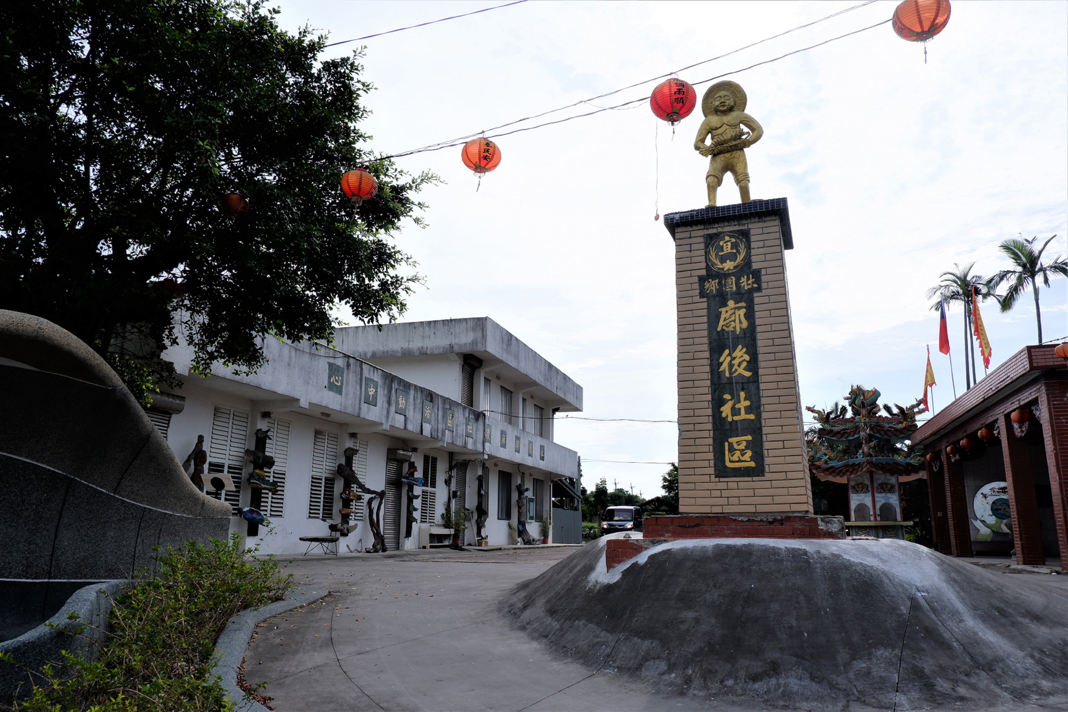
中文(臺灣): 廍後因位於製糖蔗廍後方,而得名,據村中耆老認為,當時的蔗廍便是蘭陽溪對岸五結鄉茅仔寮的蔗廍。1978年3月行政區域調整,壯圍鄉由17村併為13村,廍後村幅員不變,但因「廍」字未錄於辭典中,為方便記錄變更為東港。1955年(民44) 國民政府宣布大陳島撤退,當年4月依照職業分配將39戶234名以漁業維生的大陳人移居廍後仁愛新村。1981年因在地青壯年移出外地就業,陸續將父母接往同住,也因交通、生活不便仁愛新村逐漸沒落,空屋成群。2016年只剩四戶大陳人居住,另有非大陳人約五戶遷進新村。
相傳漁師爺是漁民捕撈拾獲的神像,於是就在海邊建廟祭祀。原在大陳島五虎山濱海處,可聞濤聲,以「漁廟濤聲」之名列為大陳十景之一的漁師廟,隨著大陳人撤退來台攜帶神像,移居廍後仁愛新村,於當地集資建廟,以供奉原先島上祭拜的漁師爺神像。每年農曆十月十三日「漁師廟」漁師大神誕辰日,此地大陳新村原住戶與散居各地的以從事捕魚的大陳人,都會攜老扶幼地趕回來祭拜。 |
| Source | https://memory.culture.tw/Home/Detail?Id=602928&IndexCode=Culture_Place |
| Author | 創作者:莊文生;鐘碧娟;徐永昶。貢獻者:宜蘭縣政府文化局 |
| Camera location | | View this and other nearby images on: OpenStreetMap |
|---|
Licensing
[edit]
This file is licensed under the Creative Commons Attribution 3.0 Taiwan license.
- You are free:
- to share – to copy, distribute and transmit the work
- to remix – to adapt the work
- Under the following conditions:
- attribution – You must give appropriate credit, provide a link to the license, and indicate if changes were made. You may do so in any reasonable manner, but not in any way that suggests the licensor endorses you or your use.

File history
Click on a date/time to view the file as it appeared at that time.
| Date/Time | Thumbnail | Dimensions | User | Comment | |
|---|---|---|---|---|---|
| current | 04:45, 14 April 2022 | | 3,744 × 2,496 (4.56 MB) | Muyueh Bot (talk | contribs) |
You cannot overwrite this file.
File usage on Commons
There are no pages that use this file.