File:府城橫貫線路線圖.svg
Jump to navigation
Jump to search

Size of this PNG preview of this SVG file: 800 × 200 pixels. Other resolutions: 320 × 80 pixels | 640 × 160 pixels | 1,024 × 256 pixels | 1,280 × 320 pixels | 2,560 × 640 pixels | 2,268 × 567 pixels.
Original file (SVG file, nominally 2,268 × 567 pixels, file size: 155 KB)
Captions
Captions
Add a one-line explanation of what this file represents
Summary
[edit]| Description |
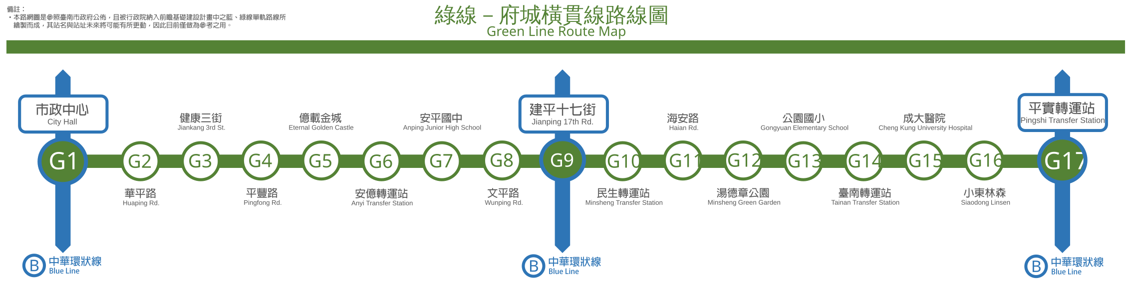
中文(臺灣):依台南市政府公告、行政院納入前瞻基礎建設計畫之臺南先進運輸系統綠線(府城橫貫線)所繪製而成之路線圖。 |
| Date | |
| Source | Own work |
| Author | Lovetainan |
| SVG development |

Licensing
[edit]
I, the copyright holder of this work, hereby publish it under the following license:
This file is licensed under the Creative Commons Attribution-Share Alike 4.0 International license.
- You are free:
- to share – to copy, distribute and transmit the work
- to remix – to adapt the work
- Under the following conditions:
- attribution – You must give appropriate credit, provide a link to the license, and indicate if changes were made. You may do so in any reasonable manner, but not in any way that suggests the licensor endorses you or your use.
- share alike – If you remix, transform, or build upon the material, you must distribute your contributions under the same or compatible license as the original.
File history
Click on a date/time to view the file as it appeared at that time.
| Date/Time | Thumbnail | Dimensions | User | Comment | |
|---|---|---|---|---|---|
| current | 22:09, 30 January 2019 | 2,268 × 567 (155 KB) | JoKalliauer (talk | contribs) | https://commons.wikimedia.org/wiki/File:%E5%BA%9C%E5%9F%8E%E6%A9%AB%E8%B2%AB%E7%B7%9A%E8%B7%AF%E7%B7%9A%E5%9C%96.pdf https://commons.wikimedia.org/wiki/Commons:Graphics_village_pump#Help_needed_with_Category:Files_with_inappropriate_PDF_format |
You cannot overwrite this file.
File usage on Commons
The following 4 pages use this file: