File:小村寿太郎侯誕生の地 - panoramio.jpg
Jump to navigation
Jump to search

Size of this preview: 800 × 527 pixels. Other resolutions: 320 × 211 pixels | 640 × 421 pixels | 1,024 × 674 pixels | 1,280 × 843 pixels | 2,560 × 1,686 pixels | 3,139 × 2,067 pixels.
Original file (3,139 × 2,067 pixels, file size: 889 KB, MIME type: image/jpeg)
Captions
Captions
Add a one-line explanation of what this file represents
Summary
[edit]
| Description |
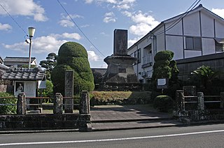
日本語: 小村寿太郎侯誕生の地。 |
| Date | Taken on 31 December 2007 |
| Source | https://web.archive.org/web/20161011103910/http://www.panoramio.com/photo/7385083 |
| Author | z tanuki |
| Camera location | | View this and other nearby images on: OpenStreetMap |
|---|
Licensing
[edit]
This file is licensed under the Creative Commons Attribution 3.0 Unported license.
Attribution: z tanuki
- You are free:
- to share – to copy, distribute and transmit the work
- to remix – to adapt the work
- Under the following conditions:
- attribution – You must give appropriate credit, provide a link to the license, and indicate if changes were made. You may do so in any reasonable manner, but not in any way that suggests the licensor endorses you or your use.
| This image, which was originally posted to Panoramio, was automatically reviewed on 24 January 2016 by Panoramio upload bot, who confirmed that it was available on Panoramio under the above license on that date. |
File history
Click on a date/time to view the file as it appeared at that time.
| Date/Time | Thumbnail | Dimensions | User | Comment | |
|---|---|---|---|---|---|
| current | 02:43, 24 January 2016 | | 3,139 × 2,067 (889 KB) | Panoramio upload bot (talk | contribs) | {{Information |description=小村寿太郎侯誕生の地 |date={{Taken on|2007-12-31}} |source=http://www.panoramio.com/photo/7385083 |author=[http://www.panoramio.com/user/238971?with_photo_id=7385083 z tanuki] |permission={{cc-by-3.0|z tanuki}} {{Pa... |
You cannot overwrite this file.
File usage on Commons
There are no pages that use this file.
File usage on other wikis
The following other wikis use this file:
- Usage on ja.wikipedia.org