File:安东坑道 - Andong Tunnel - 2016.04 - panoramio.jpg
Jump to navigation
Jump to search
Size of this preview: 800 × 600 pixels. Other resolutions: 320 × 240 pixels | 640 × 480 pixels | 1,024 × 768 pixels | 1,280 × 960 pixels | 2,560 × 1,920 pixels | 4,565 × 3,423 pixels.
Original file (4,565 × 3,423 pixels, file size: 2.56 MB, MIME type: image/jpeg)
Captions
Captions
Add a one-line explanation of what this file represents
Summary
[edit]
| Description |
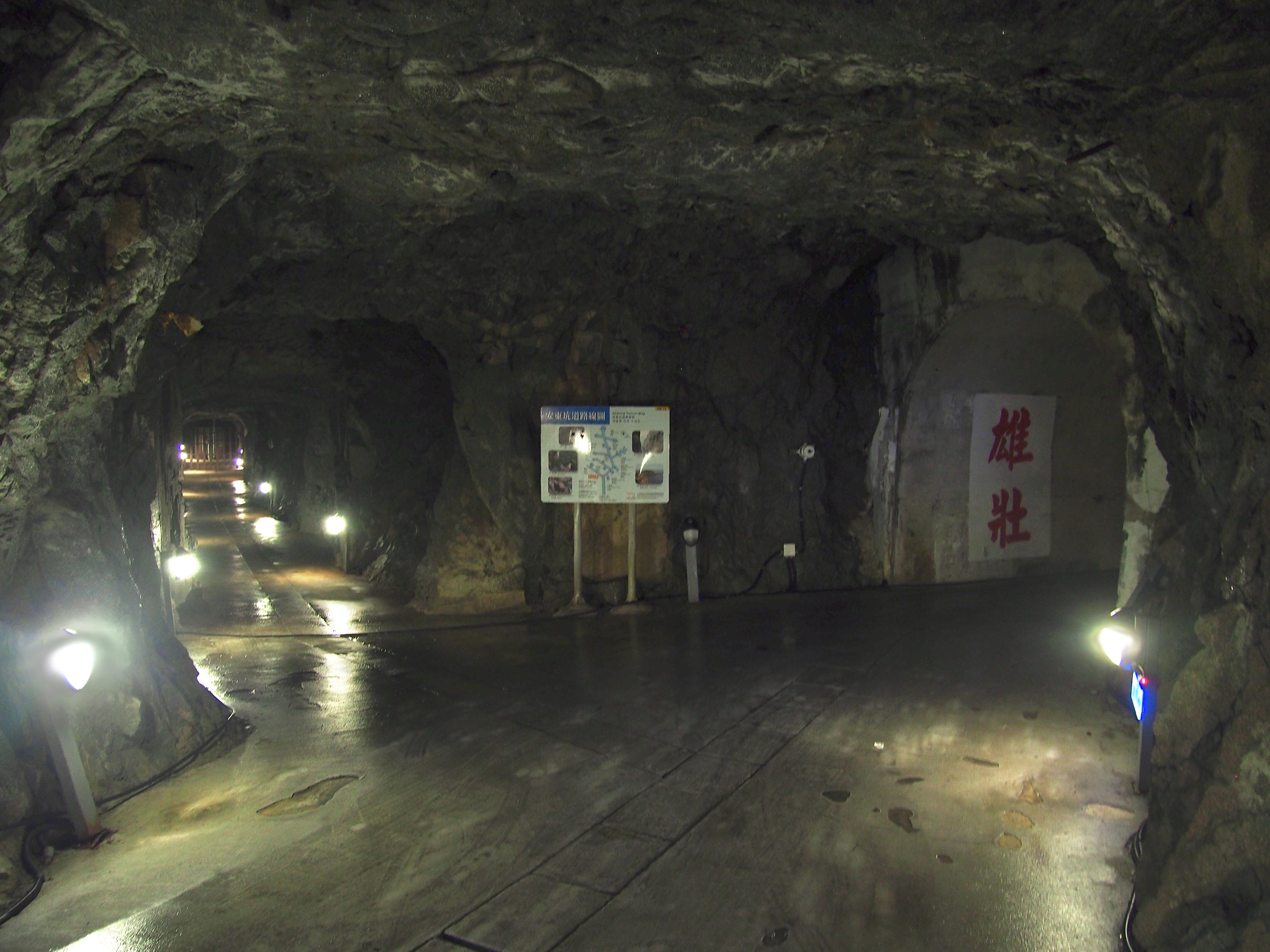
中文(臺灣):安東坑道路線圖 - 民國105年4月 中文(简体):安东坑道 - 2016.04 English: Andong Tunnel - 2016.04 The Andong Tunnel (Chinese: 安東坑道; pinyin: Āndōng Kēngdào) is a tunnel in Dongyin Township, Lienchiang County, Taiwan. It was constructed in the 1970s by the Republic of China Armed Forces, during the cold war with the People's Liberation Army. |
||
| Date | Taken on 2 April 2016 | ||
| Source | https://web.archive.org/web/20161031223023/http://www.panoramio.com/photo/129874136 | ||
| Author | Chen Huang | ||
| Permission (Reusing this file) |
This file is licensed under the Creative Commons Attribution 3.0 Unported license. Attribution: Chen Huang
|
||
| Panoramio Tags | 馬祖 - Matsu Islands |
| Camera location | | View this and other nearby images on: OpenStreetMap |
|---|
File history
Click on a date/time to view the file as it appeared at that time.
| Date/Time | Thumbnail | Dimensions | User | Comment | |
|---|---|---|---|---|---|
| current | 02:29, 14 August 2021 | | 4,565 × 3,423 (2.56 MB) | R8cocin8 (talk | contribs) | adjusted exposure |
| 05:03, 5 July 2017 |  | 4,565 × 3,423 (1.18 MB) | Panoramio upload bot (talk | contribs) | == {{int:filedesc}} == {{Information |description=安东坑道 - Andong Tunnel - 2016.04 |date={{Taken on|2016-04-02}} |source=http://www.panoramio.com/photo/129874136 |author=[http://www.panoramio.com/user/5226993?with_photo_id=129874136 Chen Huang] |... |
You cannot overwrite this file.
File usage on Commons
The following page uses this file:
File usage on other wikis
The following other wikis use this file:
- Usage on de.wikipedia.org
- Usage on en.wikipedia.org
- Usage on en.wikivoyage.org
- Usage on fr.wikipedia.org
- Usage on www.wikidata.org
- Usage on zh.wikipedia.org