File:大竹工作站.jpg
Jump to navigation
Jump to search

Size of this preview: 800 × 533 pixels. Other resolutions: 320 × 213 pixels | 640 × 427 pixels | 1,024 × 683 pixels | 1,280 × 853 pixels | 2,560 × 1,706 pixels | 3,500 × 2,333 pixels.
Original file (3,500 × 2,333 pixels, file size: 789 KB, MIME type: image/jpeg)
Captions
Captions
Add a one-line explanation of what this file represents
Summary
[edit]
| Description |
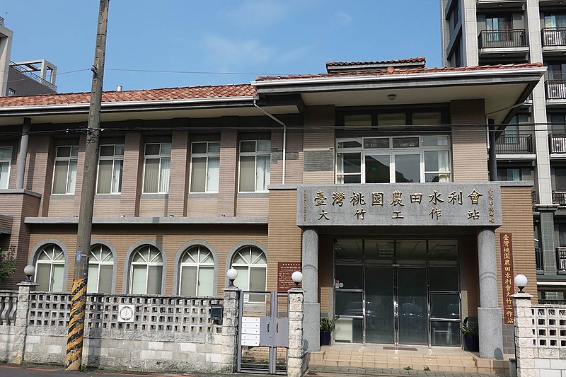
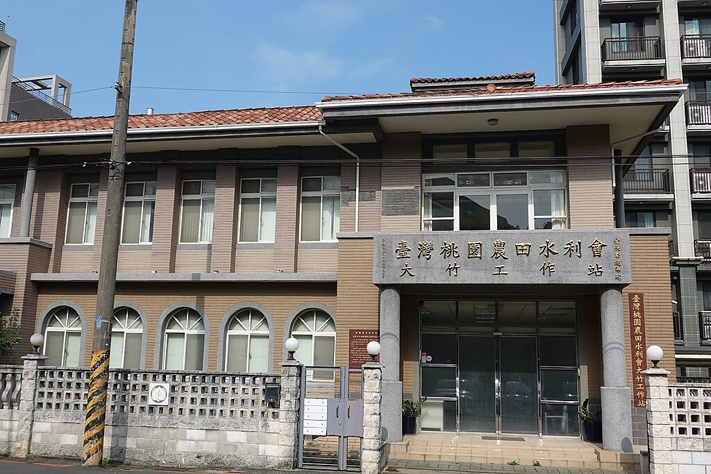
中文(臺灣):在桃園大圳灌溉系統建設之後,為了便利桃園大圳第2支線所屬灌溉設施的管理和灌溉用水調配,於是設立了大竹工作站。 大正13年(1924)桃園大圳組合成立大竹監視所。民國37年(1948)改為大竹管理站。民國45年(1956)改為現在大竹工作站,延續迄今。 工作站設立之初,原以桃園水利會的自有地建造日式木造平房;民國63年(1974)改建為二層混凝土鋼筋房屋,建地約500平方公尺,建築170平方公尺的二樓房舍,一樓為辦公室,二樓為員工宿舍。民國78年(1989)工作站原先轄管坑子口分站撤銷,改隸桃園站管理。因原有辦公室不敷使用,為方便會員洽公,決定建設新的工作站大樓。民國105年(2006)3月31日開工,隔年3月6日竣工,並於106年(2007)7月20日搬遷至桃園縣蘆竹市中福村中興四街50號,新站基地面積1045平方公尺,總樓地板面積486.8平方公尺、建蔽率22.69%、容積率43.02%的地上二層建物,一樓為辦公室,二樓為會議室及員工宿舍。 大竹工作站初設時,管理桃園大圳二支線貯水池計40口,河水堰19座,灌溉面積4、062公頃;1974年,中正機場設立,大竹工作站被徵收800公頃;1989年為管理方便,原本轄管的坑子口分站436公頃,編入桃園工作站。目前本站貯水池有30口,重要河水堰有15座,轄站設35個水利小組,灌溉面積約2,539公頃。 |
| Source | https://memory.culture.tw/Home/Detail?Id=177437&IndexCode=Culture_Place |
| Author | 創作者:林煒舒。貢獻者:桃園市政府 |
| Camera location | | View this and other nearby images on: OpenStreetMap |
|---|
Licensing
[edit]
This file is licensed under the Creative Commons Attribution 3.0 Taiwan license.
- You are free:
- to share – to copy, distribute and transmit the work
- to remix – to adapt the work
- Under the following conditions:
- attribution – You must give appropriate credit, provide a link to the license, and indicate if changes were made. You may do so in any reasonable manner, but not in any way that suggests the licensor endorses you or your use.

File history
Click on a date/time to view the file as it appeared at that time.
| Date/Time | Thumbnail | Dimensions | User | Comment | |
|---|---|---|---|---|---|
| current | 06:01, 13 April 2022 | | 3,500 × 2,333 (789 KB) | Muyueh Bot (talk | contribs) |
You cannot overwrite this file.
File usage on Commons
There are no pages that use this file.