File:充館圳.jpg
Jump to navigation
Jump to search
Size of this preview: 800 × 569 pixels. Other resolutions: 320 × 228 pixels | 640 × 455 pixels | 1,024 × 729 pixels | 1,280 × 911 pixels | 2,560 × 1,821 pixels | 3,508 × 2,496 pixels.
Original file (3,508 × 2,496 pixels, file size: 6.22 MB, MIME type: image/jpeg)
Captions
Captions
Add a one-line explanation of what this file represents
Summary
[edit]
| Description |
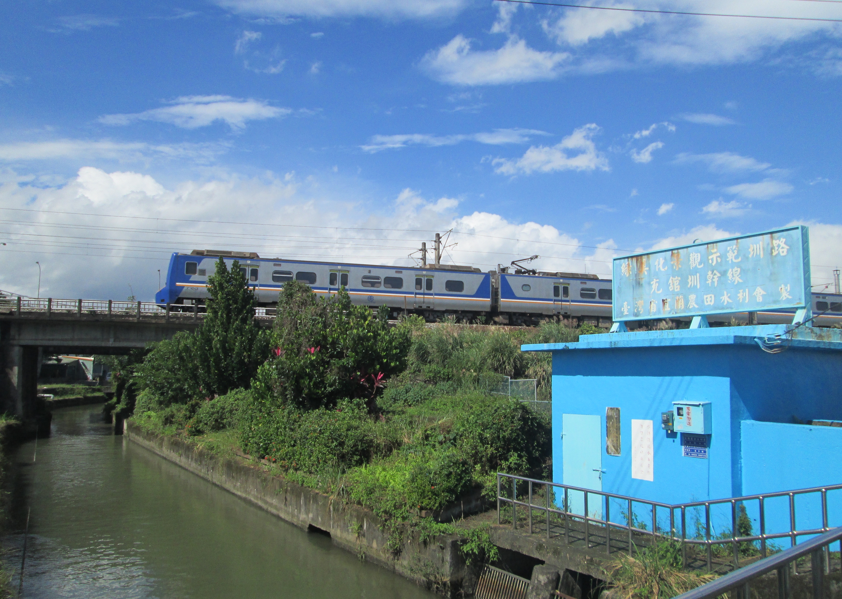
中文(臺灣): 「充館圳」是「充公圳」和「公館圳」的合併。充公圳原稱金佃安、金和安或五間圳,清道光年間由楊石頭之先人所開。光緒初年因圳路毀損無力修復,遭佃人控告判為佃圳,楊氏再上訴台北衙門,經裁斷充公為仰山書院所有而成為官圳,故稱「充公圳」。
「公館圳」則為1899年地主林本源所開,灌溉民壯圍及七張地區。兩圳皆取源於宜蘭河。1907年二圳合併稱「充館圳」,後有鑑於圳頭常因宜蘭河氾濫而受損,乃著手進行改善計畫;1915年在礁溪庄辛仔罕地方合建一圳頭水門,將二圳分道而流,左折為「充公圳」,直流為「公館圳」。1916年完工後,此區水利得到改善。 1928年因防止蘭陽溪水患,於宜蘭河上游處築員山堤防,致充館圳取水量銳減,影響千餘公頃農地。1951年改在宜蘭橋下游建攔河堰,作為圳水之渠首,農業用水趨而穩定。但由於在橋下建攔河堰,使宜蘭河床因而提高約四米,導致今日流水斷面不足,目前拆除舊宜蘭橋,再建加高之新橋。 |
| Source | https://memory.culture.tw/Home/Detail?Id=602941&IndexCode=Culture_Place |
| Author | 創作者:莊文生;鐘碧娟;謝淑娟。貢獻者:宜蘭縣政府文化局 |
| Camera location | | View this and other nearby images on: OpenStreetMap |
|---|
Licensing
[edit]
This file is licensed under the Creative Commons Attribution 3.0 Taiwan license.
- You are free:
- to share – to copy, distribute and transmit the work
- to remix – to adapt the work
- Under the following conditions:
- attribution – You must give appropriate credit, provide a link to the license, and indicate if changes were made. You may do so in any reasonable manner, but not in any way that suggests the licensor endorses you or your use.


|
This file, which was originally posted to an external website, has not yet been reviewed by an administrator or reviewer to confirm that the above license is valid. See Category:License review needed for further instructions.
|
File history
Click on a date/time to view the file as it appeared at that time.
| Date/Time | Thumbnail | Dimensions | User | Comment | |
|---|---|---|---|---|---|
| current | 04:47, 14 April 2022 | | 3,508 × 2,496 (6.22 MB) | Muyueh Bot (talk | contribs) |
You cannot overwrite this file.
File usage on Commons
There are no pages that use this file.