File:俯瞰松潘 - Overlook of Songpan County - 2011.10 - panoramio.jpg
Jump to navigation
Jump to search

Size of this preview: 800 × 261 pixels. Other resolutions: 320 × 104 pixels | 640 × 209 pixels | 1,024 × 334 pixels | 1,280 × 417 pixels | 5,341 × 1,742 pixels.
Original file (5,341 × 1,742 pixels, file size: 1.62 MB, MIME type: image/jpeg)
Captions
Captions
Add a one-line explanation of what this file represents
Summary
[edit]
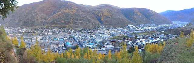
| Description | 俯瞰松潘 - Overlook of Songpan County - 2011.10 | ||
| Date | Taken on 20 October 2011 | ||
| Source | https://web.archive.org/web/20161020150019/http://www.panoramio.com/photo/63283974 | ||
| Author | rheins | ||
| Permission (Reusing this file) |
This file is licensed under the Creative Commons Attribution 3.0 Unported license. Attribution: rheins
|
||
| Tags (from Panoramio photo page) | Aba, 松潘 - Songpan County |
| Camera location | | View this and other nearby images on: OpenStreetMap |
|---|
File history
Click on a date/time to view the file as it appeared at that time.
| Date/Time | Thumbnail | Dimensions | User | Comment | |
|---|---|---|---|---|---|
| current | 16:09, 19 December 2016 | 5,341 × 1,742 (1.62 MB) | Panoramio upload bot (talk | contribs) | == {{int:filedesc}} == {{Information |description=俯瞰松潘 - Overlook of Songpan County - 2011.10 |date={{Taken on|2011-10-20}} |source=http://www.panoramio.com/photo/63283974 |author=[http://www.panoramio.com/user/5226993?with_photo_id=63283974 rh... |
You cannot overwrite this file.
File usage on Commons
The following 2 pages use this file:
File usage on other wikis
The following other wikis use this file:
- Usage on ca.wikipedia.org
- Usage on en.wikivoyage.org
- Usage on es.wikipedia.org
- Usage on he.wikivoyage.org
- Usage on incubator.wikimedia.org
- Usage on nn.wikipedia.org
- Usage on ru.wikipedia.org
- Usage on www.wikidata.org
- Usage on zh.wikivoyage.org