File:中央構造線溝口露頭 01.jpg
Jump to navigation
Jump to search

Size of this preview: 400 × 600 pixels. Other resolutions: 160 × 240 pixels | 320 × 480 pixels | 512 × 768 pixels | 1,080 × 1,620 pixels.
Original file (1,080 × 1,620 pixels, file size: 708 KB, MIME type: image/jpeg)
Captions
Captions
Add a one-line explanation of what this file represents
Summary
[edit]
| Description |
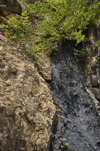
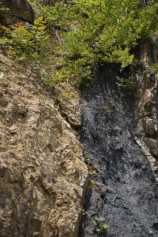
日本語: 長野県伊那市長谷村にある中央構造線溝口露頭。
南アルプスジオパークのジオサイトに指定されている。 断層が露出しており、中央構造線の様子を観察することができる。 |
| Date | |
| Source | Own work |
| Author | At1973 |
| Camera location | | View this and other nearby images on: OpenStreetMap |
|---|
Licensing
[edit]
I, the copyright holder of this work, hereby publish it under the following license:
This file is licensed under the Creative Commons Attribution-Share Alike 4.0 International license.
- You are free:
- to share – to copy, distribute and transmit the work
- to remix – to adapt the work
- Under the following conditions:
- attribution – You must give appropriate credit, provide a link to the license, and indicate if changes were made. You may do so in any reasonable manner, but not in any way that suggests the licensor endorses you or your use.
- share alike – If you remix, transform, or build upon the material, you must distribute your contributions under the same or compatible license as the original.
File history
Click on a date/time to view the file as it appeared at that time.
| Date/Time | Thumbnail | Dimensions | User | Comment | |
|---|---|---|---|---|---|
| current | 06:04, 8 May 2016 | | 1,080 × 1,620 (708 KB) | At1973 (talk | contribs) | User created page with UploadWizard |
You cannot overwrite this file.
File usage on Commons
The following page uses this file:
- File:TakatoBurari20160508-001.jpeg (file redirect)
File usage on other wikis
The following other wikis use this file:
- Usage on ja.wikipedia.org