File:『船津胎内神社』 富士山パワースポットの洞窟胎内巡り - panoramio.jpg
Jump to navigation
Jump to search

Size of this preview: 800 × 450 pixels. Other resolutions: 320 × 180 pixels | 640 × 360 pixels | 1,024 × 576 pixels | 1,280 × 719 pixels | 2,560 × 1,439 pixels | 4,896 × 2,752 pixels.
Original file (4,896 × 2,752 pixels, file size: 7.4 MB, MIME type: image/jpeg)
Captions
Captions
Add a one-line explanation of what this file represents
Summary
[edit]
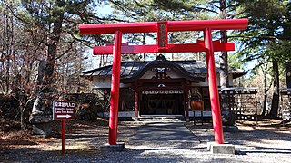
| Description | 『船津胎内神社』 富士山パワースポットの洞窟胎内巡り | ||
| Date | Taken on 19 November 2013 | ||
| Source | https://web.archive.org/web/20161028024642/http://www.panoramio.com/photo/106074753 | ||
| Author | funk bass | ||
| Permission (Reusing this file) |
This file is licensed under the Creative Commons Attribution 3.0 Unported license. Attribution: funk bass
|
||
| Tags (from Panoramio photo page) | Fujikawaguchiko |
| Camera location | | View this and other nearby images on: OpenStreetMap |
|---|
File history
Click on a date/time to view the file as it appeared at that time.
| Date/Time | Thumbnail | Dimensions | User | Comment | |
|---|---|---|---|---|---|
| current | 10:06, 2 April 2017 | | 4,896 × 2,752 (7.4 MB) | Panoramio upload bot (talk | contribs) | == {{int:filedesc}} == {{Information |description=『船津胎内神社』 富士山パワースポットの洞窟胎内巡り |date={{Taken on|2013-11-19}} |source=http://www.panoramio.com/photo/106074753 |author=[http://www.panoramio.com/user/2162507... |
You cannot overwrite this file.
File usage on Commons
The following page uses this file:
File usage on other wikis
The following other wikis use this file:
- Usage on it.wikipedia.org
- Usage on ja.wikipedia.org
- Usage on www.wikidata.org