File:Харран (2).svg
Jump to navigation
Jump to search

Size of this PNG preview of this SVG file: 800 × 419 pixels. Other resolutions: 320 × 168 pixels | 640 × 335 pixels | 1,024 × 536 pixels | 1,280 × 670 pixels | 2,560 × 1,340 pixels | 2,260 × 1,183 pixels.
Original file (SVG file, nominally 2,260 × 1,183 pixels, file size: 1.64 MB)
Captions
Captions
Add a one-line explanation of what this file represents
Summary
[edit].svg&action=edit§ion=1)
| Description |
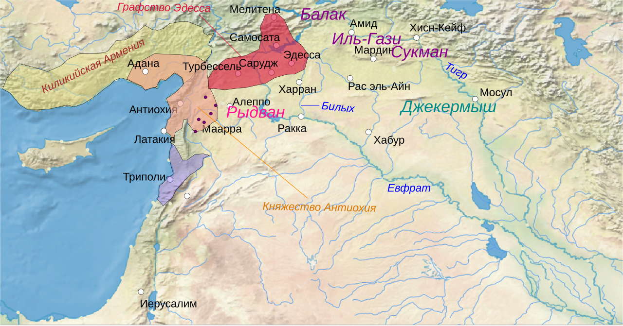
Русский: Обстановка перед битвой при Харране |
| Date | 02-09-2020 |
| Source |
Own work used QGIS. Source data:
|
| Author | Удивленный1 |
Licensing
[edit].svg&action=edit§ion=2)
| This file is made available under the Creative Commons CC0 1.0 Universal Public Domain Dedication. | |
| The person who associated a work with this deed has dedicated the work to the public domain by waiving all of their rights to the work worldwide under copyright law, including all related and neighboring rights, to the extent allowed by law. You can copy, modify, distribute and perform the work, even for commercial purposes, all without asking permission.
|
File history
Click on a date/time to view the file as it appeared at that time.
| Date/Time | Thumbnail | Dimensions | User | Comment | |
|---|---|---|---|---|---|
| current | 09:50, 2 September 2020 | | 2,260 × 1,183 (1.64 MB) | Удивленный1 (talk | contribs) | {{Изображение | описание = Обстановка перед битвой при Харране | источник = {{own}}used QGIS. Source data: * Topography: Jarvis A., H.I. Reuter, A. Nelson, E. Guevara, 2008, Hole-filled seamless SRTM data V4, International Centre for Tropical Agriculture (CIAT), available from http://srtm.csi.cgiar.org * Coast: NASA [ftp://e0srp01u.ecs.nasa.gov/srtm/version2/SWBD SWBD] (SRTM Water Body Data) | время создания = 02-09-2020 | автор = Удивленный1 }} |
You cannot overwrite this file.
File usage on Commons
There are no pages that use this file.
File usage on other wikis
The following other wikis use this file:
- Usage on ru.wikipedia.org
.svg&oldid=803583571)