File:Гора.svg
Jump to navigation
Jump to search

Size of this PNG preview of this SVG file: 470 × 599 pixels. Other resolutions: 188 × 240 pixels | 376 × 480 pixels | 602 × 768 pixels | 803 × 1,024 pixels | 1,606 × 2,048 pixels | 2,103 × 2,682 pixels.
Original file (SVG file, nominally 2,103 × 2,682 pixels, file size: 471 KB)
Captions
Captions
Add a one-line explanation of what this file represents
Summary
[edit]
| Description |
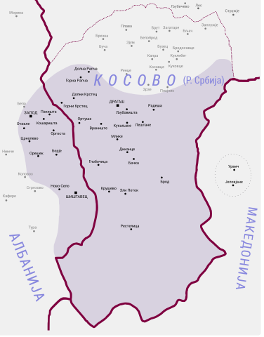
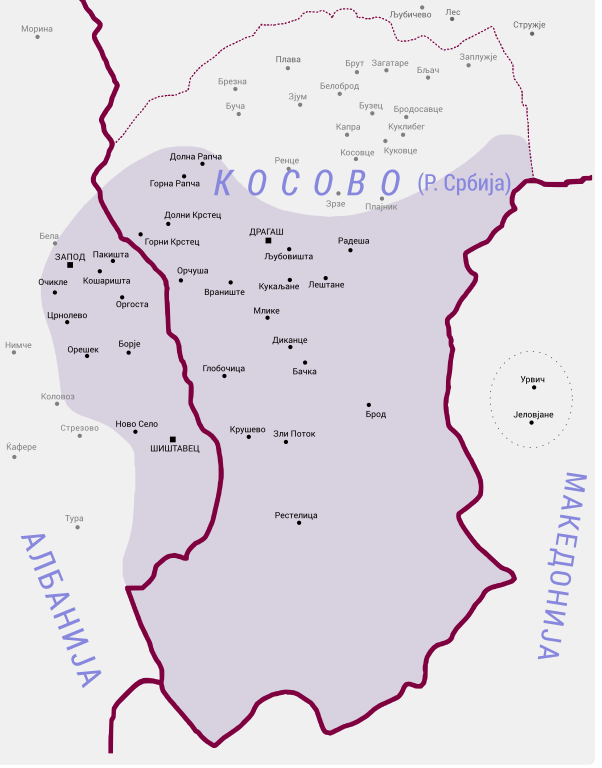
Македонски: Карта на населените места во областа Гора.
English: Map of populated places in the Gora region with labels in Macedonian. |
| Date | |
| Source | derived from File:Gora region.png |
| Author |
original by Пакко at Bulgarian Wikipedia (re-upload on Commons by Chech Explorer) derivative by B. Jankuloski |
Licensing
[edit]
This file is licensed under the Creative Commons Attribution-Share Alike 4.0 International license.
- You are free:
- to share – to copy, distribute and transmit the work
- to remix – to adapt the work
- Under the following conditions:
- attribution – You must give appropriate credit, provide a link to the license, and indicate if changes were made. You may do so in any reasonable manner, but not in any way that suggests the licensor endorses you or your use.
- share alike – If you remix, transform, or build upon the material, you must distribute your contributions under the same or compatible license as the original.
File history
Click on a date/time to view the file as it appeared at that time.
| Date/Time | Thumbnail | Dimensions | User | Comment | |
|---|---|---|---|---|---|
| current | 03:32, 3 May 2019 | | 2,103 × 2,682 (471 KB) | Bjankuloski06 (talk | contribs) | Further correction. |
| 03:27, 3 May 2019 |  | 2,103 × 2,682 (471 KB) | Bjankuloski06 (talk | contribs) | Minor name corrections. | |
| 21:16, 2 April 2019 |  | 2,103 × 2,682 (470 KB) | Bjankuloski06 (talk | contribs) | Encircling two special villages. | |
| 06:58, 1 April 2019 |  | 2,103 × 2,682 (469 KB) | Bjankuloski06 (talk | contribs) | User created page with UploadWizard |
You cannot overwrite this file.
File usage on Commons
The following 2 pages use this file:
File usage on other wikis
The following other wikis use this file:
- Usage on mk.wikipedia.org