File:Болото, що зарастає DSC 0167.jpg

Original file (9,039 × 4,956 pixels, file size: 23.57 MB, MIME type: image/jpeg)
Captions
Captions
Summary
[edit]
| Description |
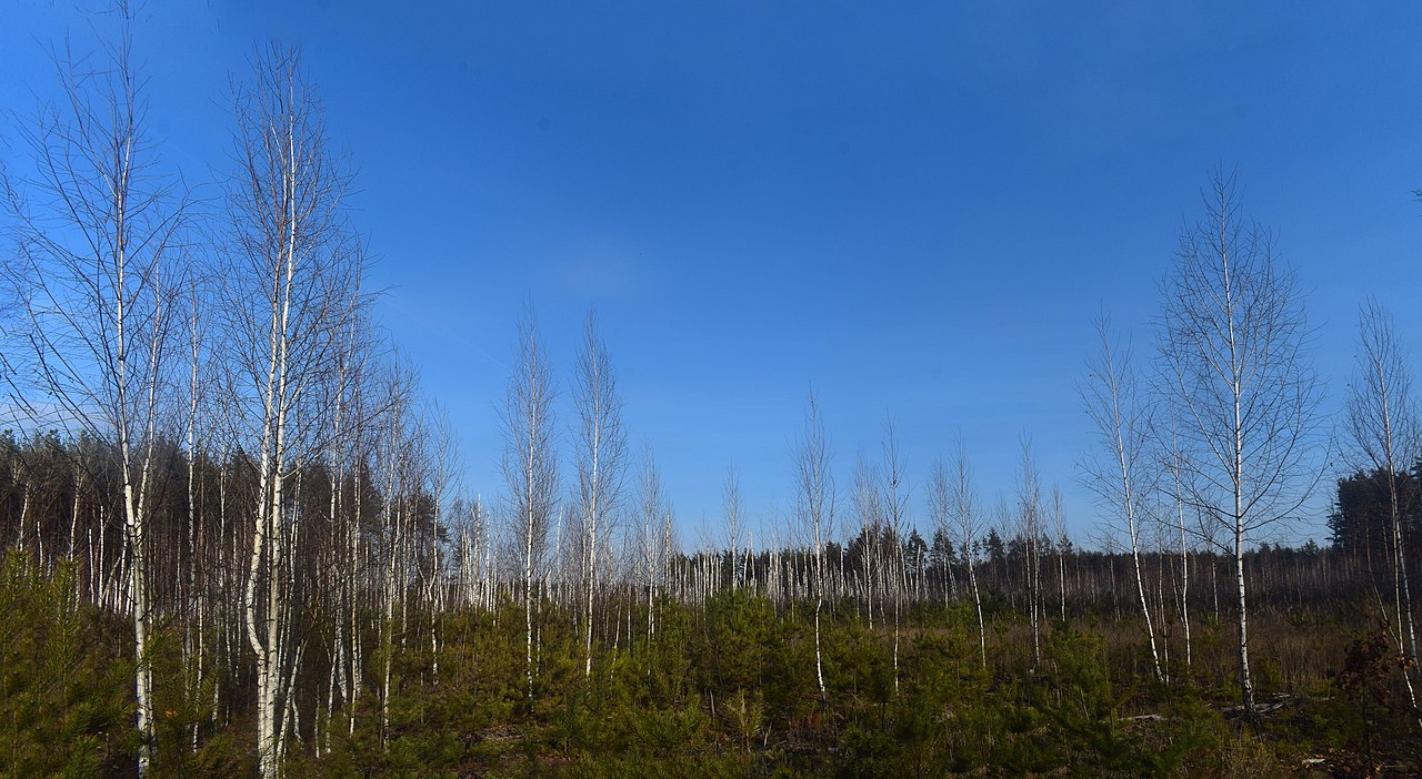
Українська: Родина: Березові (Betulaceae) Береза пухнаста (Betula pubescens Ehrh.)
Родина: Соснові (Pinaceae) Сосна звичайна (Pinus sylvestris L.) Спочатку на заболоченому ґрунті виростають берези. В глибині болота видно мертвий березняк. Скраю болота між берез виростають сосни. Через сотню років підрослі сосни зімкнутими кронами видушать березняк. Ліс між селами Дмитрівка та Любимівка Вишгородського району Київської області. 2019-11-24 13:37:34English: Family: Birch (Betulaceae) Birch downy (Betula pubescens Ehrh.)
Family: Pine (Pinaceae) Scots pine (Pinus sylvestris L.) At first, birch trees grow on the wetland. A dead birch can be seen in the depths of the swamp. There are pine trees growing between the birches. Hundreds of years later, adult pines with closed crowns will squeeze the birch. Forest between Dmytrivka and Lyubimivka villages of Vyshgorod district of Kyiv region. 2019-11-24 13:37:34English: A swamp overgrown with birch and pine |
| Date | |
| Source | Own work |
| Author | Сарапулов |
| Camera location | | View this and other nearby images on: OpenStreetMap |
|---|
Licensing
[edit]
- You are free:
- to share – to copy, distribute and transmit the work
- to remix – to adapt the work
- Under the following conditions:
- attribution – You must give appropriate credit, provide a link to the license, and indicate if changes were made. You may do so in any reasonable manner, but not in any way that suggests the licensor endorses you or your use.
| This image was uploaded as part of Wiki Science Competition 2019. |
File history
Click on a date/time to view the file as it appeared at that time.
| Date/Time | Thumbnail | Dimensions | User | Comment | |
|---|---|---|---|---|---|
| current | 20:54, 25 November 2019 | | 9,039 × 4,956 (23.57 MB) | Сарапулов (talk | contribs) | User created page with UploadWizard |
You cannot overwrite this file.
File usage on Commons
There are no pages that use this file.