File:Ρωσική Άνοιξη χάρτης 2014.png
Jump to navigation
Jump to search

Size of this preview: 800 × 537 pixels. Other resolutions: 320 × 215 pixels | 640 × 430 pixels | 1,024 × 688 pixels | 1,280 × 860 pixels | 1,545 × 1,038 pixels.
Original file (1,545 × 1,038 pixels, file size: 280 KB, MIME type: image/png)
Captions
Captions
Add a one-line explanation of what this file represents
Summary
[edit]
| Description |
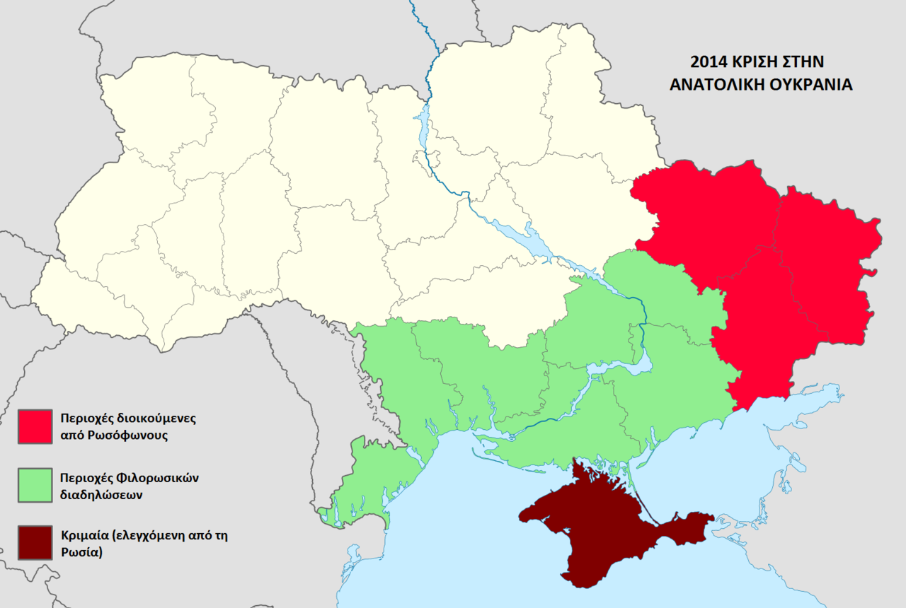
English: Map of the 2014 pro-Russian unrest in Ukraine Ελληνικά: Χάρτης της Κρίσης στην Ανατολική Ουκρανία το 2014 |
| Date | |
| Source | File:Ukraine location map.svg |
| Author |
|
Licensing
[edit]
| I, the copyright holder of this work, release this work into the public domain. This applies worldwide. In some countries this may not be legally possible; if so: I grant anyone the right to use this work for any purpose, without any conditions, unless such conditions are required by law. |
File history
Click on a date/time to view the file as it appeared at that time.
| Date/Time | Thumbnail | Dimensions | User | Comment | |
|---|---|---|---|---|---|
| current | 05:03, 16 April 2014 | | 1,545 × 1,038 (280 KB) | Cretan2014 (talk | contribs) | {{Πληροφορίες εικόνας |Περιγραφή= Χάρτης της Κρίσης στην Ανατολική Ουκρανία το 2014 |Πηγή= Ukraine_location_map.svg |Ημερομηνία= 16/04/2014 |Δημιουργός= [[Cretan20... |
You cannot overwrite this file.
File usage on Commons
There are no pages that use this file.
File usage on other wikis
The following other wikis use this file:
- Usage on el.wikipedia.org