File:Štěpánovská stupňovina, CZ150628-222.jpg
Jump to navigation
Jump to search

Size of this preview: 800 × 524 pixels. Other resolutions: 320 × 210 pixels | 640 × 419 pixels | 1,024 × 671 pixels | 1,280 × 839 pixels | 2,560 × 1,677 pixels | 4,525 × 2,965 pixels.
Original file (4,525 × 2,965 pixels, file size: 5.64 MB, MIME type: image/jpeg)
Captions
Captions
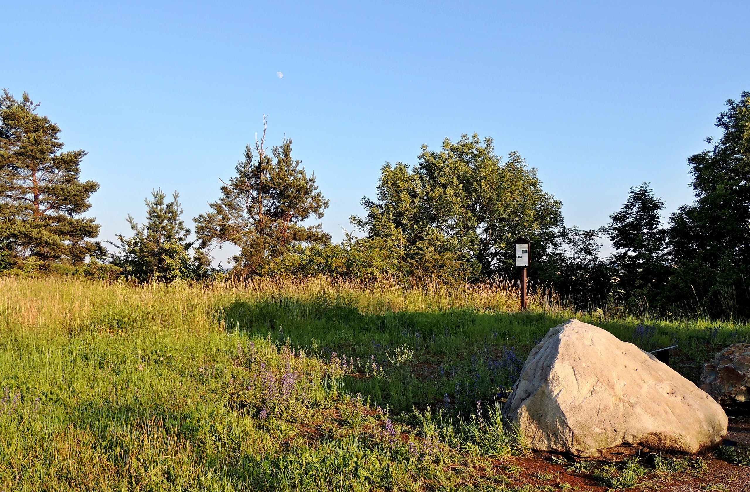
The information spot of National Geopark of Iron Mountains.
Summary
[edit]
| Description |
English: The locality of geomorphological district "Štěpánovská stupňovina" and information spot of National Geopark of Iron Mountains.
Čeština: Lokalita geomorfologického okrsku Štěpánovská stupňovina a informační stanoviště Národního geoparku Železné hory. |
| Date | |
| Source | Own work |
| Author | Josef Kreuz (PEPan) |
| Camera location | | View this and other nearby images on: OpenStreetMap |
|---|
Faktografie
[edit]
Plošina za horní hranou čelního svahu kuesty Štěpánovské stupňoviny, u místní komunikace mezi Zbožnovem a Štěpánovem, poskytuje na několika místech vyhlídku do údolí s Anenským potokem a do krajiny Skutečské pahorkatiny. Geologicky významná lokalita byla zahrnuta do území Národního geoparku Železné hory a na stráni Štěpánovské stupňoviny, nad částí přírodní rezervace a evropsky významné lokality Anenské údolí, bylo vybudováno informační stanoviště s ukázkami místních hornin.
Externí odkazy
[edit]
- 2017-01-06 Přírodní rezervace a evropsky významná lokalita Anenské údolí s okolím: turistická mapa
- 2017-01-07 Národní geopark Železné hory
Licensing
[edit]
I, the copyright holder of this work, hereby publish it under the following license:
This file is licensed under the Creative Commons Attribution-Share Alike 4.0 International license.
- You are free:
- to share – to copy, distribute and transmit the work
- to remix – to adapt the work
- Under the following conditions:
- attribution – You must give appropriate credit, provide a link to the license, and indicate if changes were made. You may do so in any reasonable manner, but not in any way that suggests the licensor endorses you or your use.
- share alike – If you remix, transform, or build upon the material, you must distribute your contributions under the same or compatible license as the original.
File history
Click on a date/time to view the file as it appeared at that time.
| Date/Time | Thumbnail | Dimensions | User | Comment | |
|---|---|---|---|---|---|
| current | 12:29, 6 January 2017 | | 4,525 × 2,965 (5.64 MB) | PEPan (talk | contribs) | User created page with UploadWizard |
You cannot overwrite this file.
File usage on Commons
There are no pages that use this file.
File usage on other wikis
The following other wikis use this file:
- Usage on cs.wikipedia.org