File:Østre Toten kart.png
Jump to navigation
Jump to search
No higher resolution available.
Østre_Toten_kart.png (99 × 135 pixels, file size: 8 KB, MIME type: image/png)
Captions
Captions
Add a one-line explanation of what this file represents
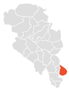
Location map for Østre Toten, Oppland, Norway.
Made by Einar Faanes in Inkscape.
| This work has been released into the public domain by its author, Emuzesto. This applies worldwide. In some countries this may not be legally possible; if so: |
File history
Click on a date/time to view the file as it appeared at that time.
| Date/Time | Thumbnail | Dimensions | User | Comment | |
|---|---|---|---|---|---|
| current | 22:21, 14 February 2005 | | 99 × 135 (8 KB) | Emuzesto (talk | contribs) | Location map for Østre Toten, Oppland, Norway. <br /> Made by Einar Faanes in Inkscape. {{PD-user|Emuzesto}} |
You cannot overwrite this file.
File usage on Commons
The following page uses this file:
File usage on other wikis
The following other wikis use this file:
- Usage on se.wikipedia.org