File:Östra Nordstaden i Göteborg år 1888.jpg
Jump to navigation
Jump to search
Size of this preview: 683 × 599 pixels. Other resolutions: 274 × 240 pixels | 547 × 480 pixels | 938 × 823 pixels.
Original file (938 × 823 pixels, file size: 652 KB, MIME type: image/jpeg)
Captions
Captions
Add a one-line explanation of what this file represents
Summary
[edit]
| Description |
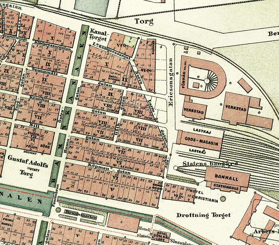
Svenska: Kartan visar Östra Nordstaden i stadsdelen Nordstaden i Göteborg år 1888. Östra Nordstaden syns i mitten av kartan och omges av Östra Hamngatan, Lilla Bommens Torg, Nils Ericsonsgatan och Norra Hamngatan. |
| Date | |
| Source | Simon's 1888 Gothenburg map |
| Author | Ludvig Simon 1888 Bearbetad av Mattias Blomgren |
| Object location | | View this and other nearby images on: OpenStreetMap |
|---|
Licensing
[edit]
|
This work is in the public domain in its country of origin and other countries and areas where the copyright term is the author's life plus 70 years or fewer. | |
| This file has been identified as being free of known restrictions under copyright law, including all related and neighboring rights. | |
File history
Click on a date/time to view the file as it appeared at that time.
| Date/Time | Thumbnail | Dimensions | User | Comment | |
|---|---|---|---|---|---|
| current | 18:05, 30 December 2023 | | 938 × 823 (652 KB) | Historiker (talk | contribs) | Uploaded a work by Ludvig Simon 1888 Bearbetad av Mattias Blomgren from Simon's 1888 Gothenburg map with UploadWizard |
You cannot overwrite this file.
File usage on Commons
There are no pages that use this file.
File usage on other wikis
The following other wikis use this file:
- Usage on sv.wikipedia.org