File:Ölgii regions map.png
Jump to navigation
Jump to search
Size of this preview: 554 × 600 pixels. Other resolutions: 222 × 240 pixels | 443 × 480 pixels | 709 × 768 pixels | 945 × 1,024 pixels | 2,216 × 2,400 pixels.
Original file (2,216 × 2,400 pixels, file size: 796 KB, MIME type: image/png)
Captions
Captions
Add a one-line explanation of what this file represents
| Description |
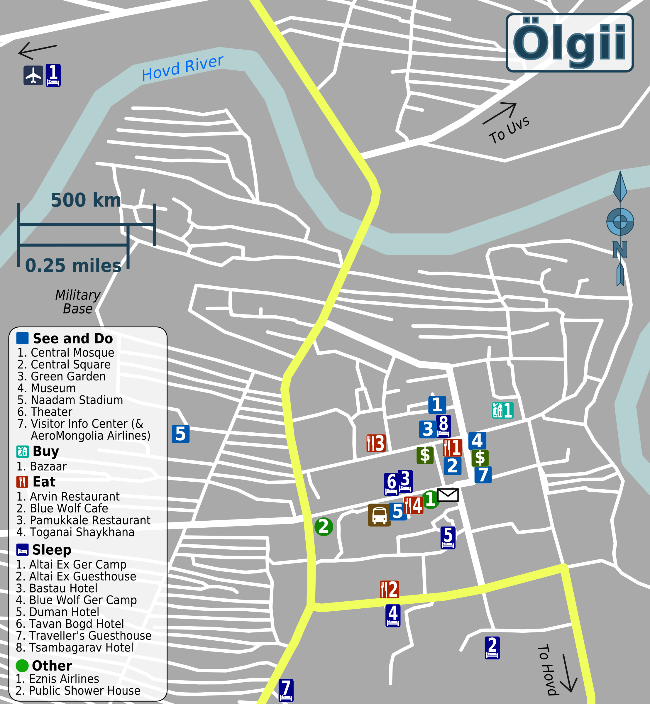
English: Travel map of Ölgii |
|||
| Date | ||||
| Source | File:Ölgii regions map.svg | |||
| Author | Peter Fitzgerald, OpenStreetMap | |||
| Permission (Reusing this file) |
This file is licensed under the Creative Commons Attribution-Share Alike 2.0 Generic license.
|
File history
Click on a date/time to view the file as it appeared at that time.
| Date/Time | Thumbnail | Dimensions | User | Comment | |
|---|---|---|---|---|---|
| current | 16:52, 25 May 2013 | | 2,216 × 2,400 (796 KB) | Peterfitzgerald (talk | contribs) | {{Information |Description ={{en|1=Travel map of Ölgii}} |Source =File:Ölgii regions map.svg |Author =Peter Fitzgerald, [http://openstreetmap.org OpenStreetMap] |Date =2013-05-25 |Permission ... |
You cannot overwrite this file.
File usage on Commons
There are no pages that use this file.
File usage on other wikis
The following other wikis use this file:
- Usage on en.wikivoyage.org
- Usage on fr.wikipedia.org
- Usage on incubator.wikimedia.org