File:"Yalung Glacier" "Camp IV, Camp V, Camp VI, Camp VII" from- KANGCHENJUNGA MAP by JACOT-GUILLARMOD, 1914 (cropped).jpg
Jump to navigation
Jump to search
Size of this preview: 479 × 600 pixels. Other resolutions: 192 × 240 pixels | 503 × 630 pixels.
Original file (503 × 630 pixels, file size: 82 KB, MIME type: image/jpeg)
Captions
Captions
Add a one-line explanation of what this file represents
Summary
[edit]| Description |
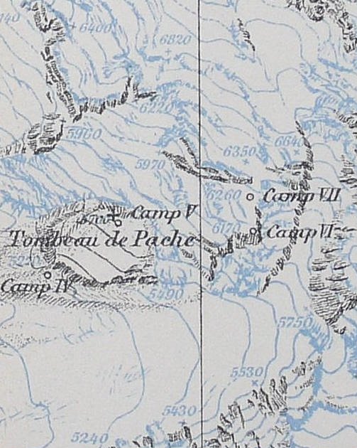
English: Kangchenjunga Map by Charles Jacot-Guillarmod
Français : Relevé topographique du Kangchenjunga et de ses environs immédiats, Charles Jacot-Guillarmod |
| Date | |
| Source | Own work |
| Author | Qwrk |
| Other versions |

.jpg&action=edit§ion=1)
Licensing
[edit].jpg&action=edit§ion=2)
I, the copyright holder of this work, hereby publish it under the following licenses:
This file is licensed under the Creative Commons Attribution-Share Alike 3.0 Unported license.
- You are free:
- to share – to copy, distribute and transmit the work
- to remix – to adapt the work
- Under the following conditions:
- attribution – You must give appropriate credit, provide a link to the license, and indicate if changes were made. You may do so in any reasonable manner, but not in any way that suggests the licensor endorses you or your use.
- share alike – If you remix, transform, or build upon the material, you must distribute your contributions under the same or compatible license as the original.

|
Permission is granted to copy, distribute and/or modify this document under the terms of the GNU Free Documentation License, Version 1.2 or any later version published by the Free Software Foundation; with no Invariant Sections, no Front-Cover Texts, and no Back-Cover Texts. A copy of the license is included in the section entitled GNU Free Documentation License. |
You may select the license of your choice.
| Annotations | This image is annotated: View the annotations at Commons |
.jpg)
File history
Click on a date/time to view the file as it appeared at that time.
| Date/Time | Thumbnail | Dimensions | User | Comment | |
|---|---|---|---|---|---|
| current | 07:30, 2 December 2019 | | 503 × 630 (82 KB) | Tibet Nation (talk | contribs) | File:KKANGCHENJUNGA MAP by JACOT-GUILLARMOD, 1914.jpg cropped 84 % horizontally, 73 % vertically using CropTool with lossless mode. |
You cannot overwrite this file.
File usage on Commons
The following page uses this file:
.jpg&oldid=735484843)