File:"The Empire of the Great Mogul," drawn by *William Baffin* and engraved by Renold Elstrack south west max.jpg
Jump to navigation
Jump to search

Size of this preview: 800 × 581 pixels. Other resolutions: 320 × 233 pixels | 640 × 465 pixels | 1,024 × 744 pixels | 1,280 × 930 pixels | 2,560 × 1,860 pixels | 3,509 × 2,550 pixels.
Original file (3,509 × 2,550 pixels, file size: 1.24 MB, MIME type: image/jpeg)
Captions
Captions
Add a one-line explanation of what this file represents
Summary
[edit]
| Description |
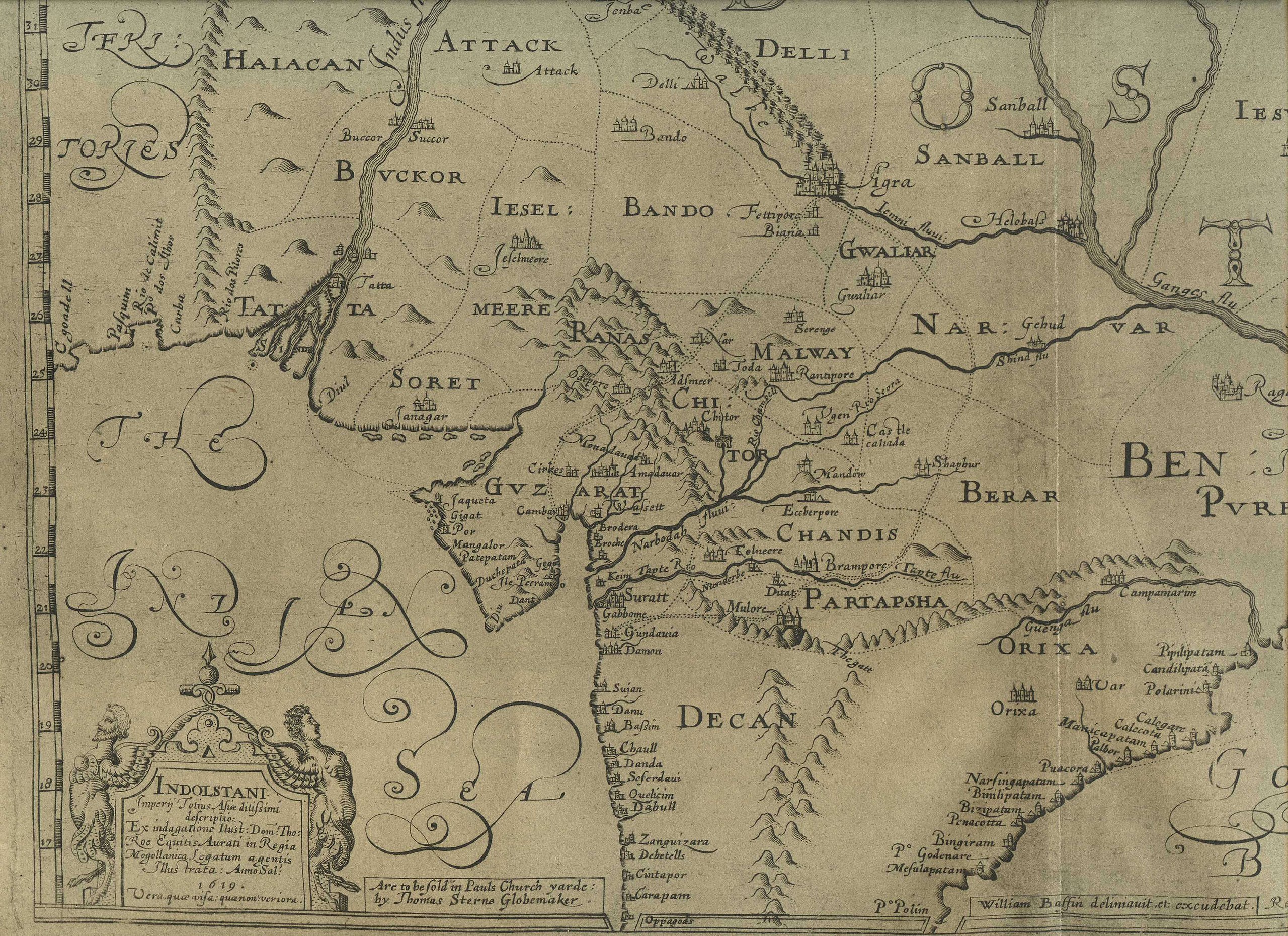
English: The MUGHAL EMPIRE, 1619
"The Empire of the Great Mogul," drawn by *William Baffin* and engraved by Renold Elstrack. Baffin was the navigator on the ship 'Anne', on which Sir Thomas Roe traveled back to England after his embassy. This map, based on Roe's information, was apparently the earliest English map of North India. CLICK ON ANY QUARTER OF THE MAP FOR A VERY LARGE SCAN. |
| Date | |
| Source | http://www.columbia.edu/itc/mealac/pritchett/00maplinks/mughal/baffin1619/baffin1619.html |
| Author | William Baffin |
Licensing
[edit]
|
This work is in the public domain in its country of origin and other countries and areas where the copyright term is the author's life plus 70 years or fewer. | |
| This file has been identified as being free of known restrictions under copyright law, including all related and neighboring rights. | |
File history
Click on a date/time to view the file as it appeared at that time.
| Date/Time | Thumbnail | Dimensions | User | Comment | |
|---|---|---|---|---|---|
| current | 15:33, 10 September 2017 | | 3,509 × 2,550 (1.24 MB) | Baddu676 (talk | contribs) | User created page with UploadWizard |
You cannot overwrite this file.
File usage on Commons
There are no pages that use this file.