Commons:Featured picture candidates/File:Agricultural Fields near Perdizes, Minas Gerais, Brazil.JPG
Jump to navigation
Jump to search

Voting period is over. Please don't add any new votes.Voting period ends on 21 Dec 2014 at 14:50:20 (UTC)
Visit the nomination page to add or modify image notes.

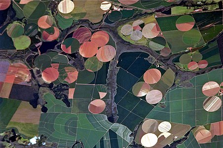
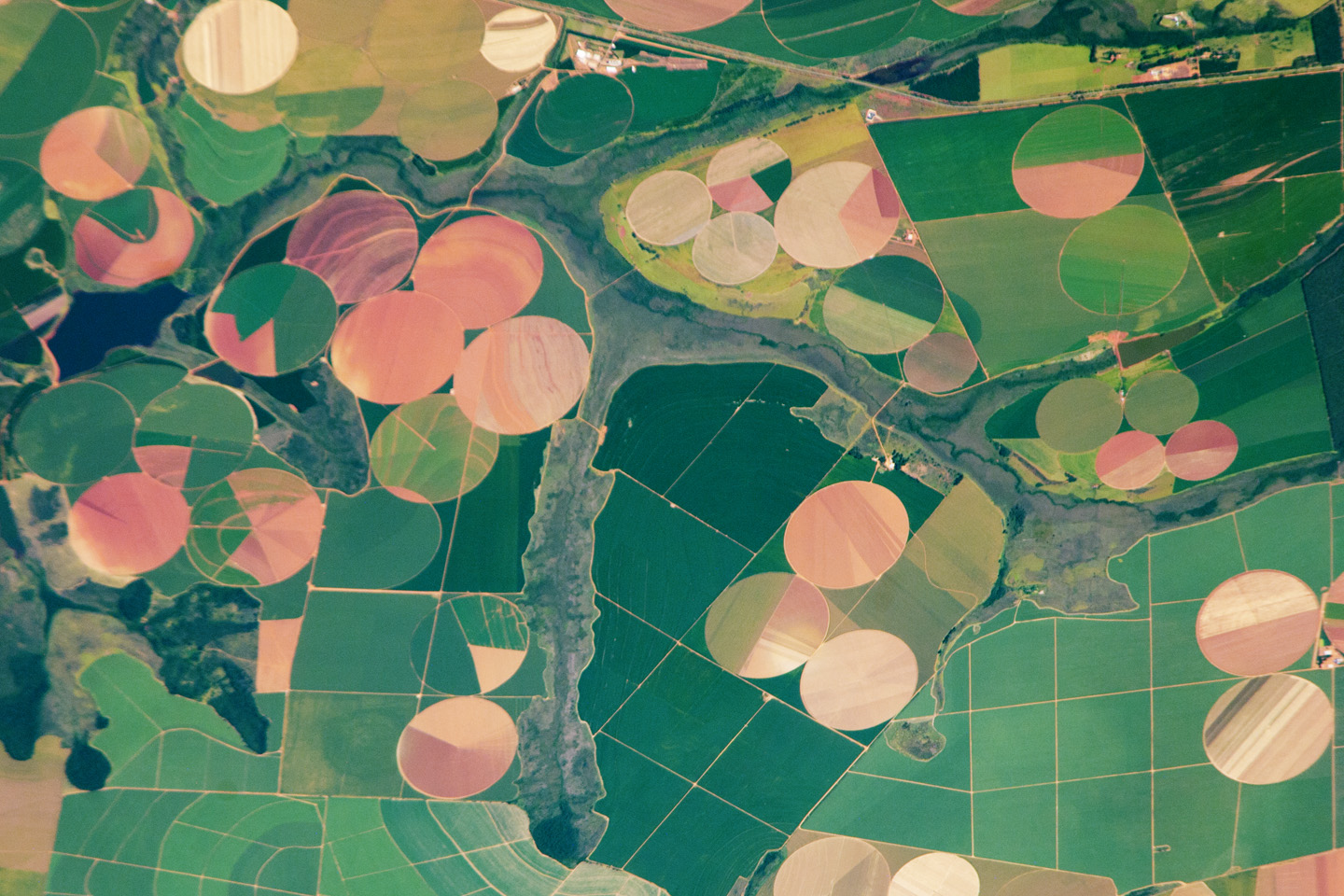
 Info This astronaut photograph illustrates the diverse agricultural landscape in the western part of Minas Gerais state in Brazil. The fields in this image are located south-west of the city of Perdizes, which means “partridges” in Portuguese. A mix of regularly-gridded polygonal fields and circular centre-pivot fields marks the human use of the region. Small streams (and their adjacent floodplains) of the Araguari River extend like fingers throughout the landscape. – The visual diversity of the field forms is matched by the variety of crops: sunflowers, wheat, potatoes, coffee, rice, soybeans, and corn are among the products of the region. While the Northern Hemisphere is still in the grip of winter, crops are growing in the Southern Hemisphere, as indicated by the many green fields. Fallow fields—not in active agricultural use—display the violet, reddish, and light tan soils common to this part of Brazil. Darker soils are often rich in iron and aluminum oxides, and are typical of highly weathered soil that forms in hot, humid climates. Created by NASA Earth Observatory - uploaded by Originalwana - nominated by Arion -- 😄 ArionEstar 😜 (talk) 14:50, 12 December 2014 (UTC)
 Support -- 😄 ArionEstar 😜 (talk) 14:50, 12 December 2014 (UTC)
- Support --AgrisR (talk) 16:02, 12 December 2014 (UTC)
 Oppose Obviously more leeway is given to aerial photos as far as sharpness is concerned, but even at minimum resolution (2 MP) it is unsharp. --King of ♥ ♦ ♣ ♠ 20:05, 13 December 2014 (UTC)
- @King of Hearts: You prefer the full version? 😄 ArionEstar 😜 (talk) 20:17, 13 December 2014 (UTC)
 I withdraw my nomination per King. Maybe other nomination in the future. 😄 ArionEstar 😜 (talk) 21:14, 13 December 2014 (UTC)