Category:Winwick, Northamptonshire
Jump to navigation
Jump to search
English: Winwick is a small village and a lost settlement and civil parish in the West Northamptonshire district of the county of Northamptonshire in England. The modern settlement is located north of West Haddon. A sixteenth-century brick manor house remains on the site.
village and civil parish in Northamptonshire, United Kingdom  | |||||
| Upload media | |||||
| Instance of | |||||
|---|---|---|---|---|---|
| Location | West Northamptonshire, Northamptonshire, East Midlands, England | ||||
| Population |
| ||||
 | |||||
Subcategories
This category has the following 7 subcategories, out of 7 total.
B
- Bridge 21, Grand Union Canal (2 F)
- Bridge 22, Grand Union Canal (4 F)
- Bridge 23, Grand Union Canal (4 F)
- Bridge 24, Grand Union Canal (3 F)
- Bridge 25, Grand Union Canal (5 F)
S
W
Media in category "Winwick, Northamptonshire"
The following 89 files are in this category, out of 89 total.
-
 Barn Ground Spinney - geograph.org.uk - 4595342.jpg 800 × 570; 120 KB
-
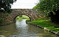
 Bridge No 21, from the south-east - geograph.org.uk - 5563097.jpg 1,016 × 762; 423 KB
-
 Byway from Winwick - geograph.org.uk - 2105594.jpg 4,000 × 3,000; 2.9 MB
-
 Byway to Winwick - geograph.org.uk - 2105575.jpg 4,000 × 3,000; 2.86 MB
-
 Canal Bank southeast of Winwick Manor Farm - geograph.org.uk - 3110886.jpg 3,072 × 2,048; 1.62 MB
-
 Canal east of Yelvertoft in Northamptonshire - geograph.org.uk - 5871125.jpg 1,280 × 869; 1.37 MB
-

-
 Church of St. Michael, Winwick - geograph.org.uk - 5230174.jpg 747 × 1,024; 174 KB
-
 Cows grazing, west of Winwick Grange - geograph.org.uk - 5563086.jpg 1,024 × 768; 158 KB
-

-

-
-

-

-
 Entrance to Winwick - geograph.org.uk - 1857337.jpg 640 × 480; 118 KB
-

-
 Farmland east of Yelvertoft in Northamptonshire - geograph.org.uk - 5871108.jpg 1,440 × 912; 1.39 MB
-
 Farmland in Northamptonshire - geograph.org.uk - 6450737.jpg 1,024 × 768; 186 KB
-
 Farmland west of Winwick Manor Farm - geograph.org.uk - 5538815.jpg 1,024 × 768; 210 KB
-
 Field boundary south-east of Flint Hill Farm - geograph.org.uk - 5563105.jpg 1,024 × 768; 147 KB
-

-
-
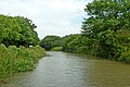
 Grand Union Canal near Flint Hill - geograph.org.uk - 4595381.jpg 800 × 526; 113 KB
-
 Grand Union Canal near Flint Hill Farm - geograph.org.uk - 4143195.jpg 4,320 × 3,240; 2.94 MB
-
 Grand Union Canal near Yelvertoft - geograph.org.uk - 3852649.jpg 1,600 × 1,190; 366 KB
-
 Grand Union Canal next to Larch Spinney - geograph.org.uk - 4595344.jpg 800 × 600; 140 KB
-

-
-

-
 Grand Union Canal, Leicester Section - geograph.org.uk - 3455914.jpg 640 × 480; 60 KB
-
 Grand Union Canal, Leicester Section - geograph.org.uk - 3455979.jpg 640 × 480; 70 KB
-

-

-
 Heygates Farm - geograph.org.uk - 1857299.jpg 640 × 480; 76 KB
-
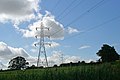 High voltage power distribution lines near Winwick - geograph.org.uk - 3110825.jpg 3,072 × 2,048; 1.16 MB
-

-
 House in Winwick - geograph.org.uk - 4599867.jpg 640 × 480; 94 KB
-
 Leaving Winwick - geograph.org.uk - 4600161.jpg 480 × 640; 64 KB
-
 Leaving Winwick - geograph.org.uk - 4600168.jpg 480 × 640; 58 KB
-
 Minor road near Yelvertoft - geograph.org.uk - 3852645.jpg 1,600 × 1,122; 340 KB
-

-
 Narrowboat on the Grand Union Canal - geograph.org.uk - 4595349.jpg 800 × 549; 149 KB
-
 New House Farm Bridge No 21 - geograph.org.uk - 4595397.jpg 800 × 549; 177 KB
-

-

-

-
 On the way to Winwick - geograph.org.uk - 4599855.jpg 480 × 640; 129 KB
-
 On the way to Winwick - geograph.org.uk - 4599856.jpg 480 × 640; 96 KB
-
 On the way to Winwick - geograph.org.uk - 4599859.jpg 480 × 640; 52 KB
-
 On the way to Winwick - geograph.org.uk - 4599861.jpg 480 × 640; 80 KB
-
 On the way to Winwick - geograph.org.uk - 4599863.jpg 480 × 640; 81 KB
-
 Path close to Winwick - geograph.org.uk - 4600172.jpg 480 × 640; 68 KB
-
 Personal Post Box - geograph.org.uk - 4599869.jpg 480 × 640; 101 KB
-
 Smart's Bridge No 24 - geograph.org.uk - 4595351.jpg 800 × 581; 169 KB
-

-

-
 Stream and signpost, Winwick - geograph.org.uk - 1858947.jpg 640 × 480; 136 KB
-
 Thatched cottage, Winwick - geograph.org.uk - 4600159.jpg 480 × 640; 68 KB
-
 The Jurassic Way - geograph.org.uk - 4600180.jpg 480 × 640; 56 KB
-
 The Jurassic Way - geograph.org.uk - 4600182.jpg 480 × 640; 73 KB
-
 The Jurassic Way - geograph.org.uk - 4600186.jpg 480 × 640; 73 KB
-
 The Jurassic Way - geograph.org.uk - 4600188.jpg 480 × 640; 89 KB
-
 The Jurassic Way - geograph.org.uk - 4600191.jpg 480 × 640; 93 KB
-
 The quick and the dead - geograph.org.uk - 3110594.jpg 3,072 × 2,048; 1.17 MB
-
 The start of the road to Winwick - geograph.org.uk - 1857293.jpg 640 × 480; 60 KB
-
 Track to Winwick Manor Farm - geograph.org.uk - 4595337.jpg 800 × 551; 131 KB
-
 Victorian postbox in Winwick - geograph.org.uk - 4600147.jpg 480 × 640; 96 KB
-
 War Memorial, Winwick - geograph.org.uk - 4600156.jpg 480 × 640; 65 KB
-
 Wellhouse on road to Winwick Grange - geograph.org.uk - 2105640.jpg 4,000 × 3,000; 2.87 MB
-
 West Haddon Road Bridge No 22 - geograph.org.uk - 4595385.jpg 800 × 600; 211 KB
-
 Wind turbine near the Grand Union Canal - geograph.org.uk - 4595391.jpg 559 × 800; 144 KB
-
 Winwick - geograph.org.uk - 201861.jpg 640 × 480; 163 KB
-
 Winwick - geograph.org.uk - 201904.jpg 640 × 480; 107 KB
-
 Winwick - geograph.org.uk - 201906.jpg 640 × 480; 156 KB
-
 Winwick - geograph.org.uk - 201908.jpg 640 × 480; 120 KB
-
 Winwick - geograph.org.uk - 201910.jpg 640 × 480; 101 KB
-
 Winwick - geograph.org.uk - 202256.jpg 640 × 480; 169 KB
-
 Winwick gateway - geograph.org.uk - 4600177.jpg 640 × 480; 74 KB
-
 Winwick Manor - geograph.org.uk - 4600144.jpg 480 × 640; 89 KB
-
 Winwick Manor - geograph.org.uk - 4600163.jpg 640 × 480; 61 KB
-
 Winwick Manor - geograph.org.uk - 5230181.jpg 1,024 × 630; 150 KB
-
 Winwick Manor Farm - geograph.org.uk - 4595325.jpg 800 × 634; 162 KB
-
 Winwick Manor Farm, from the south - geograph.org.uk - 5538809.jpg 1,024 × 615; 134 KB
-
 Winwick Manor gateway - geograph.org.uk - 4600176.jpg 640 × 480; 62 KB
-
 Winwick Phone Box - geograph.org.uk - 4600154.jpg 640 × 480; 103 KB
-
 A Change in Direction. - geograph.org.uk - 466109.jpg 640 × 480; 111 KB
-
 Gated Byway. - geograph.org.uk - 466099.jpg 640 × 480; 148 KB
-
 Trouble in Store. - geograph.org.uk - 466173.jpg 640 × 480; 86 KB
-
 Way meets Byway. - geograph.org.uk - 466135.jpg 640 × 480; 99 KB


