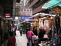
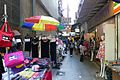
Category:Wing Kut Street
Jump to navigation
Jump to search
 | |||||
| Upload media | |||||
| Instance of | |||||
|---|---|---|---|---|---|
| Location | Central and Western District, Hong Kong, PRC | ||||
 | |||||
The border of Central and Sheung Wan is along Aberdeen Street and Wing Kut Street.
zh:上環zh:永吉街
Subcategories
This category has the following 12 subcategories, out of 12 total.
2
- 2018 in Wing Kut Street (6 F)
- 2019 in Wing Kut Street (11 F)
- 2020 in Wing Kut Street (11 F)
- 2021 in Wing Kut Street (34 F)
- 2023 in Wing Kut Street (2 F)
B
S
V
- Visitors in Wing Kut Street (9 F)
W
Media in category "Wing Kut Street"
The following 53 files are in this category, out of 53 total.
-
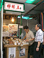
 HK Central Wing Kut Street 1 Noon near Queen s Road C a.jpg 1,600 × 1,200; 384 KB
-
 HK Central Wing Kut Street 22 Lemon King a.jpg 1,200 × 1,600; 318 KB
-
 HK Central Wing Kut Street 28 noon Wong Kee Wholesale n Export 永吉利商業大厦.JPG 1,200 × 1,600; 1.13 MB
-
 HK Central Wing Kut Street Chung Kee Noodle Shop.JPG 1,600 × 1,200; 1.17 MB
-
 HK Central Wing Kut Street noon HKD100 for 3 Pure Silk Neckties.JPG 1,600 × 1,200; 1.13 MB
-
 HK Central Wing Kut Street sign near Des Voeux Road C.JPG 1,200 × 1,600; 1.12 MB
-
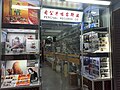
 HK Central Wing Kut Street Wholesale n Retailing 1.JPG 1,600 × 1,200; 1.12 MB
-
 HK Central Wing Kut Street Wholesale n Retailing 2.JPG 1,600 × 1,200; 1.12 MB
-

-

-

-

-

-
 HK 上環 Sheung Wan 永吉街 Wing Kut Street October 2021 SS2 01.jpg 4,128 × 3,096; 3.89 MB
-
 HK 上環 Sheung Wan 永吉街 Wing Kut Street October 2021 SS2 02.jpg 3,096 × 4,128; 3.3 MB
-
 HK 上環 Sheung Wan 永吉街 Wing Kut Street October 2021 SS2 03.jpg 4,128 × 3,096; 3.7 MB
-
 HK 上環 Sheung Wan 永吉街 Wing Kut Street October 2021 SS2 04.jpg 4,128 × 3,096; 4.83 MB
-
 HK 上環 Sheung Wan 永吉街 Wing Kut Street October 2021 SS2 05.jpg 4,128 × 3,096; 5.03 MB
-
 HK 上環 Sheung Wan 永吉街 Wing Kut Street October 2021 SS2 06.jpg 3,096 × 4,128; 3.97 MB
-
 HK 上環 Sheung Wan 永吉街 Wing Kut Street October 2021 SS2 07.jpg 4,128 × 3,096; 3.25 MB
-
 HK 上環 Sheung Wan 永吉街 Wing Kut Street October 2021 SS2 08.jpg 3,096 × 4,128; 3.03 MB
-
 HK 上環 Sheung Wan 永吉街 Wing Kut Street October 2021 SS2 09.jpg 3,096 × 4,128; 3.03 MB
-
 HK 上環 Sheung Wan 永吉街 Wing Kut Street October 2021 SS2 10.jpg 4,128 × 3,096; 3.1 MB
-
 HK 上環 Sheung Wan 永吉街 Wing Kut Street October 2021 SS2 11.jpg 4,128 × 3,096; 5.11 MB
-
 HK 上環 Sheung Wan 永吉街 Wing Kut Street October 2021 SS2 12.jpg 4,128 × 3,096; 4.77 MB
-
 HK 上環 Sheung Wan 永吉街 Wing Kut Street October 2021 SS2 13.jpg 3,096 × 4,128; 3.35 MB
-
 HK 上環 Sheung Wan 永吉街 Wing Kut Street October 2021 SS2 14.jpg 4,128 × 3,096; 3.79 MB
-
 HK 上環 Sheung Wan 永吉街 Wing Kut Street October 2021 SS2 15.jpg 3,096 × 4,128; 3.21 MB
-
 HK 上環 Sheung Wan 永吉街 Wing Kut Street October 2021 SS2 16.jpg 4,128 × 3,096; 2.83 MB
-
 HK 上環 Sheung Wan 永吉街 Wing Kut Street October 2021 SS2 17.jpg 4,128 × 3,096; 4.3 MB
-
 HK 上環 Sheung Wan 永吉街 Wing Kut Street October 2021 SS2 18.jpg 3,096 × 4,128; 3.56 MB
-
 HK 上環 Sheung Wan 永吉街 Wing Kut Street October 2021 SS2 19.jpg 3,096 × 4,128; 2.94 MB
-
 HK 上環 Sheung Wan 永吉街 Wing Kut Street October 2021 SS2 20.jpg 4,128 × 3,096; 2.82 MB
-
 HK 上環 Sheung Wan 永吉街 Wing Kut Street October 2021 SS2 21.jpg 3,096 × 4,128; 3.88 MB
-
 HK 上環 Sheung Wan 永吉街 Wing Kut Street October 2021 SS2 22.jpg 4,128 × 3,096; 3.63 MB
-
 HK 上環 Sheung Wan 永吉街 Wing Kut Street October 2021 SS2 23.jpg 4,128 × 3,096; 3.15 MB
-
 HK 上環 Sheung Wan 永吉街 Wing Kut Street October 2021 SS2 24.jpg 4,128 × 3,096; 3.33 MB
-
 HK 上環 Sheung Wan 永吉街 Wing Kut Street October 2021 SS2 25.jpg 4,128 × 3,096; 3.89 MB
-
 HK 上環 Sheung Wan 永吉街 Wing Kut Street October 2021 SS2 26.jpg 4,128 × 3,096; 3.04 MB
-
 HK 上環 Sheung Wan 永吉街 Wing Kut Street October 2021 SS2 27.jpg 4,128 × 3,096; 3.07 MB
-
 HK 上環 Sheung Wan 永吉街 Wing Kut Street October 2021 SS2 28.jpg 4,128 × 3,096; 3 MB
-
 HK 上環 Sheung Wan 永吉街 Wing Kut Street October 2021 SS2 29.jpg 4,128 × 3,096; 4.01 MB
-
 HK 上環 Sheung Wan 永吉街 Wing Kut Street October 2021 SS2 30.jpg 4,128 × 3,096; 4.52 MB
-
 HK 上環 Sheung Wan 永吉街 Wing Kut Street October 2021 SS2 31.jpg 3,096 × 4,128; 3.04 MB
-
 HK 上環 Sheung Wan 永吉街 Wing Kut Street October 2021 SS2 32.jpg 3,096 × 4,128; 3.84 MB
-
 HK 上環 Sheung Wan 永吉街 Wing Kut Street October 2021 SS2 33.jpg 4,128 × 3,096; 3.08 MB
-
 HK 上環 Sheung Wan 永吉街 Wing Kut Street October 2021 SS2 34.jpg 4,128 × 3,096; 3.37 MB
-
-

-

-

-
 Market of Wing Kut Street.jpg 2,560 × 1,920; 1.56 MB
-
 Wing Kut Street 2015.jpg 2,112 × 1,408; 2.46 MB


