Category:Willey, Warwickshire
Jump to navigation
Jump to search
village and civil parish in Rugby, Warwickshire, England  | |||||
| Upload media | |||||
| Instance of | |||||
|---|---|---|---|---|---|
| Location | Rugby, Warwickshire, West Midlands, England | ||||
| Population |
| ||||
| Area |
| ||||
 | |||||
English: Willey is a rural village and civil parish in the English county of Warwickshire. In the 2001 census it had a population of 95.
Subcategories
This category has the following 2 subcategories, out of 2 total.
F
W
Media in category "Willey, Warwickshire"
The following 52 files are in this category, out of 52 total.
-
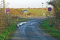 A5 Road junction - geograph.org.uk - 619568.jpg 640 × 434; 85 KB
-
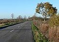
 Approaching the A5 - geograph.org.uk - 5303083.jpg 4,128 × 2,322; 4.01 MB
-
 Coal Pit Lane - geograph.org.uk - 5457994.jpg 1,600 × 900; 458 KB
-
 Coal Pit Lane near Cross in Hand - geograph.org.uk - 619584.jpg 640 × 458; 85 KB
-
 Coal Pit Lane near Willey - geograph.org.uk - 619577.jpg 640 × 514; 114 KB
-
 Coal Pit Lane towards Cloudesley Bush - geograph.org.uk - 5410713.jpg 640 × 460; 154 KB
-
 Coal Pit Lane towards Cloudesley Bush - geograph.org.uk - 5410717.jpg 640 × 505; 102 KB
-

-
 Coal Pit Lane towards Cross in Hand - geograph.org.uk - 5410714.jpg 640 × 429; 110 KB
-
 Coal Pit Lane towards Cross in Hand - geograph.org.uk - 5410718.jpg 640 × 467; 100 KB
-

-
 Cross in Hand - geograph.org.uk - 6697787.jpg 1,280 × 851; 1.28 MB
-
 Ex-flower display - geograph.org.uk - 5410722.jpg 640 × 546; 195 KB
-
 Farmland near Little Walton - geograph.org.uk - 403258.jpg 640 × 428; 141 KB
-
 Farmland near Willey - geograph.org.uk - 5303049.jpg 4,128 × 2,322; 5.76 MB
-
 Field edge north of Coal Pit Lane - geograph.org.uk - 5410715.jpg 640 × 472; 85 KB
-
 Magna Park - geograph.org.uk - 619590.jpg 640 × 344; 52 KB
-
 Main Street into Willey - geograph.org.uk - 5410724.jpg 640 × 463; 104 KB
-
 Main Street towards Willey - geograph.org.uk - 5410728.jpg 640 × 478; 120 KB
-
 Main Street-Coal Pit Lane junction - geograph.org.uk - 5410723.jpg 640 × 404; 122 KB
-
 Milk bar north of Coal Pit Lane - geograph.org.uk - 5410716.jpg 640 × 419; 119 KB
-
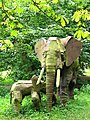 Newnham Paddox Sculpture Park - geograph.org.uk - 72141.jpg 480 × 640; 217 KB
-
 Norwood Farm - geograph.org.uk - 5457989.jpg 1,600 × 900; 468 KB
-
 Norwood Farm and buildings - geograph.org.uk - 5410719.jpg 640 × 458; 109 KB
-
 Norwood Farm driveway - geograph.org.uk - 5410720.jpg 640 × 460; 93 KB
-
 Norwood Farm sign - geograph.org.uk - 5410721.jpg 640 × 458; 107 KB
-

-
 The hamlet of Willey - geograph.org.uk - 5303055.jpg 4,128 × 2,322; 4.01 MB
-

-
 Willey - geograph.org.uk - 97999.jpg 640 × 480; 104 KB
-
 Willey Bridleway - geograph.org.uk - 1316377.jpg 640 × 480; 152 KB
-
 Willey Bridleway - geograph.org.uk - 1316381.jpg 640 × 480; 72 KB
-
 Willey Cottages - geograph.org.uk - 5245570.jpg 1,600 × 1,200; 556 KB
-
 Willey Main Street - geograph.org.uk - 1316367.jpg 640 × 480; 57 KB
-
 Willey Village Hall - geograph.org.uk - 1316366.jpg 640 × 480; 59 KB
-
 Willey-Dismantled Railway - geograph.org.uk - 1316338.jpg 640 × 480; 162 KB
-
 Willey-Dismantled Railway - geograph.org.uk - 1316362.jpg 640 × 480; 142 KB
-
 Willey-Disused Railway - geograph.org.uk - 1315755.jpg 640 × 480; 143 KB
-
 Willey-Main Street - geograph.org.uk - 1315709.jpg 640 × 480; 77 KB
-
 Willey-Main Street - geograph.org.uk - 1315732.jpg 640 × 480; 67 KB
-
 Willey-The Sarah Mansfield - geograph.org.uk - 5245573.jpg 1,600 × 1,200; 353 KB
-
 WOOD FARM BREWERY WILLEY NEAR RUGBY WARWICKSHIRE AUG 2013 (9482757969).jpg 5,115 × 2,545; 7.66 MB
-
 WOOD FARM BREWERY WILLEY NEAR RUGBY WARWICKSHIRE AUG 2013 (9482775891).jpg 5,106 × 2,281; 7.81 MB
-
 WOOD FARM BREWERY WILLEY NEAR RUGBY WARWICKSHIRE AUG 2013 (9485561764).jpg 5,000 × 2,939; 8.8 MB
-
 WOOD FARM BREWERY WILLEY NEAR RUGBY WARWICKSHIRE AUG 2013 (9485802484).jpg 4,446 × 2,628; 7.31 MB
-

-
 Cross-In-Hand - geograph.org.uk - 97989.jpg 640 × 480; 55 KB
-
 Little Walton - geograph.org.uk - 144322.jpg 640 × 480; 114 KB
-
 Little Walton - geograph.org.uk - 144777.jpg 640 × 480; 150 KB
-
 Newnham - Newnham Fields Farm - geograph.org.uk - 80193.jpg 640 × 480; 131 KB
-
 Pailton - Cestersover Farm - geograph.org.uk - 97986.jpg 640 × 480; 86 KB
-
 Pailton Pastures Farm - geograph.org.uk - 61113.jpg 640 × 480; 95 KB


.jpg)
.jpg)
.jpg)
.jpg)
.jpg)


