Category:Warning signs in London
Jump to navigation
Jump to search
Media in category "Warning signs in London"
The following 67 files are in this category, out of 67 total.
-
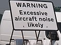 "Excessive aircraft noise" warning, A40 by RAF Northolt - geograph.org.uk - 2968663.jpg 1,600 × 1,200; 196 KB
-
 2006-03-25 - London - Caution Stairs Down (4888201195).jpg 2,592 × 1,726; 5.52 MB
-
 2010-06-04 Willesden Junction Station.jpg 3,888 × 2,592; 2.43 MB
-
 Sainsbury's Local, Hackney Road A1208, Hackney E2.jpg 3,500 × 2,625; 5.55 MB
-
 Anerley Hill - Steep Hill 10^ - geograph.org.uk - 1435658.jpg 640 × 400; 77 KB
-
 Anti climb paint sign.jpg 2,044 × 1,324; 1,009 KB
-
 Arterberry Road - Steep Hill 10^ - geograph.org.uk - 1425488.jpg 640 × 400; 103 KB
-
 Arthur Road - Steep Hill 10^ - geograph.org.uk - 1435585.jpg 640 × 400; 89 KB
-
 Average speed cameras at roadworks - geograph.org.uk - 938662.jpg 518 × 640; 248 KB
-
 Bencombe Road - Steep Hill 15^ - geograph.org.uk - 1426743.jpg 640 × 400; 85 KB
-
 Bencombe Road - Steep Hill 15^ - geograph.org.uk - 1426756.jpg 640 × 400; 112 KB
-
 Broomhill Road - Steep Hill 11^ - geograph.org.uk - 1436043.jpg 640 × 400; 100 KB
-
 Caution Jet Blast sign Docklands London.jpg 1,936 × 2,592; 1.9 MB
-
 Caution Teenagers 4889126077.jpg 1,922 × 1,281; 1.86 MB
-
 Chelsfield Hill - Steep Hill 12^ - geograph.org.uk - 1426665.jpg 640 × 400; 115 KB
-
 Chiswick Mall flooded at high tide - geograph.org.uk - 1327767.jpg 640 × 480; 96 KB
-
 College Road - Steep Hill 10^ - geograph.org.uk - 1435603.jpg 640 × 400; 100 KB
-
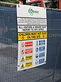 Conway building site warning sign in London.jpg 2,448 × 3,264; 1.25 MB
-
 Corkscrew Hill - Steep Hill 11^ - geograph.org.uk - 1436063.jpg 640 × 400; 88 KB
-
 Crocs escalator safety warning sign.jpg 3,000 × 4,000; 5.41 MB
-
 Crofton Road - Steep Hill 10^ - geograph.org.uk - 1436054.jpg 640 × 400; 90 KB
-
 Danger of Death door, Monken Hadley.JPG 3,000 × 4,000; 4.52 MB
-
 Denmark Avenue - Steep Hill 10^ - geograph.org.uk - 1435649.jpg 640 × 400; 82 KB
-
 Down Street tube station 10.jpg 5,857 × 3,905; 2.33 MB
-
 Edge Hill - Steep Hill 12^ - geograph.org.uk - 1435675.jpg 640 × 400; 91 KB
-
 Erith Road - Steep Hill 1-9 - geograph.org.uk - 1435416.jpg 640 × 400; 74 KB
-
 Euston station MMB 09 321406.jpg 2,217 × 1,548; 1.5 MB
-
 Ew, I'm all sticky! (3297162194).jpg 1,361 × 1,836; 319 KB
-
 Fence at wellesley road - panoramio.jpg 3,264 × 2,448; 4.21 MB
-
 Fox Hill - Steep Hill 20^ - geograph.org.uk - 1425662.jpg 640 × 400; 120 KB
-
 Fox Hill - Steep Hill 20^ - geograph.org.uk - 1425667.jpg 640 × 400; 113 KB
-
 Glassmill Lane - Steep Hill 12^ - geograph.org.uk - 1436028.jpg 640 × 400; 71 KB
-
 Hartley Hill - Steep Hill 15^ - geograph.org.uk - 1427040.jpg 640 × 400; 71 KB
-
 Hornsey railway station MMB 11.jpg 1,567 × 2,229; 1.24 MB
-
 Humpty dumpty warning.jpg 800 × 600; 228 KB
-
 Imperial War Museum (20449130444).jpg 1,920 × 1,280; 1.89 MB
-
 Jewels Hill - Steep Hill 15^ - geograph.org.uk - 1426702.jpg 640 × 400; 78 KB
-

-
 Leesons Hill - Steep Hill 14^ - geograph.org.uk - 1436036.jpg 640 × 400; 107 KB
-
 London Barking (4896326628).jpg 3,026 × 2,017; 1.39 MB
-
 London Look Right.jpg 4,048 × 3,040; 3.35 MB
-
 London Sign.jpg 395 × 509; 78 KB
-
 London Transport Executive sign opposite Northolt station 2024-04-28 01.jpg 3,456 × 4,608; 6.03 MB
-
 London Transport Executive sign opposite Northolt station 2024-04-28 02.jpg 4,608 × 3,456; 6.96 MB
-
 London Transport Executive sign opposite Northolt station 2024-04-28 03.jpg 4,608 × 3,456; 6.99 MB
-
 Look Right.jpg 2,592 × 1,944; 1.54 MB
-
 LU warning notices in Brompton Road Tube (6036113784).jpg 2,048 × 1,536; 523 KB
-
 Marryat Road - Steep Hill 10^ - geograph.org.uk - 1435595.jpg 640 × 400; 64 KB
-
 Milestone Road - Steep Hill 17^ - geograph.org.uk - 1435661.jpg 640 × 400; 96 KB
-
 Mind Your Head^ - geograph.org.uk - 3432385.jpg 480 × 640; 428 KB
-
 Oyster prepay warning 2006 1.jpg 318 × 480; 25 KB
-
 Parliament Hill Lido (6448960385).jpg 5,616 × 3,744; 14.87 MB
-
 Polesteeple Hill - Steep Hill 20^ - geograph.org.uk - 1428636.jpg 640 × 400; 79 KB
-
 Radiation supervised area.jpg 671 × 800; 96 KB
-
 Richmond park.JPG 1,200 × 1,600; 258 KB
-
 Ridgway Place - Steep Hill 10^ - geograph.org.uk - 1435630.jpg 640 × 400; 90 KB
-
 Saltbox Hill - Steep Hill 15^ - geograph.org.uk - 1427024.jpg 640 × 400; 86 KB
-
 Salter's Hill - Steep Hill 10^ - geograph.org.uk - 1435614.jpg 640 × 400; 91 KB
-
 Security spikes 1.jpg 2,816 × 2,112; 3.57 MB
-
 Sign at Gainsborough Gardens, Hampstead, June 2021.jpg 4,032 × 3,024; 7.25 MB
-
 Spencer Hill - Steep Hill 10^ - geograph.org.uk - 1435638.jpg 640 × 400; 82 KB
-
 Star and Garter Hill - Steep Hill 10^ - geograph.org.uk - 1435546.jpg 640 × 400; 105 KB
-
 Stock Hill - Steep Hill 12^ - geograph.org.uk - 1427122.jpg 640 × 400; 71 KB
-
 Summer Hill - Steep Hill 10^ - geograph.org.uk - 1436021.jpg 640 × 400; 100 KB
-
 The Downs - Steep Hill 10^ - geograph.org.uk - 1425425.jpg 640 × 400; 103 KB
-
 Warning signs on london door (Unsplash).jpg 6,000 × 4,000; 735 KB
-
 You have been warned^ - geograph.org.uk - 491168.jpg 480 × 640; 58 KB

.jpg)


.jpg)


.jpg)

_,_Chingford,_London_E4_-_geograph.org.uk_-_1053316.jpg)

.jpg)


.jpg)


.jpg)


.jpg)
