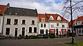
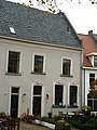
Category:Vischmarkt 17, Harderwijk
Jump to navigation
Jump to search
| Object location | | View all coordinates using: OpenStreetMap |
|---|
 | |||||
| Upload media | |||||
| Instance of |
| ||||
|---|---|---|---|---|---|
| Location | Harderwijk, Gelderland, Netherlands | ||||
| Street address |
| ||||
| Located on street | |||||
| Heritage designation |
| ||||
 | |||||
|
This is a category about rijksmonument number 20226
|
| Address |
|
Media in category "Vischmarkt 17, Harderwijk"
The following 4 files are in this category, out of 4 total.
-
 Aanzicht - Harderwijk - 20101325 - RCE.jpg 1,200 × 803; 200 KB
-
 Binnenstad, 3841 Harderwijk, Netherlands - panoramio (53).jpg 2,048 × 1,148; 502 KB
-
 Binnenstad, 3841 Harderwijk, Netherlands - panoramio (80).jpg 2,048 × 1,148; 504 KB
-
 Vischmarkt 17 - Harderwijk.jpg 2,736 × 3,648; 4.37 MB

.jpg)
.jpg)