Category:Upleatham
Jump to navigation
Jump to search
village in United Kingdom | |||||
| Upload media | |||||
| Instance of | |||||
|---|---|---|---|---|---|
| Location | Guisborough, Redcar and Cleveland, North Yorkshire, North East England, England | ||||
 | |||||
English: Upleatham is a village in the borough of Redcar and Cleveland and the ceremonial county of North Yorkshire, England.
Subcategories
This category has the following 3 subcategories, out of 3 total.
Media in category "Upleatham"
The following 17 files are in this category, out of 17 total.
-
 Access Road to Reservoir - geograph.org.uk - 150974.jpg 640 × 480; 63 KB
-
 Former Track of Narrow Gauge Railway - geograph.org.uk - 469249.jpg 427 × 640; 220 KB
-

-
 Cleveland Way - geograph.org.uk - 544250.jpg 640 × 427; 100 KB
-
 Ellers - geograph.org.uk - 92645.jpg 640 × 482; 55 KB
-
 Former Ironstone Quarry, Upleatham Mine - geograph.org.uk - 469235.jpg 640 × 427; 211 KB
-
 Former Track of Narrow Gauge Railway - geograph.org.uk - 469282.jpg 427 × 640; 157 KB
-
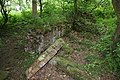 Foundations, Upleatham Ironstone Mine - geograph.org.uk - 469270.jpg 640 × 427; 223 KB
-
 Four Lane Ends Crossroads - geograph.org.uk - 39233.jpg 640 × 303; 45 KB
-
 Pontac Road - geograph.org.uk - 469215.jpg 427 × 640; 155 KB
-
 Pumping Shaft, Tocketts Ironstone Mine - geograph.org.uk - 329644.jpg 640 × 426; 109 KB
-
 Retaining Wall, Upleatham Ironstone Mine - geograph.org.uk - 469276.jpg 640 × 427; 212 KB
-
 Skelton Beck - geograph.org.uk - 163324.jpg 640 × 482; 92 KB
-

-
 Tocketts House - geograph.org.uk - 330685.jpg 640 × 384; 47 KB
-

-
 Waterfall Gill - geograph.org.uk - 92643.jpg 640 × 482; 107 KB


