Category:United Kingdom photographs taken on 2009-09-21
Jump to navigation
Jump to search
| ← | Monday 21 September 2009 | → | ||
| ← | September 2009 | → | ||

United Kingdom photographs taken on 21 September 2009.
Image files should be categorized here automatically using {{taken on}} template. Direct categorisation is also possible, if automatic is impossible.
Subcategories
This category has only the following subcategory.
S
Media in category "United Kingdom photographs taken on 2009-09-21"
The following 200 files are in this category, out of 780 total.
(previous page) (next page)-
 "Oh what a circus" - Richmond - geograph.org.uk - 1502436.jpg 640 × 480; 102 KB
-
 (2240) Blair's Shoulder-knot (Lithophane leautieri) (3939733855).jpg 1,500 × 1,004; 851 KB
-
 (2255) Feathered Ranunculus (Polymixis lichenea) (3939735627).jpg 1,500 × 1,004; 718 KB
-
 (2255) Feathered Ranunculus (Polymixis lichenea) (3940514550).jpg 1,500 × 1,004; 860 KB
-
 (2267) Beaded Chestnut (Agrochola lychnidis) (3939734403).jpg 1,500 × 1,004; 729 KB
-
 1, Navigation Yard - geograph.org.uk - 1518449.jpg 640 × 480; 86 KB
-
 150-154 Kirkgate (3) - geograph.org.uk - 1539261.jpg 480 × 640; 58 KB
-
 150-154 Kirkgate (4) - geograph.org.uk - 1539270.jpg 480 × 640; 68 KB
-
 2, Navigation Yard - geograph.org.uk - 1518457.jpg 640 × 480; 74 KB
-
 A corner near Scamps yard - geograph.org.uk - 1500605.jpg 640 × 480; 110 KB
-
 A pub sign that rhymes, Clun - geograph.org.uk - 1502929.jpg 640 × 424; 55 KB
-
 A road and C road - geograph.org.uk - 1522455.jpg 640 × 480; 61 KB
-
 A talking telescope - geograph.org.uk - 1505513.jpg 489 × 640; 72 KB
-
 A Tree Reflected in the Derwent - geograph.org.uk - 1511956.jpg 427 × 640; 144 KB
-
 A view up the valley from Clun Castle - geograph.org.uk - 1502911.jpg 640 × 424; 103 KB
-
 A Wood Entrance - panoramio.jpg 2,048 × 1,536; 1.13 MB
-
 A92, Rossie Island - geograph.org.uk - 1778482.jpg 640 × 480; 87 KB
-
 Aberdeen Railway, Montrose branch - geograph.org.uk - 1512204.jpg 640 × 480; 102 KB
-
 Aberdeen Railway, Montrose branch - geograph.org.uk - 1512313.jpg 640 × 480; 103 KB
-
 Aberdyfi pier from the west - geograph.org.uk - 1499638.jpg 640 × 467; 72 KB
-
 About the Dunkeld ell - geograph.org.uk - 1505823.jpg 461 × 640; 90 KB
-
 Ackroyd Street - Clough Street - geograph.org.uk - 1499671.jpg 640 × 480; 230 KB
-
 Ackroyd Street - Commercial Street - geograph.org.uk - 1499636.jpg 640 × 480; 226 KB
-
 Across the valley - Glyncorrwg - geograph.org.uk - 1505406.jpg 640 × 425; 83 KB
-
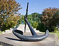 Admiralty pattern anchor, 1848 - geograph.org.uk - 1502569.jpg 640 × 500; 122 KB
-
 Albert Road - viewed from Troy Road - geograph.org.uk - 1499794.jpg 640 × 480; 227 KB
-
 Albert Road - viewed from Troy Road - geograph.org.uk - 1499797.jpg 640 × 480; 260 KB
-
 Alvanley Arms - geograph.org.uk - 1738104.jpg 640 × 375; 90 KB
-

-
 Approaching Llangloffan Cross - geograph.org.uk - 1503868.jpg 640 × 480; 54 KB
-

-

-
 Ash Tree with Swollen Base - geograph.org.uk - 1512010.jpg 427 × 640; 89 KB
-
 Auld Kirk, Chapel Street, Aberfeldy - geograph.org.uk - 1508653.jpg 480 × 640; 99 KB
-
 B9120 - geograph.org.uk - 1513315.jpg 640 × 480; 92 KB
-
 B9120, Balhagarty - geograph.org.uk - 1779515.jpg 640 × 480; 96 KB
-
 Back alley, Dunkeld - geograph.org.uk - 1505896.jpg 480 × 640; 96 KB
-
 Barn at Hookhams Farm - geograph.org.uk - 1502894.jpg 640 × 360; 82 KB
-
 Barn on Tote Lane - geograph.org.uk - 1500458.jpg 640 × 360; 56 KB
-

-
 Bay to the east of Little Castle Head - geograph.org.uk - 1544350.jpg 640 × 480; 268 KB
-
 Beach huts at Goodrington Sands - geograph.org.uk - 1505501.jpg 640 × 541; 83 KB
-
 Beck - Old Road - geograph.org.uk - 1503049.jpg 480 × 640; 337 KB
-
 Beckmere Lake - geograph.org.uk - 1550889.jpg 480 × 640; 107 KB
-
 Berry head fort cannon - geograph.org.uk - 1505729.jpg 496 × 640; 114 KB
-
 Berry Head lighthouse - geograph.org.uk - 1505498.jpg 640 × 603; 95 KB
-
 Big Ben - geograph.org.uk - 1582570.jpg 427 × 640; 57 KB
-
 Birnam Hill path - geograph.org.uk - 1506010.jpg 640 × 480; 110 KB
-
 Blue Plaque - geograph.org.uk - 1526788.jpg 640 × 571; 146 KB
-
 Blue Plaque 1, Navigation Yard - geograph.org.uk - 1518438.jpg 640 × 588; 152 KB
-
 Bosherston Lily Pond - geograph.org.uk - 1591802.jpg 640 × 480; 46 KB
-
 Bridge over Hammer Stream on Hammer Lane - geograph.org.uk - 1500348.jpg 640 × 360; 100 KB
-
 Bridge over Sandyhaven Pill - geograph.org.uk - 1544379.jpg 640 × 480; 274 KB
-
 Bridge over the Lowring Burn - geograph.org.uk - 1574830.jpg 640 × 481; 124 KB
-
 BT Tower Tolsford Hill - panoramio.jpg 2,048 × 1,536; 1.14 MB
-
 BT Tower Tolsford HIll - panoramio.jpg 1,536 × 2,048; 504 KB
-
 Buildings on Torquay harbour - geograph.org.uk - 1508473.jpg 451 × 640; 81 KB
-
 Burial Mound Tolsford Hill - panoramio.jpg 1,959 × 1,230; 621 KB
-
-
-
 Bus garage, Rossie Island - geograph.org.uk - 1512156.jpg 640 × 480; 73 KB
-
 Bus shelter, Upton Lovell - geograph.org.uk - 1502311.jpg 640 × 480; 105 KB
-
 Byway south from Titty Hill - geograph.org.uk - 1500051.jpg 640 × 360; 93 KB
-

-
 California Mews - Victoria Road - geograph.org.uk - 1500667.jpg 640 × 480; 259 KB
-
 Canada Water, SE16 - geograph.org.uk - 1618810.jpg 640 × 480; 110 KB
-
 Chapel of St Nicholas, Carisbrook Castle - geograph.org.uk - 1505538.jpg 480 × 640; 111 KB
-
 Cathedral Street, Dunkeld - geograph.org.uk - 1505848.jpg 640 × 480; 92 KB
-
 Cathedral Street, Dunkeld - geograph.org.uk - 1505854.jpg 640 × 480; 88 KB
-
 Cattle Grid - panoramio.jpg 1,502 × 1,572; 781 KB
-
 Cattle, Hill of Garvock - geograph.org.uk - 1779554.jpg 640 × 480; 88 KB
-
 Cattle, Kinnaber - geograph.org.uk - 1512358.jpg 640 × 480; 131 KB
-

-
 Chantry Chapel of St Mary Wakefield.jpg 480 × 640; 80 KB
-
 Chapel Hill - Station Road - geograph.org.uk - 1499808.jpg 640 × 480; 245 KB
-
 Charles Street - Ackroyd Street - geograph.org.uk - 1499681.jpg 640 × 480; 239 KB
-
 Charles Street - Clough Street - geograph.org.uk - 1499665.jpg 640 × 480; 242 KB
-

-

-
 Chillenden Court Farm - geograph.org.uk - 1500257.jpg 640 × 402; 62 KB
-
 Chillenden post mill - geograph.org.uk - 1500210.jpg 480 × 640; 64 KB
-
 Chillenden post mill - geograph.org.uk - 1500230.jpg 640 × 487; 46 KB
-
 Chillenden post mill - geograph.org.uk - 1502442.jpg 640 × 480; 43 KB
-
 Chimneys and balloon, Torquay - geograph.org.uk - 1508493.jpg 546 × 640; 76 KB
-

-

-
 Clifford Place - Hartley Street - geograph.org.uk - 1501102.jpg 640 × 480; 207 KB
-
 Climb to Kirkside - geograph.org.uk - 1512767.jpg 640 × 480; 109 KB
-
 Cloud formations over Reading - geograph.org.uk - 1535535.jpg 640 × 427; 97 KB
-
-
 Clough Street - viewed from Peel Street - geograph.org.uk - 1499662.jpg 640 × 480; 214 KB
-
 Clough Street - viewed from Peel Street - geograph.org.uk - 1499663.jpg 640 × 480; 240 KB
-
 Clowning around^ - geograph.org.uk - 1543056.jpg 480 × 640; 169 KB
-
 Clun Bridge and church - geograph.org.uk - 1502931.jpg 640 × 424; 85 KB
-
 Coast path above Lindsway Bay - geograph.org.uk - 1544320.jpg 640 × 480; 241 KB
-
 Coastwatch lookout in the Deer Park - geograph.org.uk - 1544430.jpg 640 × 480; 238 KB
-

-
 Collecting bales of straw - geograph.org.uk - 1500185.jpg 640 × 480; 85 KB
-
 Commemorative plaque, Dunkeld bridge - geograph.org.uk - 1505917.jpg 640 × 480; 120 KB
-
 Commemorative seat near Iping church - geograph.org.uk - 1500400.jpg 360 × 640; 94 KB
-

-
 Compton Road, Burmantofts, Leeds - geograph.org.uk - 1503293.jpg 640 × 480; 69 KB
-
 Confluence of a burn and a river - geograph.org.uk - 1574843.jpg 640 × 471; 107 KB
-
 Cooperative Street - Fountain Street - geograph.org.uk - 1501657.jpg 640 × 480; 234 KB
-
 Copse on the hill - geograph.org.uk - 1513138.jpg 640 × 480; 57 KB
-
 Staddle stones beside Bushey Lane - geograph.org.uk - 1767881.jpg 640 × 427; 100 KB
-
 Cosy Corner - geograph.org.uk - 1521032.jpg 640 × 480; 136 KB
-
 Cotebrook Shire Horse Centre - geograph.org.uk - 1738098.jpg 640 × 263; 56 KB
-
 Cotebrook Shire Horse Centre - geograph.org.uk - 1738110.jpg 640 × 300; 76 KB
-
 Cotebrook Shire Horse Centre - geograph.org.uk - 1738115.jpg 640 × 457; 55 KB
-
 Cottage by bridleway at Iping - geograph.org.uk - 1500413.jpg 640 × 360; 90 KB
-
 Cottage gate in Iping - geograph.org.uk - 1500384.jpg 360 × 640; 118 KB
-
 Cottage on Moorhouse Lane - geograph.org.uk - 1500318.jpg 640 × 360; 84 KB
-

-
 Cottage south of Northchapel - geograph.org.uk - 1502871.jpg 640 × 360; 57 KB
-
 Cottages at Iping - geograph.org.uk - 1500368.jpg 640 × 360; 48 KB
-
 Cottages in Cullipool - geograph.org.uk - 1509220.jpg 640 × 426; 259 KB
-
 Cottages near Woolhouse Farm - geograph.org.uk - 1500467.jpg 640 × 360; 83 KB
-
-
 Cottingley Approach - Cottingley Drive - geograph.org.uk - 1503085.jpg 640 × 480; 227 KB
-
 Cottingley Approach - Cottingley Drive - geograph.org.uk - 1503189.jpg 640 × 480; 217 KB
-
 Cottingley Crescent - Cottingley Drive - geograph.org.uk - 1503206.jpg 640 × 480; 242 KB
-

-
 Cottingley Green - Cottingley Approach - geograph.org.uk - 1503097.jpg 640 × 480; 218 KB
-
 Cottingley Towers - Cottingley Drive - geograph.org.uk - 1503200.jpg 640 × 480; 268 KB
-
 Country road, near Jordanston - geograph.org.uk - 1502353.jpg 640 × 480; 64 KB
-
 Craggy viewpoint, Birnam Hill - geograph.org.uk - 1506089.jpg 640 × 480; 124 KB
-
 Crews Hill to left of May Hill - geograph.org.uk - 1527801.jpg 640 × 480; 58 KB
-
 Croft House Avenue - King George Avenue - geograph.org.uk - 1500557.jpg 640 × 480; 230 KB
-
 Croft House Close - Croft House Road - geograph.org.uk - 1500568.jpg 640 × 480; 253 KB
-
 Croft House Drive - Croft House Avenue - geograph.org.uk - 1500565.jpg 640 × 480; 216 KB
-
 Croft House Drive - New Bank Street - geograph.org.uk - 1499832.jpg 640 × 480; 224 KB
-
 Croft House Gardens - Croft House Road - geograph.org.uk - 1500567.jpg 640 × 480; 230 KB
-
 Croft House Gardens - New Bank Street - geograph.org.uk - 1499827.jpg 640 × 480; 234 KB
-
 Croft House Grove - Croft House Road - geograph.org.uk - 1500570.jpg 640 × 480; 226 KB
-
 Croft House Grove - New Bank Street - geograph.org.uk - 1499822.jpg 640 × 480; 236 KB
-
 Croft House Lane - Croft House Avenue - geograph.org.uk - 1500559.jpg 640 × 480; 216 KB
-
 Croft House Lane - New Bank Street - geograph.org.uk - 1499842.jpg 640 × 480; 245 KB
-
 Croft House Mews - King George Avenue - geograph.org.uk - 1500556.jpg 640 × 480; 240 KB
-
 Croft House Road - Church Street - geograph.org.uk - 1500571.jpg 640 × 480; 220 KB
-
 Croft House View - Croft House Avenue - geograph.org.uk - 1500564.jpg 640 × 480; 217 KB
-
 Croft House View - New Bank Street - geograph.org.uk - 1499837.jpg 640 × 480; 221 KB
-
 Croft House Way - Croft House Avenue - geograph.org.uk - 1500563.jpg 640 × 480; 218 KB
-
-
 Cross Peel Street - Peel Street - geograph.org.uk - 1499657.jpg 640 × 480; 233 KB
-
 Crossing Hill of Garvock - geograph.org.uk - 1779552.jpg 640 × 480; 79 KB
-
 Crossland Road - Elland Road - geograph.org.uk - 1501132.jpg 640 × 480; 213 KB
-
 Crossroads near Goodnestone - geograph.org.uk - 1500151.jpg 640 × 480; 46 KB
-
 Cullipool pier - geograph.org.uk - 1509216.jpg 640 × 426; 204 KB
-
 Cwm of the Nant Braich-y-rhiw - geograph.org.uk - 1499698.jpg 640 × 489; 124 KB
-
 Cwm Rheidol - geograph.org.uk - 1549371.jpg 640 × 480; 72 KB
-
 Daffil Road - Elland Road - geograph.org.uk - 1501129.jpg 640 × 480; 203 KB
-
 Deanfield Avenue - Ingle Avenue - geograph.org.uk - 1500609.jpg 640 × 480; 219 KB
-
 Den Finella - geograph.org.uk - 1513300.jpg 640 × 480; 126 KB
-
 Dismantled Railway line - geograph.org.uk - 1523296.jpg 428 × 640; 119 KB
-
-
 Disused fuel pump at Mathry - geograph.org.uk - 1598464.jpg 480 × 640; 110 KB
-
 Double vision^ - geograph.org.uk - 1508663.jpg 480 × 640; 106 KB
-
 Dounie Burn - geograph.org.uk - 1508134.jpg 640 × 480; 132 KB
-
 Dounie Burn - geograph.org.uk - 1508144.jpg 480 × 640; 113 KB
-
 Downpatrick sunset (01), September 2009.JPG 4,272 × 2,848; 2.92 MB
-
 Downpatrick sunset (02), September 2009.JPG 4,272 × 2,848; 3.04 MB
-
 Downpatrick sunset (03), September 2009.JPG 4,272 × 2,848; 2.96 MB
-
-
 Dry stone wall between thistles - geograph.org.uk - 1508125.jpg 480 × 640; 128 KB
-
 Dulverton Green - Cottingley Drive - geograph.org.uk - 1503070.jpg 640 × 480; 227 KB
-
 Dulverton Square - Cottingley Drive - geograph.org.uk - 1503087.jpg 640 × 480; 288 KB
-
 Dunkeld Cathedral - geograph.org.uk - 1505864.jpg 480 × 640; 126 KB
-
 Dunkeld Cathedral - geograph.org.uk - 1505929.jpg 640 × 480; 118 KB
-
 Dunkeld Street, Aberfeldy - geograph.org.uk - 1508672.jpg 640 × 480; 100 KB
-
 Dunkeld Street, Aberfeldy - geograph.org.uk - 1508686.jpg 640 × 432; 83 KB
-
 East Burnham - geograph.org.uk - 1499833.jpg 640 × 480; 79 KB
-
 East from Birnam Hill - geograph.org.uk - 1506075.jpg 480 × 640; 127 KB
-
 East Street, Leeds - geograph.org.uk - 1504318.jpg 640 × 480; 75 KB
-

-
 Elland Road - viewed from Westwood Side - geograph.org.uk - 1501094.jpg 640 × 480; 245 KB
-
 Entrance to Mathry Community Hall - geograph.org.uk - 1598198.jpg 640 × 480; 67 KB
-
 Entrance to The United Lodge of Dunkeld - geograph.org.uk - 1505922.jpg 480 × 640; 119 KB
-
 Etiolated baobab trees - geograph.org.uk - 1499928.jpg 640 × 482; 45 KB
-
 Farm track, Chapelfield - geograph.org.uk - 1513292.jpg 640 × 480; 113 KB
-

-
 Faulds Road - geograph.org.uk - 1512194.jpg 640 × 480; 92 KB
-
-
 Fence through forest - geograph.org.uk - 1508070.jpg 480 × 640; 96 KB
-
 Field near Tentworth - geograph.org.uk - 1500270.jpg 640 × 360; 38 KB
-
 Field north east of Old Court Farm - geograph.org.uk - 1499763.jpg 640 × 376; 35 KB
-
 Field with sheep near Ebernoe - geograph.org.uk - 1502866.jpg 640 × 360; 56 KB
-
 Field, Longleys - geograph.org.uk - 1779527.jpg 640 × 480; 95 KB
-

-

-

-

-

-

-

-

-

-

-
 Fishing on the Tay, Dunkeld - geograph.org.uk - 1505873.jpg 640 × 480; 122 KB
-
 Flamboyant larva of a Pale tussock moth - geograph.org.uk - 1505782.jpg 640 × 442; 106 KB

_Blair%27s_Shoulder-knot_(Lithophane_leautieri)_(3939733855).jpg)
_Feathered_Ranunculus_(Polymixis_lichenea)_(3939735627).jpg)
_Feathered_Ranunculus_(Polymixis_lichenea)_(3940514550).jpg)
_Beaded_Chestnut_(Agrochola_lychnidis)_(3939734403).jpg)

_-_geograph.org.uk_-_1539261.jpg)
_-_geograph.org.uk_-_1539270.jpg)


_Hudson_Road_Mill,_Burmantofts,_Leeds_-_geograph.org.uk_-_1503235.jpg)


,_Crown_Point_Road,_Leeds_-_geograph.org.uk_-_1504769.jpg)


,_September_2009.JPG)
,_September_2009.JPG)
,_September_2009.JPG)


_-_geograph.org.uk_-_1525054.jpg)
_-_geograph.org.uk_-_1525055.jpg)
_-_geograph.org.uk_-_1525056.jpg)
_-_geograph.org.uk_-_1525058.jpg)
_-_geograph.org.uk_-_1525059.jpg)
_-_geograph.org.uk_-_1525060.jpg)
_-_geograph.org.uk_-_1525062.jpg)
_-_geograph.org.uk_-_1525063.jpg)


