Category:USGS ShakeMaps of earthquakes in California
Jump to navigation
Jump to search
Media in category "USGS ShakeMaps of earthquakes in California"
The following 49 files are in this category, out of 49 total.
-
 USGS Shakemap - 1968 Borrego Mountain earthquake.jpg 612 × 720; 186 KB
-
 February 1971 San Fernando earthquake intensity USGS.jpg 612 × 711; 163 KB
-
 USGS Shakemap - 1971 San Fernando earthquake (alternate).jpg 864 × 792; 242 KB
-
 USGS Shakemap - 1979 Coyote Lake earthquake.jpg 612 × 725; 182 KB
-
 USGS Shakemap - 1979 Imperial Valley earthquake.jpg 612 × 722; 185 KB
-
 USGS Shakemap - 1980 Eureka earthquake.jpg 612 × 715; 152 KB
-
 USGS Shakemap - 1983 Coalinga earthquake (aftershock).jpg 612 × 727; 181 KB
-
 USGS Shakemap - 1983 Coalinga earthquake (mainshock).jpg 612 × 723; 190 KB
-
 USGS Shakemap - 1984 Morgan Hill earthquake.jpg 612 × 718; 115 KB
-
 USGS Shakemap - 1986 Chalfant Valley earthquake.jpg 1,663 × 2,132; 2.05 MB
-
 USGS Shakemap - 1986 Palm Springs earthquake.jpg 612 × 721; 180 KB
-
 USGS Shakemap - 1987 Superstition Hills earthquake.jpg 612 × 724; 187 KB
-
 USGS Shakemap - 1987 Whittier Narrows earthquake.jpg 1,692 × 2,120; 1.83 MB
-
 LomaPrieta ShakeMap.png 775 × 949; 1.27 MB
-
 1989 Loma Prieta Shake Map.jpg 437 × 647; 69 KB
-
 USGS Shakemap - 1991 Sierra Madre earthquake.jpg 612 × 718; 120 KB
-
 USGS Shakemap - 1992 Big Bear earthquake.jpg 612 × 718; 133 KB
-
 USGS Shakemap - 1992 Cape Mendocino earthquake (first aftershock).jpg 612 × 716; 146 KB
-

-
 USGS Shakemap - 1992 Cape Mendocino earthquake.jpg 612 × 718; 97 KB
-
 USGS ShakeMap - 1992 Landers earthquake.jpg 612 × 718; 132 KB
-
 Shake Map Northridge 1994.jpg 612 × 718; 114 KB
-
 2005 Eureka Earthquake ShakeMap.jpg 612 × 662; 131 KB
-
 California Quake September 2 2007.jpg 612 × 625; 104 KB
-
 CISN Shakemap - 2007 Alum Rock earthquake.jpg 612 × 643; 108 KB
-
 LA Earthquake July 29 2008.jpg 612 × 718; 116 KB
-
 LA Earthquake May 17 2009.jpg 612 × 626; 167 KB
-
 April 2010 Baja California aftershock intensity USGS.jpg 863 × 1,077; 559 KB
-
 January 2010 Eureka earthquake intensity USGS.jpg 612 × 719; 96 KB
-
 March 2010 Pico Rivera earthquake intensity USGS.jpg 612 × 627; 177 KB
-
 South California 5.4 earthquake.jpg 612 × 624; 194 KB
-
 5 3 Earthquake in Southern California.jpg 612 × 684; 193 KB
-
 2014 Eureka Earthquake ShakeMap.jpg 612 × 663; 76 KB
-
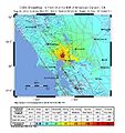 2014-08-24 M6.1 American Canyon, California.jpg 612 × 648; 107 KB
-

-
 2019-07-04 Searles Valley, CA M6.4 earthquake shakemap (cgs).jpg 612 × 635; 134 KB
-
 2019-07-04 Searles Valley, CA M6.4 earthquake shakemap (ci).jpg 612 × 792; 275 KB
-
 2019-07-04 Searles Valley, CA M6.4 earthquake shakemap (USGS).jpg 867 × 1,070; 451 KB
-
 2019-07-06 Ridgecrest, CA M7.1 earthquake shakemap (ATLAS).png 2,498 × 3,199; 5.84 MB
-
 2019-07-06 Ridgecrest, CA M7.1 earthquake shakemap (cgs).jpg 612 × 635; 138 KB
-
 2019-07-06 Ridgecrest, CA M7.1 earthquake shakemap (ci).jpg 612 × 792; 328 KB
-
 2019-07-06 Ridgecrest, CA M7.1 earthquake shakemap (USGS).jpg 869 × 1,079; 464 KB
-
 2019-07-06 Searles Valley, CA M7.1 earthquake shakemap (cgs).jpg 612 × 792; 169 KB
-
 2019-07-06 Searles Valley, CA M7.1 earthquake shakemap (ci).jpg 612 × 792; 278 KB
-
 2019-07-06 Searles Valley, CA M7.1 earthquake shakemap (USGS).jpg 832 × 1,068; 447 KB
-
 April 2010 Baja California earthquake intensity USGS.jpg 612 × 718; 123 KB
-
 Shake Intensity - 2014 South Napa Earthquake.jpg 612 × 718; 114 KB
-
 USGS Shakemap - 1989 Loma Prieta earthquake (August 1989 foreshock).jpg 612 × 726; 152 KB
-
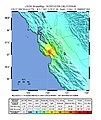 USGS Shakemap - 1989 Loma Prieta earthquake (June 1988 foreshock).jpg 612 × 726; 145 KB


.jpg)


.jpg)
.jpg)


.jpg)
.jpg)


.jpg)
.jpg)
.jpg)
.jpg)
.png)
.jpg)
.jpg)
.jpg)
.jpg)
.jpg)
.jpg)


.jpg)
.jpg)