Category:Tundergarth
Jump to navigation
Jump to search
Scottish parish in Dumfries and Galloway, Scotland, UK | |||||
| Upload media | |||||
| Instance of | |||||
|---|---|---|---|---|---|
| Part of |
| ||||
| Location |
| ||||
| Population |
| ||||
| Area |
| ||||
 | |||||
Media in category "Tundergarth"
The following 161 files are in this category, out of 161 total.
-
 A farm track from Capelfoot - geograph.org.uk - 1034109.jpg 427 × 640; 144 KB
-
 A fence running up to Newland Hill - geograph.org.uk - 1030181.jpg 427 × 640; 119 KB
-
 A forestry track in Capelfoot Forest - geograph.org.uk - 1123344.jpg 640 × 427; 147 KB
-
 A fort on Newland Hill - geograph.org.uk - 1034174.jpg 639 × 407; 122 KB
-
 A grass track on Newland Hill - geograph.org.uk - 1034170.jpg 427 × 640; 127 KB
-

-
 A grazing field at Cairnknowe - geograph.org.uk - 1034155.jpg 640 × 427; 125 KB
-
 A settlement on Mid Hill - geograph.org.uk - 1030192.jpg 640 × 427; 130 KB
-
 A shed on Newland Hill - geograph.org.uk - 1034178.jpg 640 × 427; 124 KB
-
 A standing stone on Woody Hill - geograph.org.uk - 1228025.jpg 640 × 427; 117 KB
-

-
 A track running down to Capelfoot - geograph.org.uk - 1030128.jpg 640 × 427; 119 KB
-
 A weather battered shed door - geograph.org.uk - 1034188.jpg 427 × 640; 133 KB
-
 A wind turbine on Blackcleuchedge Moss - geograph.org.uk - 1225240.jpg 640 × 410; 159 KB
-
 A74 (M) - geograph.org.uk - 849036.jpg 640 × 480; 226 KB
-
 A74(M) - geograph.org.uk - 3164345.jpg 640 × 430; 46 KB
-
 A74(M) approaches Junction 18 - geograph.org.uk - 3507742.jpg 640 × 481; 41 KB
-
 A74(M) signage - north bound - geograph.org.uk - 6227584.jpg 1,024 × 806; 98 KB
-
 An enclosure on Crawthat Hill - geograph.org.uk - 994221.jpg 640 × 427; 126 KB
-
 B7068 - geograph.org.uk - 4707486.jpg 800 × 600; 533 KB
-
 B7068, Paddockhole - geograph.org.uk - 4705568.jpg 800 × 600; 440 KB
-
 Bankshill - geograph.org.uk - 4705930.jpg 800 × 600; 451 KB
-
 Bankshill, Dumfriesshire - geograph.org.uk - 5305203.jpg 1,024 × 683; 298 KB
-
 Birny Hill - geograph.org.uk - 379736.jpg 640 × 478; 101 KB
-
 Broadleaf tree planting - geograph.org.uk - 1034161.jpg 640 × 427; 122 KB
-
 Burnt Hill - geograph.org.uk - 379467.jpg 640 × 480; 124 KB
-
 Castlehill - geograph.org.uk - 4705988.jpg 800 × 600; 485 KB
-
 Cattle in pasture near Northburn Farm - geograph.org.uk - 451219.jpg 610 × 465; 122 KB
-
 Cleughhead - geograph.org.uk - 4705824.jpg 800 × 600; 505 KB
-
 Cottages at Bankshill - geograph.org.uk - 3580880.jpg 640 × 480; 92 KB
-
 Courstein Farm - geograph.org.uk - 979527.jpg 640 × 427; 57 KB
-
 Eldery Knowe - geograph.org.uk - 5946980.jpg 640 × 480; 295 KB
-
 Farm buildings at Cairnknowe - geograph.org.uk - 1034138.jpg 640 × 427; 127 KB
-
 Farm track and ford - geograph.org.uk - 4719376.jpg 1,024 × 768; 199 KB
-
 Farmland at Newhall - geograph.org.uk - 996680.jpg 640 × 427; 132 KB
-
 Farmland at Pearsby Hall - geograph.org.uk - 2568207.jpg 640 × 427; 258 KB
-
 Farmland at Powhaffet - geograph.org.uk - 994202.jpg 640 × 427; 147 KB
-
 Farmland at Standburn - geograph.org.uk - 5671390.jpg 2,592 × 1,944; 1.6 MB
-
 Farmland at Tundergarth Mains - geograph.org.uk - 1034237.jpg 640 × 427; 114 KB
-
 Farmland near Hazelberry - geograph.org.uk - 1242145.jpg 640 × 427; 140 KB
-
 Farmland to the east of Crow Wood - geograph.org.uk - 994207.jpg 640 × 427; 126 KB
-
 Field and stripwood, Burnhead - geograph.org.uk - 5305207.jpg 1,024 × 683; 397 KB
-
 Field, Gibson - geograph.org.uk - 4707592.jpg 800 × 600; 454 KB
-
 Field, Hallbank - geograph.org.uk - 4707430.jpg 800 × 600; 494 KB
-
 Field, Westwood - geograph.org.uk - 4707532.jpg 800 × 600; 522 KB
-
 Fields and dykes, Tundergarth - geograph.org.uk - 4707461.jpg 800 × 600; 464 KB
-
 Fields near Tundergarth Church - geograph.org.uk - 4720501.jpg 1,024 × 768; 216 KB
-
 Fields south of Bankshill - geograph.org.uk - 3580883.jpg 640 × 480; 91 KB
-
 Forest road, Hazelberry Hill - geograph.org.uk - 5305212.jpg 1,024 × 683; 361 KB
-
 Former Ford at Wyliehole - geograph.org.uk - 5854052.jpg 3,000 × 2,000; 6.73 MB
-
 Friar Edge - geograph.org.uk - 1034167.jpg 640 × 427; 135 KB
-
 From Shawshill to Lockerbie - geograph.org.uk - 3561662.jpg 3,525 × 3,586; 2.86 MB
-
 Gardiner's Brae - geograph.org.uk - 4705771.jpg 800 × 600; 422 KB
-
 Garvald Church graveyard - geograph.org.uk - 68323.jpg 480 × 640; 146 KB
-
 Grange Fell - geograph.org.uk - 3359515.jpg 1,600 × 1,200; 1.1 MB
-
 Grange of Tundergarth - geograph.org.uk - 838703.jpg 640 × 480; 123 KB
-
 Grazing field - geograph.org.uk - 440891.jpg 640 × 480; 109 KB
-
 Grazing near Gibsons - geograph.org.uk - 4686010.jpg 640 × 430; 47 KB
-
 Grazing sheep - geograph.org.uk - 1034220.jpg 640 × 403; 131 KB
-
 Heading for Scroggs - geograph.org.uk - 699721.jpg 640 × 480; 52 KB
-
 Hen Hill - geograph.org.uk - 379320.jpg 640 × 480; 153 KB
-
 Hill countryside - geograph.org.uk - 1034192.jpg 640 × 427; 144 KB
-
 Hill farming countryside - geograph.org.uk - 1030186.jpg 640 × 427; 122 KB
-
 Hill farming countryside - geograph.org.uk - 1034119.jpg 427 × 640; 139 KB
-

-
 Hillside tracks near Shawhill - geograph.org.uk - 3580875.jpg 640 × 480; 82 KB
-
 In Remembrance - geograph.org.uk - 699701.jpg 640 × 480; 85 KB
-
 Junction, B7068 - geograph.org.uk - 4707524.jpg 800 × 600; 627 KB
-
 Katie's Knowe - geograph.org.uk - 5305199.jpg 1,024 × 683; 231 KB
-
 Kirtle Nick - geograph.org.uk - 379456.jpg 640 × 480; 119 KB
-
 Lade, Burnhead - geograph.org.uk - 5305210.jpg 1,024 × 683; 386 KB
-
 Linnhead - geograph.org.uk - 4707477.jpg 800 × 600; 491 KB
-
 Livestock farmland - geograph.org.uk - 440889.jpg 640 × 480; 108 KB
-
 Locks, Minsca wind farm - geograph.org.uk - 4705615.jpg 800 × 600; 501 KB
-
 Looking towards Shawhill - geograph.org.uk - 4719374.jpg 1,024 × 768; 186 KB
-
 Lunelly Tower - geograph.org.uk - 4705863.jpg 800 × 600; 549 KB
-
 Milton House - geograph.org.uk - 4269768.jpg 3,183 × 2,079; 1.73 MB
-
 Minsca Hill Wind Farm Entrance - geograph.org.uk - 800948.jpg 640 × 480; 156 KB
-
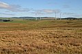
 Minsca Wind Farm - geograph.org.uk - 5946179.jpg 640 × 480; 177 KB
-
 Minsca wind farm entrance - geograph.org.uk - 4705608.jpg 800 × 600; 516 KB
-
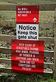
 Minsca wind farm notices - geograph.org.uk - 4705673.jpg 640 × 480; 95 KB
-
 Minsca wind farm road - geograph.org.uk - 4705638.jpg 800 × 600; 422 KB
-
 New wind farm near Crow Wood - geograph.org.uk - 2177804.jpg 3,872 × 2,592; 3.63 MB
-
 Newhall - geograph.org.uk - 4269766.jpg 3,456 × 1,977; 1.03 MB
-
 Newhall Farm - geograph.org.uk - 1037090.jpg 640 × 427; 133 KB
-
 Newhall Hill - geograph.org.uk - 4705553.jpg 800 × 600; 520 KB
-
 Old building by the B7068 - geograph.org.uk - 261490.jpg 640 × 480; 79 KB
-
 Ordnance Survey Flush Bracket 10395 - geograph.org.uk - 4255586.jpg 4,000 × 3,000; 3.73 MB
-
 Paddockhill Bridge - geograph.org.uk - 4705595.jpg 800 × 600; 524 KB
-
 Pasture at Capelfoot - geograph.org.uk - 1034213.jpg 640 × 416; 120 KB
-
 Pasture field - geograph.org.uk - 440896.jpg 640 × 480; 102 KB
-
 Perceiving Burn (2) - geograph.org.uk - 4719335.jpg 1,024 × 768; 385 KB
-
 Perceiving Burn - geograph.org.uk - 4578101.jpg 1,024 × 768; 186 KB
-
 Posts on Pleamoss Hill - geograph.org.uk - 2570308.jpg 640 × 427; 257 KB
-
 Pylons march across the countryside - geograph.org.uk - 2177142.jpg 2,592 × 3,872; 2.75 MB
-
 Road (B7068) and Village Hall at Bankshill - geograph.org.uk - 4189991.jpg 4,000 × 3,000; 2.95 MB
-
 Road (B7068) at Cleuchhead - geograph.org.uk - 4189988.jpg 4,000 × 3,000; 2.71 MB
-
 Road (B7068) descending from Standburn - geograph.org.uk - 4189987.jpg 4,000 × 3,000; 3.68 MB
-
 Road Junction at Scroggs - geograph.org.uk - 4189994.jpg 4,000 × 3,000; 3.98 MB
-
 Road near Gibsons - geograph.org.uk - 4707578.jpg 800 × 600; 545 KB
-
 Rough grazing at Powhaffet - geograph.org.uk - 995479.jpg 640 × 427; 120 KB
-

-
 Rough grazing near Hazelberry - geograph.org.uk - 1225267.jpg 427 × 640; 124 KB
-
 Rough grazing on Newland Hill - geograph.org.uk - 1030215.jpg 640 × 427; 115 KB
-
 Rough grazing on Newland Hill - geograph.org.uk - 1034104.jpg 640 × 427; 134 KB
-
 Rough grazing on Percy Hill - geograph.org.uk - 1030211.jpg 640 × 427; 132 KB
-
 Rough grazing on Pleamoss Hill - geograph.org.uk - 2570299.jpg 640 × 427; 272 KB
-
 Scalehill Farm - geograph.org.uk - 796011.jpg 640 × 480; 65 KB
-
 Scroggs Bridge - geograph.org.uk - 699643.jpg 640 × 480; 85 KB
-
 Seven Brethren stone circle - geograph.org.uk - 996688.jpg 427 × 640; 125 KB
-
 Sheep in the valley of the Water of Milk - geograph.org.uk - 5946769.jpg 640 × 480; 345 KB
-
 Sheep on Crawthat Hill - geograph.org.uk - 996692.jpg 640 × 427; 123 KB
-
 Sheep on the road - geograph.org.uk - 440880.jpg 640 × 480; 105 KB
-
 Sheep pasture - geograph.org.uk - 1228048.jpg 640 × 427; 153 KB
-
 Sheep pens near Capelfoot - geograph.org.uk - 1034099.jpg 640 × 423; 125 KB
-
-
 Small gulley feeding into the Water of Milk - geograph.org.uk - 2177072.jpg 3,872 × 2,592; 4.77 MB
-
 Snowy riverbank - geograph.org.uk - 2177797.jpg 3,485 × 2,333; 4.76 MB
-
 Standburn - geograph.org.uk - 4705798.jpg 800 × 600; 497 KB
-
 Strange cloud formations over Minsca - geograph.org.uk - 5946181.jpg 640 × 480; 158 KB
-
 The access road to Minsca Wind Farm - geograph.org.uk - 1225263.jpg 427 × 640; 154 KB
-
 The access road to Minsca Wind Farm - geograph.org.uk - 1227970.jpg 640 × 427; 123 KB
-
 The B7068 west-southwest of Bankshill - geograph.org.uk - 2913066.jpg 816 × 612; 114 KB
-
 The Cadgill Burn - geograph.org.uk - 2568209.jpg 427 × 640; 340 KB
-
 The Capel Burn - geograph.org.uk - 1034215.jpg 640 × 406; 133 KB
-
 The edge of Capelfoot Forest - geograph.org.uk - 1034122.jpg 640 × 427; 117 KB
-
 The forest edge - geograph.org.uk - 1030208.jpg 640 × 392; 115 KB
-
 The road to Bankshill - geograph.org.uk - 3580872.jpg 640 × 480; 84 KB
-

-
 Todhole Wood - geograph.org.uk - 4707452.jpg 800 × 600; 484 KB
-
 Trig point of Grange Fell - geograph.org.uk - 6671649.jpg 1,999 × 1,309; 2.36 MB
-
 Tundergarth Church - geograph.org.uk - 36045.jpg 640 × 480; 189 KB
-
 Tundergarth Mains - geograph.org.uk - 4578097.jpg 1,024 × 768; 245 KB
-
 Tundergarth Parish Church - geograph.org.uk - 1034227.jpg 427 × 640; 112 KB
-
 Tundergarth Parish Church - geograph.org.uk - 4189983.jpg 4,000 × 3,000; 3.84 MB
-
 Tundergarth Parish Church - geograph.org.uk - 4719319.jpg 1,024 × 768; 242 KB
-
 Tundergarth Parish Church - geograph.org.uk - 5787064.jpg 640 × 480; 94 KB
-
 Tundergarth Parish Church - geograph.org.uk - 6759747.jpg 1,600 × 778; 523 KB
-
 Tundergarth Parish Churchyard - geograph.org.uk - 1034233.jpg 640 × 427; 138 KB
-
 Tundergarth Primary School - geograph.org.uk - 4705971.jpg 800 × 600; 390 KB
-
 Tundergarth Road, Lockerbie - geograph.org.uk - 380569.jpg 640 × 428; 96 KB
-
 Tundergarth, Lockerbie, Scotland, UK (2646910583).jpg 4,206 × 2,314; 4.57 MB
-
 Tundergarth, Lockerbie, Scotland, UK (2646917145).jpg 3,764 × 2,500; 4.48 MB
-
 Tundergarth, Lockerbie, Scotland, UK (2647727066).jpg 4,151 × 2,758; 7.24 MB
-
 Upper reaches of the Water of Milk - geograph.org.uk - 5946723.jpg 640 × 480; 241 KB
-
 Valley of the Water of Milk - geograph.org.uk - 3579319.jpg 640 × 480; 83 KB
-
 Valley of the Water of Milk - geograph.org.uk - 3579322.jpg 640 × 480; 143 KB
-
 View to the north west of Tundergarth Church - geograph.org.uk - 4720502.jpg 1,024 × 768; 234 KB
-
 View towards the Southern Uplands - geograph.org.uk - 4578106.jpg 1,024 × 768; 181 KB
-
 Water of Milk - geograph.org.uk - 2177157.jpg 3,872 × 2,592; 5.17 MB
-
 Water of Milk - geograph.org.uk - 4705697.jpg 800 × 600; 417 KB
-
 Water of Milk - geograph.org.uk - 4705729.jpg 800 × 600; 432 KB
-
 Water of Milk - geograph.org.uk - 4705755.jpg 800 × 600; 461 KB
-
 Water of Milk - geograph.org.uk - 4705886.jpg 800 × 600; 467 KB
-
 Water of Milk and Craighousesteads Farm - geograph.org.uk - 5946673.jpg 640 × 480; 244 KB
-
 West Coast Main Line - geograph.org.uk - 4707591.jpg 800 × 600; 463 KB
-
 Westwood Farm - geograph.org.uk - 796087.jpg 640 × 480; 58 KB
-
 Whiteknowe - geograph.org.uk - 4705762.jpg 800 × 600; 457 KB
-
 Whitstone Hill - geograph.org.uk - 4705805.jpg 800 × 600; 424 KB
-
 Woodland by Gibson - geograph.org.uk - 4707543.jpg 800 × 600; 472 KB
-
 Young ash trees - geograph.org.uk - 1034157.jpg 427 × 640; 120 KB


_-_geograph.org.uk_-_849036.jpg)
_-_geograph.org.uk_-_3164345.jpg)
_approaches_Junction_18_-_geograph.org.uk_-_3507742.jpg)
_signage_-_north_bound_-_geograph.org.uk_-_6227584.jpg)


_-_geograph.org.uk_-_4719335.jpg)


_and_Village_Hall_at_Bankshill_-_geograph.org.uk_-_4189991.jpg)
_at_Cleuchhead_-_geograph.org.uk_-_4189988.jpg)
_descending_from_Standburn_-_geograph.org.uk_-_4189987.jpg)


.jpg)
.jpg)
.jpg)


