Category:Tram maps of Dublin
Jump to navigation
Jump to search
Media in category "Tram maps of Dublin"
The following 15 files are in this category, out of 15 total.
-
 Dublin 1922-23 Map Suburbs MatureTrams wFaresTimes Trains EarlyBus Canals pub.png 3,976 × 3,000; 16.29 MB
-
 Dublin East & Ctr w Roads & Trams w Termini inc centre pt Nelsons Pillar.jpg 1,255 × 2,042; 1.88 MB
-
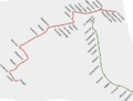
 Dublin tram combination.jpg 850 × 768; 168 KB
-
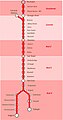
 GreenLineStops.jpg 582 × 1,048; 40 KB
-
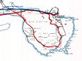 Howth Tram map, 1922.jpg 976 × 730; 115 KB
-
 Luas map.png 3,808 × 2,898; 470 KB
-
 Luas map.svg 512 × 408; 212 KB
-
 Luas network map (ga).svg 760 × 550; 38 KB
-
 LUAS NETWORK MAP.png 739 × 507; 10 KB
-
 Luas network map.svg 760 × 550; 32 KB
-
 Luas system map.png 3,392 × 2,545; 5.35 MB
-
 Luas system map.svg 2,594 × 1,959; 1.95 MB
-
 LuasRedLineStops.jpg 581 × 1,108; 47 KB
-
 Mapluas.png 590 × 435; 311 KB
-
 Ulster Transport Museum, Cultra, historic drawings 01.jpg 1,054 × 1,833; 1.08 MB


.svg)


