Category:Town hall of Saint-Pierre-la-Palud
Jump to navigation
Jump to search
| Object location | | View all coordinates using: OpenStreetMap |
|---|
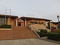
town hall located in Rhône department, France  | |||||
| Upload media | |||||
| Instance of |
| ||||
|---|---|---|---|---|---|
| Location | Saint-Pierre-la-Palud, Rhône, Auvergne-Rhône-Alpes, Metropolitan France, France | ||||
| Street address |
| ||||
| Has use | |||||
| Owned by | |||||
| Operator | |||||
 | |||||
Media in category "Town hall of Saint-Pierre-la-Palud"
This category contains only the following file.
-
 Saint-Pierre-la-Palud - Mairie.jpg 4,608 × 3,456; 3.31 MB