Category:Torphichen (civil parish)
Jump to navigation
Jump to search
Scottish parish in West Lothian, Scotland, UK  | |||||
| Upload media | |||||
| Instance of | |||||
|---|---|---|---|---|---|
| Part of |
| ||||
| Named after | |||||
| Location |
| ||||
| Population |
| ||||
| Area |
| ||||
 | |||||
Subcategories
This category has the following 3 subcategories, out of 3 total.
B
T
W
Media in category "Torphichen (civil parish)"
The following 200 files are in this category, out of 372 total.
(previous page) (next page)-
 1914-1918 War Memorial - geograph.org.uk - 2874233.jpg 427 × 640; 341 KB
-
 1939-1945 War Memorial - geograph.org.uk - 2874240.jpg 412 × 640; 407 KB
-
 A closed road - geograph.org.uk - 6350262.jpg 1,024 × 683; 397 KB
-
 A strange deposit near Wallhouse - geograph.org.uk - 6398855.jpg 3,264 × 2,448; 5.15 MB
-

-
 A wet midwinter day near Torphichen - geograph.org.uk - 6350256.jpg 1,024 × 810; 245 KB
-
 A706 at B792 junction - geograph.org.uk - 2018491.jpg 640 × 480; 87 KB
-
 A801 - geograph.org.uk - 3771205.jpg 640 × 480; 301 KB
-
 A801 towards the M9 Motorway - geograph.org.uk - 5449764.jpg 640 × 480; 66 KB
-
 A801 towards the M9 Motorway - geograph.org.uk - 5449768.jpg 640 × 480; 102 KB
-
 A89 approaching Blackridge - geograph.org.uk - 4575363.jpg 640 × 480; 68 KB
-
 A89 towards Armadale - geograph.org.uk - 4575331.jpg 640 × 480; 71 KB
-
 A89 towards Armadale - geograph.org.uk - 4575350.jpg 640 × 480; 64 KB
-
 A89 towards Armadale - geograph.org.uk - 4575361.jpg 640 × 480; 53 KB
-
 A89 towards Armadale - geograph.org.uk - 4575393.jpg 640 × 480; 57 KB
-
 A89, Blackridge - geograph.org.uk - 4575391.jpg 640 × 480; 53 KB
-
 A89, Entryfoot - geograph.org.uk - 4575358.jpg 640 × 480; 66 KB
-
 Access road - geograph.org.uk - 2283156.jpg 640 × 480; 76 KB
-
 Airdrie - Bathgate railway - geograph.org.uk - 4223484.jpg 800 × 600; 385 KB
-
 Airdrie - Bathgate railway - geograph.org.uk - 4223492.jpg 800 × 600; 424 KB
-
 Airdrie - Bathgate railway - NCN 75 - geograph.org.uk - 3947875.jpg 640 × 480; 319 KB
-
 Airdrie-Bathgate Rail Link - geograph.org.uk - 4565715.jpg 640 × 480; 61 KB
-
 Along the Barbauchlaw Burn - geograph.org.uk - 6350594.jpg 1,024 × 683; 235 KB
-
 Approaching track junction, Bedlormie - geograph.org.uk - 6508936.jpg 5,152 × 3,864; 7.51 MB
-
 Armadale Water Treatment Works - geograph.org.uk - 6398295.jpg 3,264 × 2,448; 2.97 MB
-
 Armadale Water Treatment Works - geograph.org.uk - 6398314.jpg 3,264 × 2,448; 2.59 MB
-
 Avon Viaduct - geograph.org.uk - 3303567.jpg 1,920 × 1,440; 261 KB
-
 Avoncrook - geograph.org.uk - 1836523.jpg 1,024 × 768; 94 KB
-
 Avoncrook - geograph.org.uk - 3881458.jpg 640 × 480; 294 KB
-
 Avoncrook Wood - geograph.org.uk - 1836673.jpg 1,024 × 768; 231 KB
-
 B8028, Westfield - geograph.org.uk - 3831614.jpg 640 × 480; 258 KB
-
 B8047 towards Torphichen - geograph.org.uk - 5449760.jpg 640 × 480; 58 KB
-
 Badger sett in the Avon Gorge - geograph.org.uk - 1836680.jpg 1,024 × 768; 244 KB
-
 Barn Wood (2) - geograph.org.uk - 4767797.jpg 1,024 × 683; 215 KB
-
 Barn Wood (3) - geograph.org.uk - 4767800.jpg 1,024 × 683; 231 KB
-
 Barn Wood - geograph.org.uk - 4767794.jpg 1,024 × 683; 259 KB
-
 Bathgate-Airdrie Railway and path - geograph.org.uk - 2681719.jpg 3,264 × 2,448; 4.85 MB
-
 Beech shelter belt - geograph.org.uk - 6420004.jpg 3,264 × 2,448; 3.29 MB
-
 Beeches by the A89 - geograph.org.uk - 2681732.jpg 3,264 × 2,448; 5.34 MB
-
 Bing, Woodend Colliery - geograph.org.uk - 3831472.jpg 640 × 480; 232 KB
-
 Bishopbrae - geograph.org.uk - 6350255.jpg 1,024 × 881; 267 KB
-
 Bishopbrae farm - geograph.org.uk - 6393814.jpg 3,264 × 2,448; 3.74 MB
-
 Blackridge - geograph.org.uk - 4018707.jpg 4,320 × 3,240; 2.87 MB
-
 Blackridge from the air - geograph.org.uk - 5016536.jpg 640 × 480; 129 KB
-
 Blackridge from the station - geograph.org.uk - 3987826.jpg 3,264 × 2,448; 4.02 MB
-
 Blackridge Health Centre - geograph.org.uk - 4565739.jpg 640 × 480; 58 KB
-
 Blackridge Parish Church - geograph.org.uk - 4018714.jpg 4,320 × 3,240; 2.98 MB
-
 Blackridge Post Office - geograph.org.uk - 4575382.jpg 640 × 480; 78 KB
-
 Blackridge Station from Westrigg Way - geograph.org.uk - 3987378.jpg 3,264 × 2,448; 3.86 MB
-
 Blackridge, Main Street - geograph.org.uk - 4767822.jpg 1,024 × 683; 108 KB
-
 Blackridge, West Craigs Road - geograph.org.uk - 4767828.jpg 1,024 × 683; 121 KB
-
 Blairhill Quarry Access Bridge - geograph.org.uk - 2681723.jpg 3,264 × 2,448; 4.78 MB
-
 Blairhill Quarry access bridge - geograph.org.uk - 3947869.jpg 640 × 480; 253 KB
-
 Blawhorn Moss - geograph.org.uk - 4767806.jpg 1,024 × 683; 204 KB
-
 Blawhorn Moss interpretative board - geograph.org.uk - 2681875.jpg 3,062 × 1,205; 1.04 MB
-
 Blawhorn Moss National Nature Reserve - geograph.org.uk - 2681262.jpg 3,264 × 2,448; 5.11 MB
-
 Blawhorn Moss NNR - geograph.org.uk - 2680953.jpg 3,264 × 2,448; 5.02 MB
-
 Blawhorn Moss, boardwalk (2) - geograph.org.uk - 4767813.jpg 1,024 × 683; 149 KB
-
 Blawhorn Moss, boardwalk (3) - geograph.org.uk - 4767816.jpg 1,024 × 683; 106 KB
-
 Blawhorn Moss, boardwalk - geograph.org.uk - 4767809.jpg 1,024 × 683; 102 KB
-
 Blawhorn, Moss - geograph.org.uk - 4767819.jpg 1,024 × 683; 137 KB
-
 Block of flats, Blackridge - geograph.org.uk - 4575388.jpg 640 × 480; 47 KB
-
 Boardwalk at Blawhorn Moss - geograph.org.uk - 2681886.jpg 3,264 × 2,448; 5.03 MB
-
 Boardwalk at Blawhorn Moss - geograph.org.uk - 6508849.jpg 5,152 × 3,864; 6.45 MB
-
 Boardwalk at Blawhorn Moss - geograph.org.uk - 6508855.jpg 5,035 × 3,777; 4.47 MB
-
 Bogend - geograph.org.uk - 4223429.jpg 800 × 600; 444 KB
-
 Boulders by the Burn - geograph.org.uk - 2875992.jpg 640 × 427; 456 KB
-
 Bowden Hill - geograph.org.uk - 2875920.jpg 427 × 640; 551 KB
-
 Bowdenhill Fort - geograph.org.uk - 2875958.jpg 640 × 427; 453 KB
-
 Bowdenhill Fort - geograph.org.uk - 2875973.jpg 640 × 427; 422 KB
-
 Bowyett Torphichen - geograph.org.uk - 2018431.jpg 640 × 480; 70 KB
-
 Bridge Castle - geograph.org.uk - 6398466.jpg 3,264 × 2,448; 3.58 MB
-
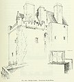 Bridge Castle, Linlithgowshire.jpg 951 × 1,060; 514 KB
-
 Bridge over Brunton Burn - geograph.org.uk - 2018461.jpg 640 × 480; 89 KB
-
 Bridge over Drumtassie Burn - geograph.org.uk - 6420120.jpg 3,264 × 2,448; 3.67 MB
-
 Bridge over the Brunton Burn - geograph.org.uk - 3077861.jpg 3,264 × 2,448; 5.01 MB
-
 Bridge over unnamed burn - geograph.org.uk - 1836425.jpg 1,024 × 768; 251 KB
-
 Bridge, Bedlormie Toll - geograph.org.uk - 4223490.jpg 800 × 600; 433 KB
-
 Bridge, Bogend - geograph.org.uk - 4223479.jpg 800 × 600; 421 KB
-
 Bridgehouse Burn - geograph.org.uk - 6398341.jpg 3,264 × 2,448; 6.05 MB
-
 Bridgehouse Community Hall - geograph.org.uk - 6398338.jpg 3,264 × 2,448; 2.93 MB
-
 Bronze Age graves at Cairnpapple - geograph.org.uk - 1978911.jpg 640 × 480; 62 KB
-
 Broomparkwell Cottage - geograph.org.uk - 4468715.jpg 1,600 × 1,067; 462 KB
-
 Broomparkwell Cottage near Broompark - geograph.org.uk - 1970208.jpg 3,264 × 2,448; 2.56 MB
-
 Burial site, Cairnpapple Hill - geograph.org.uk - 1978944.jpg 640 × 480; 129 KB
-
 Burial site, Cairnpapple Hill - geograph.org.uk - 1978951.jpg 640 × 480; 117 KB
-
 Burn in the Avon Gorge - geograph.org.uk - 1836585.jpg 1,024 × 768; 256 KB
-
 Burnhead wind farm - geograph.org.uk - 5016528.jpg 640 × 480; 131 KB
-
 Bus shelter by B8028 at Westfield - geograph.org.uk - 4468685.jpg 5,184 × 3,456; 7.01 MB
-
 Bus stop on the A89, Westrigg - geograph.org.uk - 4596864.jpg 640 × 480; 59 KB
-
 Cairnpapple burial cist - geograph.org.uk - 1978891.jpg 640 × 480; 61 KB
-
 Cairnpapple burial cist - geograph.org.uk - 1978899.jpg 480 × 640; 62 KB
-
 Cairnpapple burial cist - geograph.org.uk - 1978920.jpg 640 × 480; 87 KB
-
 Cairnpapple burial cists - geograph.org.uk - 1978905.jpg 480 × 640; 62 KB
-
 Cairnpapple Hill - geograph.org.uk - 2054923.jpg 427 × 640; 246 KB
-
 Cairnpapple Hill - geograph.org.uk - 2054942.jpg 640 × 427; 219 KB
-
 Cairnpapple Hill - geograph.org.uk - 2054947.jpg 640 × 427; 296 KB
-
 Cairnpapple Hill - geograph.org.uk - 2054989.jpg 640 × 407; 251 KB
-
 Cairnpapple Hill - geograph.org.uk - 2055001.jpg 640 × 397; 220 KB
-
 Cairnpapple Hill - geograph.org.uk - 2577745.jpg 640 × 480; 307 KB
-
 Cairnpapple Hill - geograph.org.uk - 2735001.jpg 640 × 480; 40 KB
-
 Cairnpapple Hill - geograph.org.uk - 2803685.jpg 1,500 × 1,125; 1.35 MB
-
 Cairnpapple Hill - geograph.org.uk - 3239088.jpg 640 × 637; 101 KB
-
 Cairnpapple Hill - geograph.org.uk - 5879705.jpg 5,184 × 3,888; 4.56 MB
-

-
 Cairnpapple Hill from near The Knock - geograph.org.uk - 3875885.jpg 3,264 × 2,448; 3.76 MB
-
 Cairnpapple Sign - geograph.org.uk - 5879701.jpg 5,184 × 3,888; 4.93 MB
-
 Chain of locks - geograph.org.uk - 2577738.jpg 640 × 480; 298 KB
-
 Children's Play Area ^ Recreation Ground, Torphichen - geograph.org.uk - 4479199.jpg 5,184 × 3,456; 7.5 MB
-
 Children's playground, Blackridge - geograph.org.uk - 4575374.jpg 640 × 480; 75 KB
-
 Cockleroy from Bowden Hill - geograph.org.uk - 2875964.jpg 640 × 427; 368 KB
-
 Cockleroy from the West - geograph.org.uk - 2875843.jpg 640 × 427; 423 KB
-
 Coopers Bar, Blackridge - geograph.org.uk - 4575384.jpg 640 × 480; 78 KB
-
 Covered reservoir, Blackridge - geograph.org.uk - 4208610.jpg 800 × 402; 313 KB
-
 Crawberry Hill (2) - geograph.org.uk - 4767228.jpg 1,024 × 683; 118 KB
-
 Crawberry Hill - geograph.org.uk - 4767227.jpg 1,024 × 683; 94 KB
-
 Croft Plantation - geograph.org.uk - 4208605.jpg 800 × 600; 607 KB
-
 Cup Cake Café Bar - geograph.org.uk - 2875527.jpg 640 × 320; 275 KB
-

-
 Daisies (Bellis perennis) - geograph.org.uk - 2876010.jpg 640 × 430; 323 KB
-

-
 Disused Quarry - geograph.org.uk - 4633851.jpg 640 × 427; 460 KB
-
 Dragonfly at Blawhorn - geograph.org.uk - 2681286.jpg 3,264 × 2,448; 4.03 MB
-
 Dragonfly sculpture at Blawhorn Moss - geograph.org.uk - 6508852.jpg 5,017 × 3,763; 3.97 MB
-
 Drumduff Wind Farm - geograph.org.uk - 6420017.jpg 2,448 × 3,264; 2.21 MB
-
 Drumduff Windfarm - geograph.org.uk - 6420096.jpg 3,264 × 2,448; 2.15 MB
-
 Drystane Dyke - geograph.org.uk - 2875824.jpg 640 × 427; 535 KB
-
 Drystane Dyke - geograph.org.uk - 2875831.jpg 427 × 640; 522 KB
-
 Dumped tyres - geograph.org.uk - 6350263.jpg 1,024 × 683; 371 KB
-
 Dumping Ground - geograph.org.uk - 4633802.jpg 640 × 427; 425 KB
-
 Dyke or Drain^ - geograph.org.uk - 2875979.jpg 640 × 427; 374 KB
-
 East Wall of Torphichen Preceptory - geograph.org.uk - 2874288.jpg 408 × 640; 434 KB
-
 Easter Redburn - geograph.org.uk - 2680941.jpg 3,264 × 2,448; 5.49 MB
-
 Eco House near Blackcraig - geograph.org.uk - 4633869.jpg 640 × 384; 372 KB
-
 Edge of new plantation, Bedlormie - geograph.org.uk - 6508907.jpg 5,152 × 3,864; 6.8 MB
-
 Elridgside Wood - geograph.org.uk - 6420204.jpg 3,264 × 2,448; 2.65 MB
-
 Entering Blackridge - geograph.org.uk - 4575366.jpg 640 × 480; 56 KB
-
 Entering West Lothian - geograph.org.uk - 4575330.jpg 640 × 480; 76 KB
-
 Entryfoot (derelict) - geograph.org.uk - 4767231.jpg 1,024 × 683; 147 KB
-
 EWOS at Westfield - geograph.org.uk - 6398807.jpg 3,264 × 2,448; 3.55 MB
-
 Fallen oak with honey fungus - geograph.org.uk - 1836645.jpg 1,024 × 768; 250 KB
-
 Farm building, Strathavon - geograph.org.uk - 5449758.jpg 640 × 460; 56 KB
-
 Farm buildings (derelict) - geograph.org.uk - 4767773.jpg 1,024 × 683; 185 KB
-
 Farm buildings at Heights - geograph.org.uk - 4018704.jpg 4,320 × 3,240; 2.99 MB
-
 Farm buildings, Avoncrook - geograph.org.uk - 5448632.jpg 640 × 480; 59 KB
-
 Farm track, Strathloanhead - geograph.org.uk - 3831612.jpg 640 × 480; 331 KB
-
 Field Boundary - geograph.org.uk - 2875699.jpg 640 × 427; 465 KB
-
 Field Boundary - geograph.org.uk - 2875984.jpg 640 × 427; 437 KB
-
 Field Drain - geograph.org.uk - 2875723.jpg 427 × 640; 445 KB
-
 Field edge, Hillhouse - geograph.org.uk - 3831482.jpg 640 × 480; 257 KB
-
 Field entrance with roller - geograph.org.uk - 3077867.jpg 3,264 × 2,448; 5.23 MB
-
 Field entrance, Wester Woodside - geograph.org.uk - 5448638.jpg 640 × 480; 65 KB
-
 Field margin trees at Heights farm - geograph.org.uk - 6420119.jpg 3,264 × 2,448; 2.78 MB
-
 Field, Wester Woodside - geograph.org.uk - 2577496.jpg 640 × 480; 286 KB
-
 Fields at Linhouse - geograph.org.uk - 6420124.jpg 3,264 × 2,448; 2.62 MB
-
 Fields near Gormyre - geograph.org.uk - 1836556.jpg 1,024 × 768; 141 KB
-
 Fields near North Couston - geograph.org.uk - 6398883.jpg 3,264 × 2,448; 5.09 MB
-
 Fields near Over Hillhouse - geograph.org.uk - 4633820.jpg 640 × 416; 409 KB
-
 Firewood, anyone^ - geograph.org.uk - 2875898.jpg 640 × 427; 512 KB
-
 Flooded road, Drumtassie - geograph.org.uk - 3831510.jpg 640 × 480; 213 KB
-
 Footbridge over the River Avon - geograph.org.uk - 1836625.jpg 1,024 × 768; 238 KB
-
 Footbridge to the Blawhorn Moss boardwalk - geograph.org.uk - 2681738.jpg 3,264 × 2,448; 4.32 MB
-
 Former garage premises, Torphichen - geograph.org.uk - 4479181.jpg 5,184 × 3,456; 7.09 MB
-
 Former Quarry - geograph.org.uk - 4633848.jpg 640 × 427; 440 KB
-
 Future Grazing - geograph.org.uk - 2875688.jpg 640 × 427; 500 KB
-
 Gate near Kipps - geograph.org.uk - 2876000.jpg 427 × 640; 539 KB
-
 Gormyre Hill - geograph.org.uk - 2577500.jpg 640 × 480; 276 KB
-
 Gormyre Hill - geograph.org.uk - 2875570.jpg 427 × 640; 530 KB
-
 Gormyre Refuge Stone - geograph.org.uk - 2875654.jpg 640 × 405; 384 KB
-
 Gormyre Refuge Stone - geograph.org.uk - 2875669.jpg 427 × 640; 406 KB
-
 Grangemouth from Cairnpapple - geograph.org.uk - 1978969.jpg 640 × 490; 58 KB
-
 Grass field above Blackridge - geograph.org.uk - 4208663.jpg 800 × 450; 313 KB
-
 Grass field above Blackridge - geograph.org.uk - 4208667.jpg 800 × 450; 286 KB
-
 Grassland, Woodside - geograph.org.uk - 3771186.jpg 640 × 426; 239 KB
-
 Grazing and power lines, Westfield - geograph.org.uk - 5448630.jpg 640 × 480; 47 KB
-
 Grazing beside woodland - geograph.org.uk - 4565724.jpg 640 × 480; 82 KB
-
 Grazing land at Bedlormie - geograph.org.uk - 5537768.jpg 4,608 × 3,456; 6.06 MB
-
 Grazing, Crawberry Hill - geograph.org.uk - 4575332.jpg 640 × 480; 58 KB
-
 Grazing, Entryfoot - geograph.org.uk - 4575355.jpg 640 × 480; 63 KB
-
 Heights farm - geograph.org.uk - 6420117.jpg 3,264 × 2,448; 3.27 MB
-
 Heritage trail into the Avon Gorge - geograph.org.uk - 1836533.jpg 1,024 × 768; 229 KB
-
 High Brae - geograph.org.uk - 2874325.jpg 640 × 427; 388 KB
-
 High Brae - geograph.org.uk - 2874331.jpg 640 × 427; 324 KB
-
 Hilderston Farm - geograph.org.uk - 6393790.jpg 3,264 × 2,448; 3.73 MB
-
 Hilltop trees near Gowan Bank - geograph.org.uk - 3831493.jpg 640 × 480; 273 KB
-
 House on the A89, Entryfoot - geograph.org.uk - 4575356.jpg 640 × 439; 47 KB
-

-
 Houses on Redburn Road, Blackridge - geograph.org.uk - 4565729.jpg 640 × 480; 49 KB
-
-
 Industrial site, Bridgehouse - geograph.org.uk - 3831622.jpg 640 × 480; 264 KB
-
 Jubilee Fountain, The Square, Torphichen - geograph.org.uk - 4479193.jpg 800 × 1,200; 289 KB
-
 Junction B792-A706 - geograph.org.uk - 2018476.jpg 640 × 480; 94 KB
-
 Kipps Hill - geograph.org.uk - 2875580.jpg 640 × 427; 382 KB
-
 Kirkyard Gateway - geograph.org.uk - 2874303.jpg 640 × 437; 498 KB
-
 Korean War Memorial - geograph.org.uk - 1979007.jpg 640 × 480; 86 KB
-
 Laid-back Lambs - geograph.org.uk - 2875850.jpg 427 × 640; 437 KB
-
 Lochcote - geograph.org.uk - 2875862.jpg 640 × 427; 381 KB
-
 Lochcote Castle - geograph.org.uk - 2875886.jpg 640 × 427; 507 KB
-
 Lochcote Reservoir - geograph.org.uk - 6176119.jpg 1,600 × 1,067; 360 KB
-
 Lochcote Tower - geograph.org.uk - 2875879.jpg 427 × 640; 511 KB


_-_geograph.org.uk_-_4767797.jpg)
_-_geograph.org.uk_-_4767800.jpg)


_-_geograph.org.uk_-_4767813.jpg)
_-_geograph.org.uk_-_4767816.jpg)


_-_geograph.org.uk_-_4767228.jpg)


_-_geograph.org.uk_-_2876010.jpg)


_-_geograph.org.uk_-_4767231.jpg)


_-_geograph.org.uk_-_4767773.jpg)


_(14784849062).jpg)


&filefrom=Looking+over+to+Blawhorn+Moss+-+geograph.org.uk+-+2681736.jpg#mw-category-media)