Category:Topographic maps of Poland by voivodeship
Jump to navigation
Jump to search
Media in category "Topographic maps of Poland by voivodeship"
The following 19 files are in this category, out of 19 total.
-
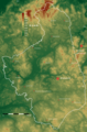
 Dolnoslaskie topo.png 2,942 × 2,254; 8.74 MB
-
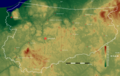
 Kujawsko-pomorskie topo.png 1,968 × 1,918; 6.18 MB
-
 Lodzkie topo.jpg 2,272 × 2,089; 484 KB
-
 Lodzkie topo.png 2,292 × 2,152; 6.29 MB
-
 Lubelskie topo.jpg 2,062 × 2,626; 690 KB
-
 Lubelskie topo.png 2,096 × 2,618; 8.38 MB
-
 Malopolskie topo.png 1,976 × 1,916; 5.87 MB
-
 Mazowieckie topo.jpg 3,012 × 3,086; 573 KB
-
 Mazowieckie topo.png 3,044 × 3,099; 11.43 MB
-
 Podkarpackie topo.png 2,138 × 2,283; 7.97 MB
-
 Podlaskie topo.png 1,808 × 2,744; 7.84 MB
-
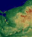
 Pomorskie topo.png 2,348 × 1,800; 6.03 MB
-
 Pomorskie.jpg 2,267 × 1,778; 541 KB
-
 Przedgórze Sudeckie relief.png 4,170 × 3,173; 10.21 MB
-
 Slaskie topo.png 1,585 × 2,352; 5.62 MB
-
 Warminsko-mazurskie topo.png 2,778 × 1,762; 6.73 MB
-
 Wielkopolskie topo.jpg 3,018 × 3,276; 1.29 MB
-
 Wielkopolskie topo.png 3,054 × 3,220; 15.15 MB
-
 Zachodniopomorskie topo.png 2,142 × 2,498; 6.7 MB


