Category:Ternopil Region on the maps of Friedrich von Mieg
Jump to navigation
Jump to search
Subcategories
This category has the following 3 subcategories, out of 3 total.
Media in category "Ternopil Region on the maps of Friedrich von Mieg"
The following 5 files are in this category, out of 5 total.
-
-
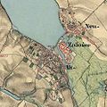
 Galizien und Lodomerien (1779–1783) - First Military Survey - Beresowice.jpg 1,273 × 933; 608 KB
-
 Mapa mig.jpg 1,224 × 488; 567 KB
-
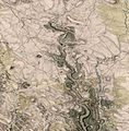 Mig500 14-10.jpg 5,825 × 5,942; 1.57 MB
-
 Монастириська та околиця на мапі фон Міґа.jpg 1,386 × 1,386; 1.72 MB

_-_First_Military_Survey_-_Beresowice.jpg)

