Category:Summerseat
Jump to navigation
Jump to search
English: Summerseat is a village in the Metropolitan Borough of Bury, in Greater Manchester, England. It lies in the Irwell Valley, on the course of the River Irwell to the north of Bury, along the course of the M66 motorway.
village in United Kingdom  | |||||
| Upload media | |||||
| Instance of | |||||
|---|---|---|---|---|---|
| Location | Bury, Greater Manchester, North West England, England | ||||
 | |||||
Subcategories
This category has the following 7 subcategories, out of 7 total.
B
- Brooksbottoms Mill, Summerseat (22 F)
- Brooksbottoms Viaduct (18 F)
C
- Brooksbottom Cricket Club (6 F)
R
- River Irwell, Summerseat (30 F)
S
- Summerseat railway station (34 F)
W
- Waterside Inn, Summerseat (6 F)
Media in category "Summerseat"
The following 200 files are in this category, out of 235 total.
(previous page) (next page)-

-

-
 45407 approaching Summerseat Station - geograph.org.uk - 1240046.jpg 640 × 427; 99 KB
-
 A congregation of gates - geograph.org.uk - 1900138.jpg 3,872 × 2,592; 4.26 MB
-
 A Wintery Riverside at Brooksbottom - geograph.org.uk - 6744046.jpg 1,024 × 768; 569 KB
-
 A56 East of Ramsbottom - geograph.org.uk - 3992442.jpg 3,264 × 2,448; 1.8 MB
-
 A56 Ramsbottom - geograph.org.uk - 381218.jpg 480 × 640; 57 KB
-
 Abandoned football pitch - geograph.org.uk - 464863.jpg 640 × 480; 144 KB
-
 Alley behind Queens Place - geograph.org.uk - 6682393.jpg 1,024 × 768; 670 KB
-
 Aqueduct beside River Irwell - geograph.org.uk - 464800.jpg 640 × 480; 154 KB
-
 Back Pollards Lane, Summerseat - geograph.org.uk - 3798612.jpg 1,024 × 768; 595 KB
-
 Bass Lane - geograph.org.uk - 403784.jpg 640 × 480; 121 KB
-
 Bass Lane with Passing Place - geograph.org.uk - 310670.jpg 640 × 480; 98 KB
-
 Bins in a back passage in Summerseat - geograph.org.uk - 5186905.jpg 6,000 × 4,000; 3.98 MB
-
 Bridge across the Irwell at Brooksbottoms - geograph.org.uk - 6634141.jpg 1,024 × 768; 534 KB
-
 Bridge at Summerseat - panoramio.jpg 3,072 × 2,304; 2.83 MB
-
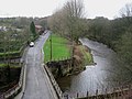
 Bridge over the River Irwell at Summerseat - geograph.org.uk - 4428090.jpg 1,600 × 1,200; 883 KB
-
 Broad Hey Wood Ramsbottom - geograph.org.uk - 400328.jpg 640 × 480; 179 KB
-
 Brooksbottom, Waterside Road - geograph.org.uk - 6644656.jpg 1,024 × 768; 544 KB
-
 Brooksbottoms - geograph.org.uk - 2734832.jpg 1,280 × 960; 898 KB
-

-
 Brooksbottoms, Plantation View - geograph.org.uk - 5100682.jpg 640 × 481; 509 KB
-
 Bury bound - geograph.org.uk - 143334.jpg 640 × 480; 158 KB
-
 Bury Old Road (track) - geograph.org.uk - 3357359.jpg 640 × 480; 564 KB
-
 Bury Old Road - geograph.org.uk - 379149.jpg 480 × 640; 112 KB
-
 Bus Stop on Manchester Road - geograph.org.uk - 4316611.jpg 640 × 480; 239 KB
-
 Buttercups - geograph.org.uk - 464858.jpg 640 × 480; 192 KB
-
 Chest Wheel Bridge - geograph.org.uk - 2773340.jpg 640 × 480; 502 KB
-
 Chest Wheel Farm - geograph.org.uk - 1900068.jpg 3,836 × 2,450; 1.42 MB
-
 Chest Wheel Farm - geograph.org.uk - 427809.jpg 640 × 480; 59 KB
-
 Chest Wheel Farm, Summerseat - geograph.org.uk - 5761909.jpg 640 × 427; 354 KB
-
 Chest Wheel Foot Crossing at Summerseat - geograph.org.uk - 3883458.jpg 640 × 481; 437 KB
-
 Cliff Avenue - geograph.org.uk - 6658981.jpg 1,024 × 768; 456 KB
-
 Closed public house - now demolished - geograph.org.uk - 6643289.jpg 640 × 423; 100 KB
-
 Cobbled footpath - geograph.org.uk - 464875.jpg 480 × 640; 136 KB
-
 Cobbled path north of Brooksbottoms - geograph.org.uk - 1860194.jpg 2,592 × 1,944; 1.7 MB
-
 Cobbled road leading from A56 - geograph.org.uk - 425399.jpg 480 × 640; 160 KB
-
 Cottages in Summerseat - geograph.org.uk - 3798614.jpg 1,024 × 689; 421 KB
-
 Cottages in Summerseat - geograph.org.uk - 3798616.jpg 1,024 × 814; 463 KB
-
 Cottages, Rowlands Road - geograph.org.uk - 2374202.jpg 3,072 × 2,304; 1.3 MB
-
 Crag Avenue-Rowlands Road, Summerseat - geograph.org.uk - 2374300.jpg 3,072 × 2,047; 1.49 MB
-

-

-
 Early Morning on the M66 - geograph.org.uk - 715736.jpg 640 × 480; 82 KB
-
 East Lancs Railway, Summerseat - panoramio (1).jpg 3,072 × 2,304; 3.04 MB
-
 East Lancs Railway, Summerseat - panoramio.jpg 3,072 × 2,304; 2.97 MB
-
 East View Brooksbottoms - geograph.org.uk - 310650.jpg 640 × 480; 86 KB
-
 Entering Summerseat Tunnel - geograph.org.uk - 922565.jpg 640 × 447; 192 KB
-
 Feeding Time - geograph.org.uk - 352265.jpg 640 × 480; 139 KB
-
 Flooding on Rowlands Road - geograph.org.uk - 6658991.jpg 1,024 × 768; 663 KB
-
 Flowers beside footpath - geograph.org.uk - 464893.jpg 640 × 480; 143 KB
-
 Flying Scotman Brooksbottom Tunnel.jpg 3,491 × 2,325; 5.02 MB
-
 Footballers Inn Summerseat - geograph.org.uk - 399621.jpg 640 × 480; 73 KB
-
 Footbridge over M66 Ramsbottom - geograph.org.uk - 378325.jpg 640 × 480; 104 KB
-
 Footpath at Summerseat - geograph.org.uk - 4870636.jpg 640 × 481; 753 KB
-
 Footpath behind Nuttall housing - geograph.org.uk - 464896.jpg 480 × 640; 167 KB
-
 Footpath level crossing south of Summerseat - geograph.org.uk - 4428086.jpg 1,600 × 1,200; 1,011 KB
-
 Footpath to Summerseat - geograph.org.uk - 5102653.jpg 6,000 × 4,000; 5.22 MB
-
 Former Brooksbottoms School - geograph.org.uk - 324111.jpg 640 × 480; 100 KB
-
 Former goods shed, Summerseat.jpg 1,024 × 768; 267 KB
-
 Former LYR Goods Shed at Summerseat - geograph.org.uk - 6674820.jpg 1,024 × 683; 979 KB
-
 Former Mill Workers Cottages, Brooksbottom - geograph.org.uk - 35074.jpg 640 × 426; 146 KB
-
 Former Railway Goods Shed at Summerseat - geograph.org.uk - 6674825.jpg 1,024 × 683; 737 KB
-
 Former Railway Goods Shed, Rowlands Road - geograph.org.uk - 6674817.jpg 1,024 × 683; 837 KB
-
 Gateway off Bury Old Road - geograph.org.uk - 379981.jpg 640 × 480; 143 KB
-
 Going Under - geograph.org.uk - 273571.jpg 640 × 480; 99 KB
-
 Gritting Waterside Road - geograph.org.uk - 2734818.jpg 1,280 × 960; 1.05 MB
-
 Hamer Terrace Brooksbottoms - geograph.org.uk - 314889.jpg 640 × 480; 117 KB
-
 Hazel Hall Lane, Summerseat - geograph.org.uk - 1627196.jpg 640 × 428; 58 KB
-
 Heading South from Summerseat, by the Railway - panoramio.jpg 3,072 × 2,304; 3.32 MB
-
 Higher Sedger Hey Farm - geograph.org.uk - 1752114.jpg 2,816 × 2,112; 824 KB
-
 Hill Street, Summerseat - geograph.org.uk - 2374283.jpg 3,072 × 2,304; 1.6 MB
-
 Hill Street, Summerseat - geograph.org.uk - 6402124.jpg 800 × 1,000; 465 KB
-
 Hill Street, Summerseat - geograph.org.uk - 936282.jpg 640 × 459; 82 KB
-
 Holly Street, Summerseat - geograph.org.uk - 920607.jpg 640 × 480; 79 KB
-
 House near A56 - geograph.org.uk - 381196.jpg 640 × 480; 84 KB
-
 Houses at Lower Summerseat - geograph.org.uk - 4802278.jpg 1,024 × 768; 133 KB
-
 Houses on Miller Street - geograph.org.uk - 3106570.jpg 1,024 × 768; 187 KB
-
 Housing in Nuttall, Ramsbottom - geograph.org.uk - 464829.jpg 640 × 480; 140 KB
-
 Impressive building, Summerseat - geograph.org.uk - 6643309.jpg 640 × 427; 85 KB
-
 Kay Bridge, Brooksbottoms - geograph.org.uk - 3260835.jpg 640 × 480; 430 KB
-
 Kay Bridge, Summerseat - geograph.org.uk - 5503592.jpg 5,152 × 3,864; 7.42 MB
-
 M66 - geograph.org.uk - 295743.jpg 640 × 480; 69 KB
-
 Manchester Road (A56) - geograph.org.uk - 3229301.jpg 640 × 480; 458 KB
-

-
 Methodist Church and school at Rowlands - geograph.org.uk - 4428095.jpg 1,600 × 1,200; 682 KB
-
 Mill Workers' Cottages - geograph.org.uk - 3260829.jpg 640 × 480; 461 KB
-
 Miller Street - geograph.org.uk - 2734927.jpg 1,280 × 960; 888 KB
-
 Miller Street, Summerseat - geograph.org.uk - 5503590.jpg 5,152 × 3,864; 7.08 MB
-
 Miller Street, Summerseat - geograph.org.uk - 6668944.jpg 1,024 × 768; 733 KB
-
 Muddy path behind the houses - geograph.org.uk - 5640054.jpg 6,000 × 4,000; 6.29 MB
-
 Near Chest Wheel Farm - geograph.org.uk - 143208.jpg 640 × 480; 259 KB
-
 New Summerseat House - geograph.org.uk - 2735218.jpg 1,280 × 960; 1.27 MB
-
 Nuttall Brow Cobblestones - geograph.org.uk - 273582.jpg 480 × 640; 176 KB
-
 Nuttall Lane Ramsbottom - geograph.org.uk - 1098794.jpg 640 × 480; 59 KB
-
 Nuttall Park Footbridge - geograph.org.uk - 358962.jpg 640 × 480; 120 KB
-
 Nuttall Railway Cutting - geograph.org.uk - 437064.jpg 480 × 640; 130 KB
-
 Nuttall Railway Cutting - geograph.org.uk - 866994.jpg 640 × 480; 135 KB
-
 Old Digger near Bast House - geograph.org.uk - 381189.jpg 640 × 480; 119 KB
-
 Old Footbridge - geograph.org.uk - 310638.jpg 640 × 480; 138 KB
-
 Old Mill Workers Cottages Robin Road - geograph.org.uk - 310645.jpg 640 × 480; 114 KB
-
 Old Mill Workers Cottages Summerseat - geograph.org.uk - 326104.jpg 640 × 480; 85 KB
-

-
 Old Tractor - geograph.org.uk - 379139.jpg 480 × 640; 87 KB
-
 Park Farm - geograph.org.uk - 1708262.jpg 1,600 × 1,200; 799 KB
-
 Path alongside the Irwell at Summerseat - geograph.org.uk - 5635994.jpg 640 × 480; 666 KB
-
 Path by the railway near Chest Wheel Bridge - geograph.org.uk - 4802284.jpg 1,024 × 768; 356 KB
-
 Path down through Park Wood - geograph.org.uk - 5186932.jpg 6,000 × 4,000; 5.79 MB
-
 Path down to Summerseat - geograph.org.uk - 5222343.jpg 6,000 × 4,000; 5.27 MB
-
 Path down to Summerseat - geograph.org.uk - 6467952.jpg 6,000 × 4,000; 6.42 MB
-
 Path down to Summerseat - geograph.org.uk - 6718407.jpg 6,000 × 4,000; 5.8 MB
-
 Path from Hill Street to Bass Lane - geograph.org.uk - 6607896.jpg 1,022 × 767; 797 KB
-
 Paved pathway at Brooksbottoms - geograph.org.uk - 5863596.jpg 5,152 × 3,864; 7.51 MB
-

-
 Peel Hall Road, Summerseat - geograph.org.uk - 2735204.jpg 1,280 × 960; 1.1 MB
-
 Peel Hall, Bury, 2014.jpg 2,709 × 2,086; 2.48 MB
-
 Pike Wood to Mount Pleasant - geograph.org.uk - 3446433.jpg 3,648 × 2,736; 4.42 MB
-
 Play Area, Summerseat - geograph.org.uk - 920614.jpg 640 × 480; 88 KB
-
 Pollards Lane - geograph.org.uk - 2734857.jpg 960 × 1,280; 843 KB
-
 Pollards Lane - geograph.org.uk - 2734861.jpg 1,280 × 960; 789 KB
-
 Power To The People - geograph.org.uk - 388786.jpg 640 × 480; 69 KB
-
 Public house - now demolished - geograph.org.uk - 6643300.jpg 640 × 422; 82 KB
-
 Queen's Place - geograph.org.uk - 6299422.jpg 800 × 600; 996 KB
-
 Queen's Place, Summerseat, Bury - geograph.org.uk - 2374204.jpg 3,066 × 2,040; 1.36 MB
-
 Queens Place - geograph.org.uk - 5323671.jpg 640 × 480; 626 KB
-
 Queens Place Summerseat - geograph.org.uk - 388809.jpg 640 × 480; 107 KB
-
 Radio Mast next to A56 - geograph.org.uk - 378373.jpg 480 × 640; 50 KB
-
 Radio Mast Ramsbottom - geograph.org.uk - 379144.jpg 480 × 640; 33 KB
-
 Railway Bridge - Summerseat - geograph.org.uk - 4009043.jpg 4,325 × 2,199; 4.02 MB
-
 Railway Street Summerseat - geograph.org.uk - 326867.jpg 640 × 480; 80 KB
-
 Railway Street Summerseat - geograph.org.uk - 343255.jpg 640 × 480; 99 KB
-
 Railway Street, Summerseat - geograph.org.uk - 3883375.jpg 640 × 481; 381 KB
-

-
 Red Hall - geograph.org.uk - 3229303.jpg 640 × 480; 414 KB
-
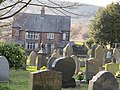
 Redundant Graveyard - geograph.org.uk - 35077.jpg 640 × 426; 230 KB
-
 Repair and Widening of Kay Street Bridge - geograph.org.uk - 6744154.jpg 1,024 × 768; 683 KB
-

-
 Ridshaw Farm - geograph.org.uk - 379986.jpg 640 × 480; 100 KB
-
 River Irwell at Brooksbottom - geograph.org.uk - 5797426.jpg 640 × 480; 538 KB
-

-
 River Irwell, Brooksbottoms - geograph.org.uk - 2734812.jpg 1,280 × 960; 1.17 MB
-
 River Irwell, Brooksbottoms - geograph.org.uk - 464819.jpg 640 × 480; 172 KB
-
 River Irwell, Summerseat - geograph.org.uk - 6402132.jpg 1,024 × 768; 1.35 MB
-
 Robin Road - geograph.org.uk - 3969853.jpg 3,264 × 2,448; 3.9 MB
-
 Rowland's Lower Cemetery, Summerseat, Bury - geograph.org.uk - 2374290.jpg 3,072 × 2,304; 2.37 MB
-
 Rowland's Lower Cemetery, Summerseat, Bury - geograph.org.uk - 2374295.jpg 3,069 × 1,722; 1.15 MB
-
 Rowlands Methodist Church Graveyard - geograph.org.uk - 6624073.jpg 1,024 × 768; 876 KB
-
 Rowlands Methodist Church, Summerseat - geograph.org.uk - 6598541.jpg 1,024 × 768; 533 KB
-
 Rowlands Methodist Church, Summerseat - geograph.org.uk - 84955.jpg 640 × 426; 155 KB
-
 Rowlands Primary School - geograph.org.uk - 3798609.jpg 1,024 × 647; 386 KB
-
 Rowlands Road - geograph.org.uk - 5761914.jpg 640 × 480; 452 KB
-
 Rowlands Road towards Nabbs Farm - geograph.org.uk - 5761919.jpg 640 × 480; 469 KB
-
 Rowlands Road, Bird Hall - geograph.org.uk - 5761916.jpg 640 × 480; 538 KB
-
 Rowlands Road, Epworth House - geograph.org.uk - 6698796.jpg 1,024 × 768; 580 KB
-
 Rowlands Road, Summerseat - geograph.org.uk - 6379624.jpg 800 × 600; 822 KB
-
 Ruby Street - geograph.org.uk - 2734836.jpg 1,280 × 960; 940 KB
-
 Ruby Street, Summerseat - geograph.org.uk - 920608.jpg 640 × 338; 58 KB
-
 Running Water - geograph.org.uk - 313408.jpg 640 × 480; 112 KB
-
 Sign of the Times - geograph.org.uk - 403794.jpg 640 × 480; 79 KB
-
 Stag sculpture on The Irwell Sculpture Trail .jpg 640 × 480; 148 KB
-
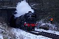
 Steam Train At Summerseat - geograph.org.uk - 387900.jpg 640 × 480; 117 KB
-

-
 Steps from Nuttall Park to M66 - geograph.org.uk - 378323.jpg 480 × 640; 171 KB
-
 Steps to cross the railway at Summerseat - panoramio.jpg 2,304 × 3,072; 2.67 MB
-
 Stile on path between M66 and A56 - geograph.org.uk - 378340.jpg 640 × 480; 123 KB
-
 Stood The Test Of Time. - geograph.org.uk - 350555.jpg 640 × 480; 126 KB
-
 Suburban gardens on a wet New Year's Day - geograph.org.uk - 3797130.jpg 3,872 × 2,592; 3.84 MB
-
 Summerseat - geograph.org.uk - 145372.jpg 640 × 480; 180 KB
-

-
 Summerseat Garden Centre - geograph.org.uk - 4854458.jpg 640 × 481; 401 KB
-
 Summerseat Garden Centre - panoramio.jpg 3,072 × 2,304; 2.71 MB
-
 Summerseat Graveyard.jpg 5,152 × 3,864; 6.97 MB
-
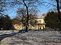 Summerseat House - geograph.org.uk - 2734702.jpg 1,280 × 960; 2 MB
-
 Summerseat House - geograph.org.uk - 2734713.jpg 1,280 × 960; 1.16 MB
-

-

-

-
 Summerseat Methodist Primary School - geograph.org.uk - 6591447.jpg 1,024 × 683; 487 KB
-
 Summerseat Methodist Primary School - geograph.org.uk - 6733531.jpg 1,024 × 683; 432 KB
-
 Summerseat Moss Lane - geograph.org.uk - 388800.jpg 640 × 480; 93 KB
-
 Summerseat, Bury - geograph.org.uk - 2374211.jpg 3,072 × 1,808; 1,021 KB
-
 Summerseat, Castle Street - geograph.org.uk - 6707398.jpg 1,024 × 768; 708 KB
-
 Summerseat, Cottages on Railway Street - geograph.org.uk - 4854455.jpg 640 × 481; 479 KB
-
 Summerseat, Hill Street - geograph.org.uk - 5308485.jpg 640 × 481; 444 KB
-
 Summerseat, Hill Street - geograph.org.uk - 5618668.jpg 640 × 480; 238 KB
-
 Summerseat, Kay Street - geograph.org.uk - 6402126.jpg 1,024 × 768; 596 KB
-
 Summerseat, Lane Behind Queen's Place - geograph.org.uk - 5101248.jpg 640 × 481; 546 KB
-

-
 Summerseat, Pollards Lane - geograph.org.uk - 6668938.jpg 1,024 × 768; 616 KB
-
 Summerseat, Railway Street - geograph.org.uk - 3248958.jpg 640 × 480; 485 KB
-
 Summerseat, Railway Street - geograph.org.uk - 3883744.jpg 640 × 481; 302 KB
-
 Summerseat, Rowlands Road - geograph.org.uk - 5797420.jpg 640 × 480; 632 KB
-
 Summerseat, Rowlands Road - geograph.org.uk - 5808058.jpg 640 × 481; 560 KB
-
 Summerseat, Rowlands Road - geograph.org.uk - 6296890.jpg 800 × 600; 480 KB
-
 Summerseat, Wood Road Lane - geograph.org.uk - 3883388.jpg 640 × 480; 428 KB
-
 Summerseat, Wood Road Lane - geograph.org.uk - 6715523.jpg 1,024 × 768; 471 KB
-
 Terraced Houses at Summerseat - geograph.org.uk - 4910261.jpg 640 × 481; 623 KB
-
 Terraced Houses on Railway Street - geograph.org.uk - 4854456.jpg 640 × 481; 527 KB
-
 The bottom of Jacob's Ladder - geograph.org.uk - 6669110.jpg 6,000 × 4,000; 7.06 MB
-
 The Irwell valley at Summerseat - geograph.org.uk - 2190870.jpg 3,872 × 2,592; 1.83 MB


_-_geograph.org.uk_-_3357359.jpg)


.jpg)


_-_geograph.org.uk_-_3229301.jpg)


