Category:Standing stones in West Yorkshire
Jump to navigation
Jump to search
Subcategories
This category has the following 7 subcategories, out of 7 total.
Media in category "Standing stones in West Yorkshire"
The following 62 files are in this category, out of 62 total.
-
 At the summit of Pule Hill, Marsden - geograph.org.uk - 6668987.jpg 2,000 × 1,500; 1.1 MB
-
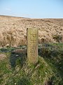
 Boundary Stone marked "JC" - geograph.org.uk - 646402.jpg 640 × 480; 104 KB
-
 Bridleway off Danny Lane, Luddenden Foot - geograph.org.uk - 1170040.jpg 640 × 467; 140 KB
-

-
 Close up of The Pimple - geograph.org.uk - 1319118.jpg 640 × 480; 352 KB
-
 Cowper's Cross, Ilkley Moor - geograph.org.uk - 48269.jpg 640 × 480; 182 KB
-
 Disused field access track off Acre Lane - geograph.org.uk - 3502219.jpg 2,000 × 1,500; 1.24 MB
-
 Footpath on a track to the site of Upper Height, Ovenden - geograph.org.uk - 5025190.jpg 2,000 × 1,473; 857 KB
-
 Gated stile on Sowerby bridge FP81, Norland - geograph.org.uk - 4488589.jpg 1,536 × 2,048; 741 KB
-
 Grobstones Stone Circle, Burley Moor - geograph.org.uk - 44791.jpg 640 × 480; 159 KB
-

-

-
 Honk (2319548342).jpg 2,560 × 1,920; 3.5 MB
-
 Horley Green Lane, near Halifax (1654253457).jpg 3,872 × 2,592; 4.56 MB
-
 Horncliffe Well gatepost - geograph.org.uk - 23702.jpg 640 × 480; 124 KB
-
-
 Informal footpath to Rose Terrace, Skircoat - geograph.org.uk - 5874640.jpg 2,000 × 1,500; 1.19 MB
-
 Junction of Pennine Way and Long Causeway - geograph.org.uk - 99541.jpg 1,600 × 1,200; 1.11 MB
-
 Le patron ne mange pas ici (16804767641).jpg 2,435 × 3,251; 7.63 MB
-
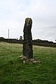
 Leaning stone at Withens Gate (3379664345).jpg 3,843 × 2,527; 6.03 MB
-
 Lonely Post at the Disused Crow Hill Delph Quarries - geograph.org.uk - 4868060.jpg 1,600 × 1,067; 643 KB
-
 Marker Stone on Limersgate - geograph.org.uk - 998953.jpg 640 × 480; 110 KB
-

-
 Mysterious stone on Brighouse FP79, Clifton - geograph.org.uk - 4690602.jpg 1,536 × 2,048; 737 KB
-

-
 Old gatepost on Broad Carr Lane - geograph.org.uk - 2231993.jpg 480 × 640; 216 KB
-
 Old Waymarker Stone in Shibden Dale (geograph 6035286).jpg 450 × 600; 333 KB
-
 Old Wayside Cross (geograph 6560351).jpg 720 × 960; 150 KB
-
 Orienteering post at the ruins of Upper Height, Mixenden - geograph.org.uk - 5347732.jpg 2,000 × 1,500; 1.02 MB
-
 Pack Horse Road stone ^1, Marsden - geograph.org.uk - 797549.jpg 480 × 640; 76 KB
-
 Pack Horse Road stone ^3, Marsden - geograph.org.uk - 797610.jpg 480 × 640; 92 KB
-
 Pack Horse Road stone ^4, Marsden - geograph.org.uk - 828267.jpg 549 × 640; 115 KB
-
 Pack Horse Road stone ^5, Marsden - geograph.org.uk - 828318.jpg 480 × 640; 102 KB
-
 Pack Horse Road stone ^6, Marsden - geograph.org.uk - 828396.jpg 505 × 640; 95 KB
-
 Queensbury FP32 at Bracken Hill - geograph.org.uk - 5280709.jpg 2,048 × 1,536; 1.19 MB
-
 Remains of cross, Morton Moor - geograph.org.uk - 48272.jpg 640 × 480; 219 KB
-
 Road sign - geograph.org.uk - 927300.jpg 480 × 640; 119 KB
-
 Seats and memorials at East Wood Top, Stainland - geograph.org.uk - 4707422.jpg 2,048 × 1,389; 899 KB
-
 Spring, Turner Lane, Halifax - geograph.org.uk - 1614382.jpg 640 × 480; 147 KB
-
 Standing stones near Stones Farm, Todmorden 01.jpg 2,304 × 3,456; 2.33 MB
-
 Standing stones near Stones Farm, Todmorden 02.jpg 2,304 × 3,456; 2.92 MB
-
 Stone near Elland FP01 and Sowerby bridge FP149 - geograph.org.uk - 4329018.jpg 1,500 × 2,000; 1.29 MB
-
 Stone on the old Apperley Bridge - geograph.org.uk - 3704972.jpg 1,500 × 2,000; 1.4 MB
-
 Stone pillar alongside Halifax FP91, Mixenden - geograph.org.uk - 5348330.jpg 2,000 × 1,500; 1.12 MB
-
 Stone post beside Rookes Lane - geograph.org.uk - 6013600.jpg 1,024 × 683; 296 KB
-

-
 Stone slab on Halifax FP676, Skircoat - geograph.org.uk - 5874522.jpg 2,000 × 1,500; 922 KB
-
 Stones on Ilkley Moor (2438832878).jpg 2,560 × 1,712; 4.57 MB
-
 Tall stone at junction of paths, Queensbury - geograph.org.uk - 4937438.jpg 2,048 × 1,536; 1.33 MB
-
 The Fryston finger - geograph.org.uk - 5973118.jpg 4,608 × 3,072; 2.92 MB
-

-

-

-

-
 The Top of Hey Clough - geograph.org.uk - 503037.jpg 640 × 480; 101 KB
-
 Toll bar - geograph.org.uk - 3355044.jpg 640 × 427; 130 KB
-
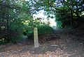 Two paths diverge in a wood (1765164286).jpg 3,332 × 2,273; 4.1 MB
-
 Unusual road sign - geograph.org.uk - 927291.jpg 480 × 640; 110 KB
-

-
 Standing Stone, Carr Manor Field - geograph.org.uk - 93194.jpg 640 × 480; 111 KB
-
 Standing stone, Crow Hill Nook - geograph.org.uk - 16661.jpg 1,024 × 773; 133 KB
-
 Standing Stone, High Brown Knoll Edge - geograph.org.uk - 32524.jpg 640 × 427; 108 KB


_stones,_Rookes_Lane,_Hipperholme_-_geograph.org.uk_-_390931.jpg)


.jpg)
.jpg)


.jpg)
.jpg)


_-_geograph.org.uk_-_837900.jpg)

.jpg)
.jpg)


,_Norland_-_geograph.org.uk_-_4490121.jpg)

.jpg)


.jpg)

.jpg)


