Category:South Humberside Main Line
Jump to navigation
Jump to search
English: The South Humberside Main Line is a railway line in England that runs from Doncaster to Cleethorpes via Scunthorpe.
railway line in the UK   | |||||
| Upload media | |||||
| Instance of | |||||
|---|---|---|---|---|---|
| Part of |
| ||||
| Location |
| ||||
| Owned by | |||||
| Operator | |||||
| |||||
Subcategories
This category has the following 18 subcategories, out of 18 total.
A
B
- Barnby Dun railway station (2 F)
C
- Crowle railway station (10 F)
D
G
- Grimsby Town railway station (36 F)
H
- Habrough railway station (14 F)
K
- Keadby Bridge (25 F)
- Kirk Sandall railway station (10 F)
M
- Medge Hall railway station (2 F)
S
- Scotter Road railway viaduct (9 F)
- Scunthorpe railway station (20 F)
T
- Thorne South railway station (10 F)
V
- Vazon Sliding Railway Bridge (13 F)
Media in category "South Humberside Main Line"
The following 27 files are in this category, out of 27 total.
-
 South Humberside Main Line.png 6,980 × 3,780; 7.24 MB
-
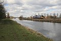 Alongside the Canal - geograph.org.uk - 1735794.jpg 640 × 427; 56 KB
-
 Rail Line to Scunthorpe - geograph.org.uk - 391987.jpg 640 × 426; 134 KB
-
 Barnetby - Scunthorpe Railway Line - geograph.org.uk - 232269.jpg 425 × 640; 134 KB
-
 Bootham Lane bridleway - geograph.org.uk - 1709013.jpg 1,280 × 853; 323 KB
-
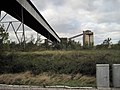 Coal Handling Plant and conveyor - geograph.org.uk - 3717232.jpg 1,024 × 768; 160 KB
-
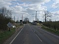
 Elsham Carrs Level Crossing - geograph.org.uk - 516594.jpg 640 × 420; 119 KB
-
 Godnow Bridge Halt - geograph.org.uk - 2208761.jpg 1,024 × 768; 163 KB
-
 Keadby MMB 01 Keadby Power Station.jpg 3,856 × 1,674; 1.99 MB
-
 Keadby MMB 02 Keadby Power Station.jpg 3,859 × 1,881; 2.84 MB
-
 Kirton Lane Level Crossing - geograph.org.uk - 1235877.jpg 640 × 480; 57 KB
-
 Line to Barnetby - geograph.org.uk - 3501661.jpg 640 × 427; 122 KB
-
 Line to Scunthorpe - geograph.org.uk - 3501654.jpg 640 × 427; 129 KB
-
 Railway and Soke Nook Plantation - geograph.org.uk - 3677206.jpg 640 × 482; 59 KB
-
 Railway lines towards Scunthorpe - geograph.org.uk - 495189.jpg 640 × 480; 87 KB
-
 Railway milepost 13, west of Medge Hall level crossing (geograph 5142017).jpg 1,024 × 768; 197 KB
-
 Railway milepost 14, near Godnow Bridge (geograph 5141946).jpg 1,024 × 768; 202 KB
-
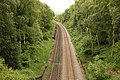
 Railway towards Doncaster - geograph.org.uk - 2550480.jpg 1,600 × 1,200; 551 KB
-
 Railway towards Grimsby - geograph.org.uk - 2529154.jpg 1,600 × 1,200; 600 KB
-
 Railway towards Scunthorpe - geograph.org.uk - 2528305.jpg 1,600 × 1,200; 471 KB
-
 Railway viaduct over Scotter Road - geograph.org.uk - 3831121.jpg 640 × 480; 81 KB
-
 Railway Yard, Scunthorpe - geograph.org.uk - 527348.jpg 640 × 480; 146 KB
-
 The Line to Scunthorpe - geograph.org.uk - 516954.jpg 640 × 426; 133 KB
-
 The Rail Line to Scunthorpe - geograph.org.uk - 496280.jpg 640 × 480; 135 KB
-
 The Railway towards Barnetby - geograph.org.uk - 749664.jpg 640 × 480; 127 KB
-
 Train by the Canal - geograph.org.uk - 1736140.jpg 640 × 427; 85 KB
-
 Viaduct crossing Scotter Road - geograph.org.uk - 3967308.jpg 1,500 × 1,125; 1.68 MB


.jpg)
.jpg)


