Category:Scaftworth
Jump to navigation
Jump to search
English: Scaftworth is a village and civil parish in the Bassetlaw district, in the county of Nottinghamshire, England.
village and civil parish in Nottinghamshire, UK | |||||
| Upload media | |||||
| Instance of | |||||
|---|---|---|---|---|---|
| Location | Bassetlaw, Nottinghamshire, East Midlands, England | ||||
| Population |
| ||||
 | |||||
Media in category "Scaftworth"
The following 54 files are in this category, out of 54 total.
-
 A631 and River Idle - geograph.org.uk - 2350796.jpg 640 × 430; 48 KB
-
 A631 just west of Scaftworth - geograph.org.uk - 2508549.jpg 640 × 480; 52 KB
-
 A631 looking towards Holly House Farm, and Bawtry - geograph.org.uk - 4614791.jpg 3,072 × 1,728; 1.78 MB
-
 A631 Road near Holly House Farm - geograph.org.uk - 4803719.jpg 4,608 × 3,456; 3.71 MB
-
 A631 towards Bawtry - geograph.org.uk - 4047594.jpg 640 × 480; 59 KB
-
 A631 towards Bawtry - geograph.org.uk - 4047598.jpg 640 × 480; 51 KB
-
 Barn across the field - geograph.org.uk - 2136571.jpg 1,024 × 768; 119 KB
-
 Bawtry Bridge from the railway viaduct - geograph.org.uk - 4697439.jpg 1,600 × 954; 221 KB
-
 Bend on the A631 nr Holly House Farm - geograph.org.uk - 2208027.jpg 640 × 427; 85 KB
-
 By The River Idle - near Newington Farm - geograph.org.uk - 4863578.jpg 5,049 × 3,748; 3.85 MB
-
 Entering Bassetlaw District - geograph.org.uk - 1956680.jpg 640 × 480; 70 KB
-
 Farmland near Scaftworth - geograph.org.uk - 4047595.jpg 640 × 480; 78 KB
-
 Fields and Bawtry - geograph.org.uk - 221113.jpg 640 × 480; 90 KB
-
 Fields near Scaftworth - geograph.org.uk - 1917685.jpg 1,024 × 751; 474 KB
-
 Fields near Scaftworth and distant smoke - geograph.org.uk - 1917703.jpg 822 × 1,024; 467 KB
-
 Flooding by the River Idle - geograph.org.uk - 2406248.jpg 640 × 430; 48 KB
-

-
 Footpath and Oak Tree - geograph.org.uk - 221114.jpg 640 × 480; 96 KB
-
 Footpath towards Barrow Hills - geograph.org.uk - 4495368.jpg 1,600 × 1,200; 790 KB
-
 Harvested maize field below Barrow Hills - geograph.org.uk - 2136576.jpg 1,024 × 768; 228 KB
-
 Holly House Farm - geograph.org.uk - 4047599.jpg 640 × 480; 69 KB
-
 Holly House Farm - geograph.org.uk - 4616627.jpg 800 × 533; 148 KB
-
 It's been a dry year... - geograph.org.uk - 4614706.jpg 3,072 × 1,728; 1.65 MB
-
 King William Inn - geograph.org.uk - 4614723.jpg 3,072 × 1,728; 1.62 MB
-
 King William Inn - geograph.org.uk - 4614732.jpg 3,072 × 1,728; 1.47 MB
-

-
 Mind the Cameras - geograph.org.uk - 2208010.jpg 640 × 427; 72 KB
-
 Minor road towards Scaftworth - geograph.org.uk - 4047590.jpg 640 × 480; 100 KB
-
 Ordnance Survey 1GL Bolt - geograph.org.uk - 4983372.jpg 392 × 640; 96 KB
-
 Ordnance Survey Cut Mark - geograph.org.uk - 4983369.jpg 640 × 528; 162 KB
-
 Pasture Lane - geograph.org.uk - 2136564.jpg 1,024 × 768; 188 KB
-
 Path to the woods on Barrow Hills - geograph.org.uk - 2136614.jpg 1,024 × 768; 203 KB
-

-
 Scaftworth Hall (geograph 4803601).jpg 4,480 × 3,354; 3.62 MB
-
 Scaftworth view - geograph.org.uk - 3248567.jpg 640 × 427; 95 KB
-
 Scaftworth village bench around the tree - geograph.org.uk - 1171127.jpg 640 × 457; 103 KB
-
 Scaftworth, King William Public House - geograph.org.uk - 199125.jpg 640 × 427; 139 KB
-
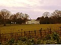
 Scaftworth, Manor House - geograph.org.uk - 199131.jpg 640 × 427; 159 KB
-
 The King William at Scaftworth - geograph.org.uk - 4495312.jpg 1,600 × 1,200; 580 KB
-
 The King William Inn at Scaftworth - geograph.org.uk - 4803716.jpg 4,608 × 3,456; 3.85 MB
-
 The King William Inn, Scaftworth - geograph.org.uk - 4616631.jpg 800 × 533; 88 KB
-
 The King William. - geograph.org.uk - 5209639.jpg 640 × 480; 54 KB
-
 The River Idle at Bawtry - geograph.org.uk - 4616626.jpg 800 × 533; 92 KB
-
 The River Idle near Bawtry - geograph.org.uk - 4795881.jpg 4,608 × 3,456; 3.67 MB
-
 The River Idle near Newington - geograph.org.uk - 5077113.jpg 1,024 × 768; 216 KB
-
 Theaker Lane - geograph.org.uk - 1214910.jpg 640 × 480; 69 KB
-
 Theaker Lane - geograph.org.uk - 2136593.jpg 1,024 × 768; 206 KB
-
 Theaker lane - geograph.org.uk - 2208012.jpg 640 × 427; 77 KB
-
 Theaker Lane entering Scaftworth - geograph.org.uk - 2136598.jpg 1,024 × 768; 243 KB
-
 Theaker Lane ^2 - geograph.org.uk - 1214919.jpg 480 × 640; 135 KB
-
 View near Scaftworth - geograph.org.uk - 2136604.jpg 1,024 × 768; 157 KB
-
 View towards Barrow Hills - geograph.org.uk - 2136550.jpg 1,024 × 768; 119 KB
-
 Water meadows along the River Idle at Bawtry - geograph.org.uk - 4698976.jpg 1,600 × 760; 178 KB
-
 Woodland path in Barrow Hills - geograph.org.uk - 4616633.jpg 533 × 800; 189 KB


_to_Barrow_Hills_-_geograph.org.uk_-_1214920.jpg)


.jpg)


