Category:SVG maps showing history of Montenegro in the Middle Ages
Jump to navigation
Jump to search
Subcategories
This category has the following 10 subcategories, out of 10 total.
F
P
Media in category "SVG maps showing history of Montenegro in the Middle Ages"
The following 26 files are in this category, out of 26 total.
-
 1440 Vojvodsvo Stefana Vukcica Kosace-es.svg 680 × 470; 73 KB
-
 1440 Vojvodsvo Stefana Vukcica Kosace.svg 680 × 470; 52 KB
-
 Attempt to capture the town of Bar 1448.svg 836 × 833; 32 KB
-
 Bulgaria Samuil (997-1014) es.svg 728 × 594; 185 KB
-
 Bulgaria Samuil (997-1014) pt.svg 728 × 594; 185 KB
-
 Bulgaria Samuil (997-1014) zh.svg 728 × 594; 183 KB
-
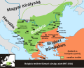 Bulgaria Samuil (997-1014)-hu.svg 728 × 594; 185 KB
-
 Bulgaria Samuil (997-1014).svg 728 × 594; 177 KB
-
 PaganiaZahumljeTravuniaDuklja.svg 805 × 590; 1.08 MB
-
 Despotovina Stefana Lazarevica 1422 godine.svg 845 × 1,620; 114 KB
-
 Division of the area in Serbia by the nobility XIV cAD.svg 1,600 × 1,200; 203 KB
-
 Djuradj II Stracimirovic Balsic map 1386 do 1389.svg 654 × 450; 37 KB
-
 Duklja Raska Bosna dio karte.svg 1,132 × 1,135; 151 KB
-
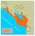 Mletacki posjedi u primorju Zete 1448 godine.svg 1,229 × 1,243; 41 KB
-
 Grad Kotor u vrijeme Balse II Balsica cir.svg 800 × 600; 302 KB
-
 Map Byzantine Empire 1045 2000px svg.png 2,000 × 1,385; 1,000 KB
-
 Novi tvrdjava pozicija 1.svg 2,976 × 585; 63 KB
-
 Rajmond IV Tuluski u Duklji sr cir.svg 626 × 441; 234 KB
-
 Rajmond IV Tuluski u Duklji sr lat.svg 626 × 441; 222 KB
-
 Rajmond IV Tuluski u Duklji-pt.svg 626 × 441; 68 KB
-
 Serb lands in the 9th century-es.svg 1,861 × 1,642; 289 KB
-
 Srbsko IX es.svg 1,259 × 1,024; 218 KB
-
 Srbsko IX v2 es.svg 1,259 × 1,024; 237 KB
-
 Venetian seside properties in Montenegro 1448-es.svg 1,156 × 1,170; 524 KB
-
 Zeta Doclea and Raymond IV de Toulouse-es.svg 2,819 × 1,974; 146 KB
-
 Zeta Doclea and Raymond IV de Toulouse.svg 626 × 441; 225 KB


_es.svg)
_pt.svg)
_zh.svg)
-hu.svg)
.svg)


