Category:Rydal, Cumbria
Jump to navigation
Jump to search
village in Cumbria, United Kingdom  | |||||
| Upload media | |||||
| Instance of | |||||
|---|---|---|---|---|---|
| Location | Lakes, South Lakeland, Cumbria, North West England, England | ||||
| Different from | |||||
 | |||||
Subcategories
This category has the following 11 subcategories, out of 11 total.
B
M
N
- Nab Cottage, Rydal (4 F)
R
- River Rothay stepping stones (12 F)
- Rydal Cave (32 F)
- Rydal Mount (19 F)
- Rydal Park (11 F)
Media in category "Rydal, Cumbria"
The following 84 files are in this category, out of 84 total.
-
 1838-30-Rydal Water and Grassmere, from Rydal Mount.png 1,064 × 690; 963 KB
-
 Alcock Tarn above Grasmere - geograph.org.uk - 797357.jpg 640 × 480; 61 KB
-

-
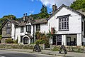
 Badger Bar and restaurant at Rydal - geograph.org.uk - 1959610.jpg 1,600 × 1,198; 523 KB
-
 Badger Bar, Rydal.jpg 3,601 × 2,401; 6.81 MB
-
 Badger's Bar - geograph.org.uk - 2379342.jpg 640 × 440; 248 KB
-
 Barn to east of Howe Top Farmhouse.jpg 3,264 × 2,448; 1.99 MB
-
 Car park near Pelter Bridge - geograph.org.uk - 30271.jpg 640 × 452; 118 KB
-
 Cottage near Rydal Mount - geograph.org.uk - 989265.jpg 640 × 453; 96 KB
-
 Cottages in Rydal, Cumbria - geograph.org.uk - 6382684.jpg 4,057 × 2,047; 3.31 MB
-
 Entrance to Rydal Hall - geograph.org.uk - 2389490.jpg 640 × 413; 268 KB
-
 Fence Post on Black Brow - geograph.org.uk - 695162.jpg 427 × 640; 93 KB
-
 Fold, Rydale - geograph.org.uk - 1940434.jpg 640 × 480; 124 KB
-
 Footbridge over beck at Rydal Water - geograph.org.uk - 1959627.jpg 1,600 × 1,198; 545 KB
-
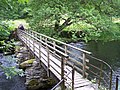 Footbridge over River Rothay at Rydal - geograph.org.uk - 1959613.jpg 1,600 × 1,198; 775 KB
-
 Glen Rothay Hotel.jpg 640 × 480; 112 KB
-
 Grasmere - geograph.org.uk - 370796.jpg 640 × 479; 90 KB
-
 Low Sweden Bridge.jpg 4,000 × 3,000; 4.75 MB
-
 Red Deer - geograph.org.uk - 667097.jpg 640 × 480; 114 KB
-
 Return to Ambleside on the Coffin route (27th April 2019) 004.jpg 5,152 × 3,864; 7.47 MB
-
 Rydal houses (10) (geograph 6241632).jpg 4,320 × 3,240; 4.12 MB
-
 Rydal houses (11) (geograph 6241636).jpg 4,001 × 3,001; 3.87 MB
-
 Rydal houses (7) (geograph 6239740).jpg 4,320 × 3,240; 4.66 MB
-
 Rydal Village and Mt Walker.jpg 1,200 × 791; 160 KB
-
 RydalCumbria.jpg 1,716 × 1,187; 453 KB
-
 Scandale Tarn - geograph.org.uk - 695135.jpg 640 × 427; 298 KB
-
 Stepping Stones, River Rothay - geograph.org.uk - 515515.jpg 463 × 640; 136 KB
-
 Stile Over Wall, Scandale Pass - geograph.org.uk - 551824.jpg 427 × 640; 95 KB
-
 The head of Nab Scar overlooks Rydal Water and Windermere - geograph.org.uk - 760639.jpg 2,604 × 1,953; 5.82 MB
-
 The Old School Room Tea Shop - geograph.org.uk - 1392628.jpg 640 × 480; 114 KB
-
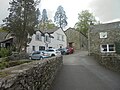
 The road up to Rydal Mount - geograph.org.uk - 2130473.jpg 3,872 × 2,592; 2.18 MB
-
 View from St Mary, Rydal, Cumbria - geograph.org.uk - 949514.jpg 640 × 426; 86 KB
-
 View Rydal church & hall cirra 1860.jpg 368 × 393; 87 KB
-
 View towards Ambleside - geograph.org.uk - 142660.jpg 640 × 479; 107 KB
-
 A wall above Rydal Beck - geograph.org.uk - 607825.jpg 640 × 480; 98 KB
-
 Above High Park - geograph.org.uk - 648463.jpg 640 × 480; 59 KB
-
 Above Rydal - geograph.org.uk - 1008129.jpg 640 × 480; 86 KB
-
 Ambleside from above - geograph.org.uk - 30279.jpg 640 × 425; 66 KB
-
 An impressive cairn for my collection - geograph.org.uk - 760573.jpg 480 × 640; 65 KB
-

-
 Ascending Nab Scar - geograph.org.uk - 1008131.jpg 640 × 480; 78 KB
-
 Brackenwife Knotts from Stone Arthur - geograph.org.uk - 760326.jpg 640 × 480; 60 KB
-
 Buckstones Jump Waterfall - geograph.org.uk - 607801.jpg 640 × 480; 98 KB
-
 Cairns High Bakestones - geograph.org.uk - 112814.jpg 640 × 594; 41 KB
-
 Caiston Beck - geograph.org.uk - 551864.jpg 640 × 427; 111 KB
-
 Caiston Beck - geograph.org.uk - 551882.jpg 640 × 427; 92 KB
-
 Caiston Glen - geograph.org.uk - 551819.jpg 640 × 427; 64 KB
-
 Coach park and the Kirkstone Pass Inn - geograph.org.uk - 461230.jpg 578 × 434; 157 KB
-
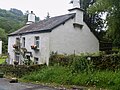
 Cottage, Field Foot - geograph.org.uk - 515522.jpg 452 × 640; 106 KB
-
 East end of Rydal Water - geograph.org.uk - 142673.jpg 640 × 479; 109 KB
-

-
 Fairfield - geograph.org.uk - 374789.jpg 640 × 480; 89 KB
-
 Fairfield Horseshoe - geograph.org.uk - 744730.jpg 478 × 640; 128 KB
-
 Frozen tarn on Red Screes - geograph.org.uk - 741121.jpg 640 × 480; 84 KB
-
 Ivy Crag - geograph.org.uk - 142568.jpg 640 × 479; 95 KB
-
 Just south of Snarker Pike - geograph.org.uk - 10562.jpg 640 × 480; 73 KB
-
 Kirkstone Beck - geograph.org.uk - 206569.jpg 640 × 480; 104 KB
-
 Kirkstone Pass - geograph.org.uk - 35755.jpg 640 × 480; 94 KB
-
 Kirkstone Pass - geograph.org.uk - 43935.jpg 510 × 336; 58 KB
-
 Large Boulder below Erne Crag - geograph.org.uk - 607792.jpg 640 × 480; 55 KB
-
 Lily Tarn - geograph.org.uk - 11659.jpg 640 × 360; 56 KB
-
 Looking up Towards Red Screes - geograph.org.uk - 551876.jpg 640 × 427; 84 KB
-
 Lower Slopes of Loughrigg - geograph.org.uk - 265218.jpg 640 × 383; 111 KB
-
 Nab Scar - geograph.org.uk - 11640.jpg 480 × 640; 93 KB
-
 On the path down from Red Screes - geograph.org.uk - 10563.jpg 640 × 480; 106 KB
-
 Raven Crag - geograph.org.uk - 194238.jpg 640 × 417; 57 KB
-
 Red Screes - geograph.org.uk - 8714.jpg 640 × 480; 71 KB
-
 River Brathay near Clappersgate - geograph.org.uk - 70102.jpg 640 × 480; 195 KB
-
 Road to Upper Sweden Bridge - geograph.org.uk - 12409.jpg 640 × 405; 90 KB
-
 Rocky Knoll, Near Pelter Bridge - geograph.org.uk - 110671.jpg 640 × 480; 75 KB
-
 Rydal Mount Gardens - geograph.org.uk - 30386.jpg 640 × 410; 186 KB
-
 Rydal Water - geograph.org.uk - 27533.jpg 640 × 481; 125 KB
-
 Rydal Water - geograph.org.uk - 332288.jpg 640 × 402; 58 KB
-
 Scandale - geograph.org.uk - 8715.jpg 640 × 480; 94 KB
-
 Scandale Beck - geograph.org.uk - 74319.jpg 640 × 480; 150 KB
-
 Sheepfold alongside Rydal Beck - geograph.org.uk - 257741.jpg 480 × 640; 85 KB
-

-
 Stream Near Jobson Close - geograph.org.uk - 266940.jpg 640 × 480; 155 KB
-
 The Struggle - geograph.org.uk - 53706.jpg 640 × 480; 25 KB
-

-
 Tributary - geograph.org.uk - 142672.jpg 479 × 640; 133 KB
-
 View across Loughrigg - geograph.org.uk - 30280.jpg 640 × 480; 100 KB
-
 View from Loughrigg - geograph.org.uk - 95486.jpg 640 × 160; 29 KB
-
 Wall Bend, Lanty Scar - geograph.org.uk - 266949.jpg 640 × 383; 108 KB


_004.jpg)
_(geograph_6241632).jpg)
_(geograph_6241636).jpg)
_(geograph_6239740).jpg)


