Category:Roughlee
Jump to navigation
Jump to search
village in Lancashire, UK  | |||||
| Upload media | |||||
| Instance of | |||||
|---|---|---|---|---|---|
| Location | Roughlee Booth, Pendle, Lancashire, North West England, England | ||||
 | |||||
English: Roughlee is a village in Pendle, Lancashire, England, in the civil parish of Roughlee Booth. It is close to Nelson, Barrowford and Blacko. The village lies at the foot of Pendle Hill, which is well known for the Pendle Witches and includes the hamlet of Crowtrees . The village is featured in the book The Spook's Battle. (→Roughlee, Lancashire)
Français : Roughlee est un petit village du district de Pendle, dans le Lancashire, en Angleterre, au Royaume-Uni. (→Roughlee)
Nederlands: Roughlee is een plaats en civil parish in het bestuurlijke gebied Pendle, in het Engelse graafschap Lancashire met 328 inwoners. (→Roughlee)
Polski: Roughlee – wieś w Anglii, w hrabstwie Lancashire, w dystrykcie Pendle. Leży 44 km na północ od miasta Manchester i 298 km na północny zachód od Londynu. W 2001 miejscowość liczyła 328 mieszkańców. (→Roughlee (Lancashire))
Media in category "Roughlee"
The following 30 files are in this category, out of 30 total.
-
 Alice Nutter Statue.tif 2,592 × 3,888; 28.87 MB
-
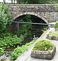 Bridge - panoramio (65).jpg 1,490 × 1,551; 527 KB
-
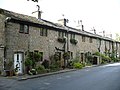
 Cottages at Crow Trees (geograph 3034925).jpg 1,024 × 736; 782 KB
-
 Cottages by Pendle Water, Roughlee - geograph.org.uk - 510598.jpg 640 × 480; 108 KB
-
 Cottages in Roughlee (geograph 3035009).jpg 1,024 × 768; 620 KB
-
 Flood from Pendle Water at Roughlee, Lancashire, England.jpg 2,640 × 1,980; 1.48 MB
-
 Hollin Farm, Roughlee (geograph 3034988).jpg 1,024 × 768; 538 KB
-
 Icy waterfall on Pendle Water - geograph.org.uk - 1626521.jpg 640 × 480; 122 KB
-
 Information Plate (geograph 3494136).jpg 480 × 640; 134 KB
-
 Ogden Reservoirs 001.jpg 2,640 × 1,980; 953 KB
-
 Pendle Water looking downstream at Roughlee (geograph 1857006).jpg 1,632 × 1,224; 419 KB
-
 Remains of a ruin - geograph.org.uk - 1582088.jpg 640 × 480; 106 KB
-
 Road Bridge over Pendle Water at Roughlee (geograph 1857014).jpg 1,632 × 1,224; 466 KB
-
 Road Sign, Roughlee, Pendle (geograph 1857012).jpg 1,224 × 1,632; 196 KB
-
 Roughlee - Old Hall Farm - geograph.org.uk - 67348.jpg 640 × 480; 90 KB
-
 Roughlee Booth, UK - panoramio (11).jpg 1,752 × 1,664; 485 KB
-
 Roughlee Booth, UK - panoramio (12).jpg 2,131 × 1,868; 758 KB
-
 Roughlee Booth, UK - panoramio (6).jpg 1,880 × 1,755; 839 KB
-
 Roughlee Booth, UK - panoramio (8).jpg 1,847 × 1,899; 781 KB
-
 Roughlee Booth, UK - panoramio (9).jpg 1,775 × 1,649; 736 KB
-
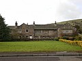 Roughlee Hall - geograph.org.uk - 1201159.jpg 640 × 479; 61 KB
-
 Roughlee sign - geograph.org.uk - 381917.jpg 375 × 500; 238 KB
-
 Roughlee Village (geograph 1857003).jpg 1,632 × 1,224; 238 KB
-
 Sign - geograph.org.uk - 622724.jpg 480 × 640; 161 KB
-
 Stepping stones - panoramio (3).jpg 2,103 × 1,920; 768 KB
-
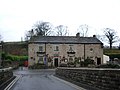 The Bay Horse, Roughlee - geograph.org.uk - 622713.jpg 608 × 456; 128 KB
-
 Waterfall on Pendle Water at Roughlee - geograph.org.uk - 83944.jpg 640 × 448; 118 KB
-
 Weir on Pendle Water, Roughlee - geograph.org.uk - 622725.jpg 640 × 480; 132 KB
-
 Cheaper than a bridge ... - geograph.org.uk - 374596.jpg 640 × 480; 157 KB
-
 Roughlee - waterfall - geograph.org.uk - 67349.jpg 640 × 480; 148 KB
.jpg)
.jpg)

.jpg)

.jpg)

.jpg)

.jpg)

.jpg)
.jpg)

.jpg)
.jpg)
.jpg)
.jpg)
.jpg)


.jpg)

.jpg)


