Category:Ros Muc
Jump to navigation
Jump to search
Cymraeg: Pentref yng nghanol Gaeltacht Conamara yn Swydd Galway, gogledd-orllewin Iwerddon, yw Ros Muc (Saesneg: Rosmuck).
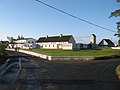
English: Ros Muc is a village in the heart of the Conamara Gaeltacht (Irish-speaking area) of County Galway, Ireland, halfway between the town of Clifden and the city of Galway. It is estimated that people first settled in Ros Muc in 400 A.D., one hundred years before Naomh Briocán (Saint Briocán) brought Christianity to the area. That is to say that there are people that have been in Ros Muc for one thousand five hundred years. Irish is the predominantly spoken language. The District Electoral Division of Turlough, Ros Muc, state that Ros Muc is the most strongly Irish-speaking area in the country. According to an analysis of the census a total of 91.9% of adults over nineteen years old said they spoke Irish on a daily basis. The population of Ros Muc is estimated to be around five hundred people. For the past thirty years there has been a decline in the population, this is mainly due to emigration, although the tide of emigration has subsided in recent years due to the robust nature of the Irish economy. The village is the birth-place of a former president of the Gaelic League, Proinsias Mac Aonghusa.
Français : Ros Muc (le nom est parfois anglicisé en Rosmuck, même si cette dénomination n’a rien d’officiel) est un village situé sur la côte nord de la Baie de Galway, dans le Comté de Galway, en Irlande. La population est environ 500 habitants.
Gaeilge: Tá Ros Muc (Rosmuck as Béarla) suite ar chósta thiar na hÉireann, i gContae na Gaillimhe i lár Ghaeltacht Chonamara. Tá paróiste na Ceathrún Rua suite ar an taobh ó dheas agus paróiste Charna ar an taobh thiar. Ón tSean-Ghaeilge a thagann an logainm Ros Muc. Ciallaíonn ros "leithinis" agus muc "cnoc ciorclach"; mar sin, ciallaíonn Ros Muc "leithinis na gcnoc ciorclach".
town in the Republic of Ireland  | |||||
| Upload media | |||||
| Instance of | |||||
|---|---|---|---|---|---|
| Location | Rosmuck, Turlough, County Galway, Connacht, Ireland | ||||
| Elevation above sea level |
| ||||
 | |||||
Media in category "Ros Muc"
The following 24 files are in this category, out of 24 total.
-
 Boat mooring - geograph.org.uk - 3633899.jpg 640 × 480; 101 KB
-
 Business centre - geograph.org.uk - 3626713.jpg 640 × 480; 101 KB
-
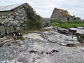
 Cellar Rosmuc Co Galway - geograph.org.uk - 6243824.jpg 577 × 1,024; 128 KB
-
 Cellar Rosmuc Co Galway - geograph.org.uk - 6243832.jpg 1,024 × 768; 265 KB
-
 Cill Bhreacáin quay - geograph.org.uk - 3626617.jpg 640 × 480; 99 KB
-
 Cows on the shore - geograph.org.uk - 3626743.jpg 640 × 480; 101 KB
-
 Gairmscoil na bPiarsach Ros Muc - geograph.org.uk - 3633981.jpg 640 × 480; 93 KB
-
 House by the rocks - geograph.org.uk - 3633913.jpg 640 × 480; 102 KB
-
 Houses above the bog - geograph.org.uk - 3633940.jpg 640 × 480; 103 KB
-
 Incomplete project - geograph.org.uk - 3627088.jpg 640 × 480; 98 KB
-
 Loch with trees - geograph.org.uk - 3634011.jpg 640 × 480; 101 KB
-
 Old slipway - geograph.org.uk - 3626635.jpg 640 × 480; 87 KB
-
 Road at Snámh Bo - geograph.org.uk - 3638322.jpg 640 × 480; 97 KB
-
 Road to the harbour - geograph.org.uk - 3636878.jpg 640 × 480; 96 KB
-
 Roche moutonnée - geograph.org.uk - 3627078.jpg 640 × 480; 88 KB
-
 Rosmuc Church - geograph.org.uk - 3636868.jpg 640 × 480; 96 KB
-
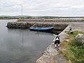 Rosmuc harbour - geograph.org.uk - 3636888.jpg 640 × 480; 100 KB
-
 Rosmuc Health Centre - geograph.org.uk - 3628348.jpg 640 × 480; 77 KB
-
 Rough pasture - geograph.org.uk - 3624906.jpg 640 × 480; 101 KB
-
 Slipway at the end of the road - geograph.org.uk - 1435551.jpg 640 × 480; 97 KB
-
 Smoothed rock outcrops - geograph.org.uk - 3633931.jpg 640 × 480; 103 KB
-
 Thatched ruin - geograph.org.uk - 3636894.jpg 640 × 480; 102 KB
-
 Tidal rapids - geograph.org.uk - 3636830.jpg 640 × 480; 104 KB
-
 Track to the shore - geograph.org.uk - 3633909.jpg 640 × 480; 95 KB


