Category:Roehampton
Jump to navigation
Jump to search
district in south-west London, England, UK  | |||||
| Upload media | |||||
| Instance of | |||||
|---|---|---|---|---|---|
| Location | London Borough of Wandsworth, Greater London, London, England | ||||
 | |||||
Subcategories
This category has the following 22 subcategories, out of 22 total.
A
D
- Downshire House (2 F)
- Drinking Fountain, Roehampton (10 F)
F
- Fairacres, Roehampton (11 F)
G
- Grove House (21 F)
H
I
K
- Kingston Road, Roehampton (6 F)
M
- Mount Clare, Roehampton (11 F)
N
P
- Priory Hospital, London (4 F)
- Putney Park House (4 F)
Q
R
- Roehampton Mounting Block (19 F)
- Roehampton Vale (5 F)
- Roehampton War Memorial (3 F)
S
U
Media in category "Roehampton"
The following 62 files are in this category, out of 62 total.
-
 166 Roehampton Lane, Putney Heath - geograph.org.uk - 3286327.jpg 4,288 × 3,216; 6.77 MB
-
 Alton Road, Roehampton - geograph.org.uk - 4184688.jpg 2,304 × 1,728; 826 KB
-
 Borough of Wandsworth Community Vulnerability Index 2018.png 566 × 459; 368 KB
-
 Bramley House, Roehampton - geograph.org.uk - 3671516.jpg 482 × 640; 88 KB
-
 Buses in Roehampton - geograph.org.uk - 2509816.jpg 4,320 × 3,240; 4.62 MB
-
 Church parade of crippled soldiers, roehampt Wellcome L0024147.jpg 1,600 × 1,180; 1.18 MB
-
 Clive House, Roehampton (1).jpg 2,168 × 1,536; 1.08 MB
-
 Clive House, Roehampton (2).jpg 2,248 × 1,494; 1.33 MB
-
 Danebury Avenue at the corner of Tangley Grove - geograph.org.uk - 4184630.jpg 2,304 × 1,728; 819 KB
-
 Danebury Avenue, London SW15 - geograph.org.uk - 2509784.jpg 4,320 × 3,240; 3.85 MB
-
 Danebury Avenue, London SW15 - geograph.org.uk - 2509810.jpg 4,320 × 3,240; 3.78 MB
-
 Danebury Avenue, London SW15 - geograph.org.uk - 2509825.jpg 4,320 × 3,240; 4.63 MB
-
 Danebury Avenue, Roehampton - geograph.org.uk - 4114064.jpg 3,648 × 2,736; 2.24 MB
-
 Danebury Avenue, Roehampton - geograph.org.uk - 5038390.jpg 640 × 480; 77 KB
-
 Danebury Avenue. London SW15 - geograph.org.uk - 2509831.jpg 4,320 × 3,240; 4.13 MB
-
 Dennison House, Hertfordshire.jpg 959 × 989; 112 KB
-
 Dover Park Drive, Roehampton - geograph.org.uk - 5865817.jpg 1,024 × 768; 247 KB
-
 Flats on Danebury Avenue, Roehampton - geograph.org.uk - 4184694.jpg 2,304 × 1,728; 639 KB
-
 Flats on the Tunworth estate, Roehampton - geograph.org.uk - 1453220.jpg 640 × 456; 102 KB
-
 High rise flats on Tunworth Crescent - geograph.org.uk - 4114087.jpg 2,736 × 3,648; 2.59 MB
-
 Highcliffe Drive, London SW15 - geograph.org.uk - 2509805.jpg 4,320 × 3,240; 4.07 MB
-
 Holyborne Avenue - Roehampton - geograph.org.uk - 6586876.jpg 6,016 × 4,512; 3.85 MB
-
 Holybourne Avenue at the junction of Alton Road - geograph.org.uk - 4184651.jpg 2,304 × 1,728; 810 KB
-
 IPS Main House 1930s.JPG 640 × 428; 49 KB
-
 London Borough of Wandsworth , Roehampton Scenery - geograph.org.uk - 5893239.jpg 6,000 × 4,000; 7.58 MB
-
 Map-Roehampton.jpg 369 × 579; 46 KB
-
 Map-Roehampton.png 374 × 615; 103 KB
-
 Medfield Street, Roehampton. Circa 1914.png 1,849 × 1,041; 1.46 MB
-
 Minstead Gardens, London SW15 - geograph.org.uk - 2509770.jpg 4,320 × 3,240; 4.27 MB
-
 National Tennis Centre and Roehampton Golf Club - geograph.org.uk - 3011464.jpg 3,264 × 2,448; 2.95 MB
-
 Priory Lane, Roehampton - geograph.org.uk - 2219235.jpg 1,600 × 1,200; 591 KB
-
 Putney from the air - geograph.org.uk - 4544467.jpg 640 × 430; 180 KB
-
 R.N.A.S. Roehampton, August 1917 by John Lavery.jpg 800 × 577; 74 KB
-
 Road junction on Danebury Avenue - geograph.org.uk - 3286589.jpg 4,288 × 3,216; 4.97 MB
-
 Roedean Crescent, Roehampton - geograph.org.uk - 4126518.jpg 2,304 × 1,728; 828 KB
-
 Roedean Crescent, SW15 - geograph.org.uk - 4793636.jpg 1,024 × 810; 126 KB
-
 Roehampton from the air - geograph.org.uk - 4537386.jpg 640 × 437; 198 KB
-
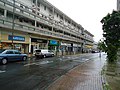
 Roehampton High Street - geograph.org.uk - 2911677.jpg 765 × 1,024; 163 KB
-
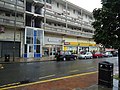
 Roehampton High Street - geograph.org.uk - 5038383.jpg 640 × 480; 74 KB
-
 Roehampton High Street.jpg 4,212 × 2,808; 7.13 MB
-
 Roehampton Lane, Barnes - geograph.org.uk - 2510359.jpg 4,320 × 3,240; 4.49 MB
-
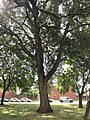
 Roehampton Lucombe Oak (1).jpg 3,024 × 4,032; 6.41 MB
-
 Roehampton Lucombe Oak (2).jpg 3,024 × 4,032; 5.42 MB
-
 Roehampton Lucombe Oak (3).jpg 4,032 × 3,024; 3.81 MB
-
 Roehampton Lucombe Oak (4).jpg 4,032 × 3,024; 4.4 MB
-
 Roehampton Lucombe Oak (5).jpg 3,024 × 4,032; 6.7 MB
-
 Roehampton Lucombe Oak (6).jpg 3,024 × 4,032; 5.7 MB
-
 Roehampton Lucombe Oak (7).jpg 3,024 × 4,032; 6.39 MB
-
 Roehampton, Clarence Lane - geograph.org.uk - 3427744.jpg 3,456 × 2,304; 6.31 MB
-
 Roehampton, Froebel Drive - geograph.org.uk - 3525386.jpg 3,385 × 2,545; 6.69 MB
-

-

-
 Roehampton, Roehampton Gate - geograph.org.uk - 3427734.jpg 3,456 × 2,304; 5.18 MB
-
 Shops and flats, Danebury Avenue, Roehampton - geograph.org.uk - 2509403.jpg 4,320 × 3,240; 4.58 MB
-
 Shops and flats, Danebury Avenue, Roehampton - geograph.org.uk - 2509413.jpg 4,320 × 3,240; 4.53 MB
-
 Shops and flats, Roehampton - geograph.org.uk - 2509820.jpg 4,320 × 3,240; 3.77 MB
-
 Tangley Grove, London SW15 - geograph.org.uk - 2509828.jpg 4,320 × 3,240; 4.71 MB
-
 Tangley Grove, Roehampton - geograph.org.uk - 5041695.jpg 640 × 480; 89 KB
-
 Telephone Box, Putney Heath - geograph.org.uk - 3286310.jpg 4,288 × 3,216; 6.58 MB
-

-
 Tower blocks in Roehampton - geograph.org.uk - 2509777.jpg 4,320 × 3,240; 3.68 MB
-
 Winchfield House, Roehampton.jpg 3,792 × 2,844; 5.59 MB


.jpg)
.jpg)


.jpg)
.jpg)
.jpg)
.jpg)
.jpg)
.jpg)
.jpg)


