Category:Rodborough
Jump to navigation
Jump to search
civil parish in Gloucestershire, England  | |||||
| Upload media | |||||
| Instance of | |||||
|---|---|---|---|---|---|
| Location | Stroud, Gloucestershire, South West England, England | ||||
| Population |
| ||||
 | |||||
Subcategories
This category has the following 2 subcategories, out of 2 total.
R
- Rodborough Fort (6 F)
Media in category "Rodborough"
The following 200 files are in this category, out of 273 total.
(previous page) (next page)-
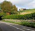
 A46 Bath Road in Stroud - geograph.org.uk - 6409184.jpg 800 × 601; 112 KB
-
 A46 northbound - geograph.org.uk - 4398978.jpg 640 × 385; 49 KB
-
 A46 northbound - geograph.org.uk - 4398988.jpg 640 × 465; 53 KB
-
 A46 northbound - geograph.org.uk - 4398995.jpg 640 × 424; 60 KB
-

-

-
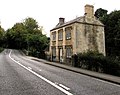
 Ashdon House, Stroud - geograph.org.uk - 4707251.jpg 800 × 574; 104 KB
-
 Autumn bank in Lightpill - geograph.org.uk - 4709337.jpg 800 × 751; 247 KB
-
 Autumn colours, Rodborough Common - geograph.org.uk - 4705313.jpg 800 × 705; 186 KB
-
 Bagpath, Thrupp and Brimscombe - geograph.org.uk - 3973915.jpg 4,211 × 2,800; 2.29 MB
-
 Balustraded bridge by Lodgemore Mill, - geograph.org.uk - 3718220.jpg 640 × 427; 109 KB
-

-

-
 Bath Road direction sign, Lightpill - geograph.org.uk - 4709326.jpg 800 × 643; 133 KB
-
 Bath Road houses, Lightpill - geograph.org.uk - 4709227.jpg 800 × 678; 139 KB
-
 Bath Road houses, Rodborough, Stroud - geograph.org.uk - 4526739.jpg 800 × 543; 134 KB
-

-

-
 Bath Road, Stroud - geograph.org.uk - 3081107.jpg 3,158 × 1,917; 1.43 MB
-
 Bath Road, Stroud - geograph.org.uk - 5011065.jpg 1,600 × 1,065; 543 KB
-
 Bear Hotel, Rodborough Common - geograph.org.uk - 2766782.jpg 640 × 480; 131 KB
-
 Bear of Rodborough - geograph.org.uk - 4705242.jpg 800 × 608; 98 KB
-
 Bear of Rodborough Hotel - geograph.org.uk - 4705283.jpg 800 × 600; 121 KB
-
 Bownham Mead, Rodborough Common - geograph.org.uk - 4705424.jpg 800 × 543; 143 KB
-
-
 Brickfield Terrace, Stroud - geograph.org.uk - 4707236.jpg 800 × 600; 127 KB
-
-
 Butterrow Hill gradient sign, Stroud - geograph.org.uk - 4649064.jpg 738 × 800; 251 KB
-
 Canal bridge - geograph.org.uk - 4815542.jpg 800 × 531; 132 KB
-
 Canal bridge near Bagpath - geograph.org.uk - 4815014.jpg 800 × 531; 176 KB
-
 Car park and road on Rodborough Common - geograph.org.uk - 5858408.jpg 1,600 × 1,200; 744 KB
-
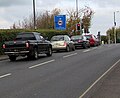
 Car park on Rodborough Common - geograph.org.uk - 4206532.jpg 800 × 531; 110 KB
-
 Cattle grid on Rodborough Common - geograph.org.uk - 4705407.jpg 800 × 600; 169 KB
-
 Cattle in the Nailsworth Valley - geograph.org.uk - 5178489.jpg 1,024 × 768; 240 KB
-
-
 Chimney at Lightpill Mill - geograph.org.uk - 6709062.jpg 427 × 640; 45 KB
-
 Clockhouse name sign, Stroud - geograph.org.uk - 4707799.jpg 800 × 795; 296 KB
-
 Clothier Arms on Bath Road, Stroud - geograph.org.uk - 5008179.jpg 1,600 × 1,065; 641 KB
-
 Clothier Arms on Bath Road, Stroud - geograph.org.uk - 5008181.jpg 1,065 × 1,600; 455 KB
-
 Clothier Arms on Bath Road, Stroud - geograph.org.uk - 5008184.jpg 1,065 × 1,600; 768 KB
-
 Court Way, Stroud - geograph.org.uk - 4706444.jpg 800 × 571; 108 KB
-
 Cows across the path - geograph.org.uk - 5066660.jpg 6,000 × 4,000; 5.94 MB
-

-

-
 Dark Lane - geograph.org.uk - 6433352.jpg 1,600 × 1,153; 237 KB
-
 Dingy Skipper. Erynnis tages - Flickr - gailhampshire (1).jpg 3,064 × 2,576; 1.34 MB
-
 Dingy Skipper. Erynnis tages - Flickr - gailhampshire.jpg 2,664 × 2,360; 969 KB
-
 Direction Sign – Signpost on Rodborough Common - geograph.org.uk - 6516705.jpg 781 × 1,200; 583 KB
-
 Direction Sign – Signpost on Rodborough Hill - geograph.org.uk - 6516702.jpg 1,905 × 3,225; 3.87 MB
-

-
 Disused lock, Thames and Severn Canal, Thrupp - geograph.org.uk - 3380546.jpg 1,024 × 805; 106 KB
-
 Disused Thames and Severn Canal - geograph.org.uk - 4814476.jpg 800 × 531; 181 KB
-
 Diverging paths in woodland - geograph.org.uk - 6605730.jpg 4,032 × 3,024; 4.76 MB
-
 Dougfield bathroom showroom, Stroud - geograph.org.uk - 4292437.jpg 800 × 484; 111 KB
-
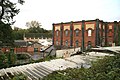
 Dudbridge Mills - geograph.org.uk - 3758429.jpg 640 × 427; 63 KB
-
 Dudbridge Mills, Stroud - geograph.org.uk - 6667467.jpg 427 × 640; 86 KB
-
 Dudbridge Mills, Stroud - geograph.org.uk - 6667474.jpg 640 × 427; 94 KB
-
 Dudbridge Mills, Stroud - geograph.org.uk - 6668963.jpg 640 × 427; 74 KB
-
 Dudbridge Mills, Stroud - geograph.org.uk - 6669030.jpg 640 × 427; 79 KB
-
 Edge of Minchinhampton Common near Bagpath - geograph.org.uk - 5779481.jpg 2,048 × 1,536; 1.37 MB
-

-

-
 Entrance to Rodborough Fort - geograph.org.uk - 4204554.jpg 1,024 × 680; 370 KB
-
 Entrance to Stroud Enterprise Centre - geograph.org.uk - 4709211.jpg 800 × 682; 180 KB
-
 Ermin plant ^ tool hire near Stroud - geograph.org.uk - 4706286.jpg 800 × 573; 97 KB
-
 Eros Close, Lightpill - geograph.org.uk - 4706263.jpg 800 × 743; 124 KB
-
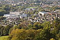
 Evening sunshine on Rodborough - Stroud, Gloucestershire - geograph.org.uk - 3961147.jpg 3,072 × 2,304; 1.6 MB
-

-

-

-
 First Great Western train and canal - geograph.org.uk - 4815020.jpg 800 × 531; 134 KB
-

-
 Former Linton pub in Stroud - geograph.org.uk - 4526795.jpg 800 × 619; 118 KB
-

-
 Former quarrying work, Rodborough Common - geograph.org.uk - 4203530.jpg 1,024 × 680; 283 KB
-
 Former Woodchester Mill - geograph.org.uk - 2159407.jpg 640 × 427; 53 KB
-
 Frome Avenue, Rodborough, Stroud - geograph.org.uk - 4526733.jpg 617 × 800; 114 KB
-
 Frome Hall Lane - geograph.org.uk - 5489843.jpg 1,024 × 768; 253 KB
-
 Frome Hall Lane, Stroud - geograph.org.uk - 4526780.jpg 800 × 535; 97 KB
-
 Frome Park Road, Rodborough, Stroud - geograph.org.uk - 4707276.jpg 800 × 683; 140 KB
-
 Fromehall Mill, Rodborough - geograph.org.uk - 3718250.jpg 640 × 427; 115 KB
-
 Front Runners, Stroud - geograph.org.uk - 4709269.jpg 800 × 602; 106 KB
-
 Golden Cross name sign, Stroud - geograph.org.uk - 4706471.jpg 800 × 580; 113 KB
-
 Golden Valley viaduct - geograph.org.uk - 4817509.jpg 800 × 531; 133 KB
-

-
 Green Carpet. Colostigia pectinaria - Flickr - gailhampshire.jpg 2,000 × 2,320; 539 KB
-
 Green Hairstreak - Flickr - gailhampshire.jpg 2,848 × 2,480; 830 KB
-
 Griffin Mill Lock from railway line - geograph.org.uk - 4697476.jpg 800 × 447; 95 KB
-
 Hillside houses, Swellshill - geograph.org.uk - 4722224.jpg 800 × 719; 180 KB
-
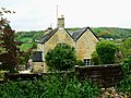
 Hilltop house in Rodborough - geograph.org.uk - 4708150.jpg 800 × 711; 185 KB
-
 Hotel side building, Rodborough Common - geograph.org.uk - 4705346.jpg 800 × 529; 120 KB
-
 Houses above Bath Road, Lightpill - geograph.org.uk - 4709226.jpg 800 × 796; 142 KB
-
 Houses on Bath Road, Nailsworth - geograph.org.uk - 5014238.jpg 1,600 × 1,065; 473 KB
-
 Houses on Bath Road, Stroud - geograph.org.uk - 5008201.jpg 1,600 × 1,065; 567 KB
-

-
 Hybrid Windows showroom, Stroud - geograph.org.uk - 4706389.jpg 800 × 620; 107 KB
-
 JE Clarke Motor Factors, Stroud - geograph.org.uk - 4707265.jpg 800 × 552; 100 KB
-
 Junction in Lightpill near Stroud - geograph.org.uk - 4706268.jpg 800 × 722; 105 KB
-
 Kimmins Mill, Dudbridge - geograph.org.uk - 3758485.jpg 427 × 640; 64 KB
-
 Kimmins Mill, Dudbridge - geograph.org.uk - 6143264.jpg 1,600 × 1,200; 307 KB
-

-
 Kingscourt Lane, Stroud - geograph.org.uk - 4706424.jpg 800 × 542; 127 KB
-
 Kitesnest Lane, Lightpill - geograph.org.uk - 4709243.jpg 800 × 592; 110 KB
-
 Kwik Fit Bath Road side, Stroud - geograph.org.uk - 4292336.jpg 800 × 600; 168 KB
-
 Kwik Fit riverbank side, Stroud - geograph.org.uk - 4707835.jpg 800 × 600; 154 KB
-
 Kwik Fit Stroud - geograph.org.uk - 4526802.jpg 800 × 546; 85 KB
-
 Kwik Fit, Stroud - geograph.org.uk - 4707811.jpg 800 × 600; 120 KB
-
 Level crossing, Ham Mill Lane - geograph.org.uk - 4892368.jpg 1,024 × 768; 173 KB
-
 Lightpill bus stop and shelter - geograph.org.uk - 4709341.jpg 643 × 800; 240 KB
-
 Lightpill houses - geograph.org.uk - 4708226.jpg 800 × 613; 172 KB
-
 Lightpill Mill - geograph.org.uk - 6709077.jpg 640 × 426; 79 KB
-
 Lightpill Mill - geograph.org.uk - 6709080.jpg 640 × 417; 65 KB
-
 Lightpill Mill - geograph.org.uk - 6709090.jpg 640 × 427; 58 KB
-
 Lightpill Mill - geograph.org.uk - 6709094.jpg 640 × 420; 81 KB
-
 Lightpill, near Stroud - geograph.org.uk - 801741.jpg 640 × 480; 184 KB
-
 Linton lost - geograph.org.uk - 3759624.jpg 2,304 × 1,704; 1.45 MB
-
 Lodgemore Mill - geograph.org.uk - 371985.jpg 640 × 480; 135 KB
-
 Lodgemore Mill - geograph.org.uk - 3721440.jpg 640 × 427; 76 KB
-
 Lodgemore Mill - geograph.org.uk - 4818261.jpg 800 × 531; 128 KB
-
 Lodgemore Mill - geograph.org.uk - 5491716.jpg 1,024 × 722; 175 KB
-
 Lodgemore Mill, Rodborough - geograph.org.uk - 3751657.jpg 640 × 427; 73 KB
-
 Lodgemore Mills - geograph.org.uk - 1052888.jpg 640 × 480; 69 KB
-
 Lodgemore Mills, Rodborough - geograph.org.uk - 3718188.jpg 640 × 421; 70 KB
-
 Lodgemore Mills, Rodborough - geograph.org.uk - 3718202.jpg 640 × 427; 100 KB
-
 Lodgemore Mills, Rodborough - geograph.org.uk - 3751659.jpg 640 × 427; 98 KB
-
 Lodgemore Mills, Rodborough - geograph.org.uk - 6716754.jpg 640 × 422; 91 KB
-

-
 Lodgemore Mills, Stroud - geograph.org.uk - 3721448.jpg 640 × 427; 91 KB
-
 Lodgemore Mills, Stroud - geograph.org.uk - 4891479.jpg 1,024 × 768; 128 KB
-
 Lodgemore Swing Bridge - geograph.org.uk - 1052889.jpg 640 × 480; 90 KB
-
 Lower Spillmans, Rodborough, Stroud - geograph.org.uk - 4292602.jpg 605 × 800; 162 KB
-
 Milestone, Bagpath - geograph.org.uk - 2025494.jpg 640 × 480; 70 KB
-
 Milestone, Bagpath - geograph.org.uk - 2025502.jpg 480 × 640; 70 KB
-
 Mist on Rodborough Common - geograph.org.uk - 4203522.jpg 800 × 531; 126 KB
-
 Moors Terrace, Butterrow - geograph.org.uk - 1286610.jpg 640 × 480; 177 KB
-

-
 Navigator Stroud - geograph.org.uk - 4706336.jpg 800 × 575; 99 KB
-
 New Beech Leaves - Flickr - gailhampshire.jpg 3,920 × 3,384; 2.18 MB
-
 New Oak leaves - Flickr - gailhampshire.jpg 4,080 × 2,904; 2.22 MB
-
 New slate roof, Bath Road, Stroud - geograph.org.uk - 4707795.jpg 800 × 602; 114 KB
-
 Nexgen, Stroud - geograph.org.uk - 4707827.jpg 585 × 800; 144 KB
-

-
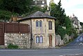 Old Toll House, Butterrow (geograph 6114986).jpg 640 × 434; 137 KB
-
 On Rodborough Common - geograph.org.uk - 4207224.jpg 1,024 × 680; 370 KB
-

-
 On the edge of Rodborough Common - geograph.org.uk - 3454691.jpg 640 × 480; 52 KB
-
 Orchid, Rodborough Common - geograph.org.uk - 1286533.jpg 480 × 640; 130 KB
-
 Orchid, Rodborough Common - geograph.org.uk - 801623.jpg 480 × 640; 161 KB
-
 Ordnance Survey Cut Mark - geograph.org.uk - 5116585.jpg 621 × 640; 140 KB
-
 Over Stroud to Doverow-Glos - geograph.org.uk - 2872039.jpg 3,264 × 2,448; 2.44 MB
-
 Overhead traffic lights, Stroud - geograph.org.uk - 4706404.jpg 800 × 668; 99 KB
-
 Parish of Rodborough boundary sign - geograph.org.uk - 4292361.jpg 800 × 799; 127 KB
-
 Part of Rodborough Common - geograph.org.uk - 5385263.jpg 3,264 × 2,448; 3.22 MB
-
 Path beside the road across Rodborough Common - geograph.org.uk - 5858426.jpg 1,600 × 1,200; 773 KB
-
 Path down to the Frome valley - geograph.org.uk - 5066680.jpg 6,000 × 4,000; 4.81 MB
-
 Path on Rodborough Common - geograph.org.uk - 4855464.jpg 640 × 427; 328 KB
-
 Picture Framing - geograph.org.uk - 6657964.jpg 600 × 900; 636 KB
-
 Playing fields below Rodborough Hill - geograph.org.uk - 5066671.jpg 6,000 × 4,000; 4.06 MB
-
 Post box - Rodborough Common - geograph.org.uk - 3454666.jpg 480 × 640; 97 KB
-
 Prince Albert, Rodborough - geograph.org.uk - 4203516.jpg 800 × 531; 114 KB
-
 Priory Lodge, Rodborough - geograph.org.uk - 4708158.jpg 800 × 636; 131 KB
-
 Probably Cryptocephalus aureolus. Cryptocephalinae - Flickr - gailhampshire (1).jpg 2,580 × 2,226; 635 KB
-
 Probably Cryptocephalus aureolus. Cryptocephalinae - Flickr - gailhampshire (2).jpg 2,392 × 1,896; 494 KB
-
 Probably Cryptocephalus aureolus. Cryptocephalinae - Flickr - gailhampshire.jpg 2,776 × 2,560; 817 KB
-

-
-
 Ragged Moon music studios, Stroud - geograph.org.uk - 4526727.jpg 790 × 800; 179 KB
-
 Railway viaduct - geograph.org.uk - 6607265.jpg 1,024 × 768; 237 KB
-

-
 Redler's at Dudbridge - geograph.org.uk - 719208.jpg 480 × 640; 86 KB
-
 Revive in Stroud - geograph.org.uk - 4709236.jpg 800 × 576; 124 KB
-
 River Frome at Dudbridge, Stroud - geograph.org.uk - 3053714.jpg 900 × 720; 122 KB
-
 River Frome SE of Bath Road, Stroud - geograph.org.uk - 4292374.jpg 800 × 600; 145 KB
-
 River Frome, Stroud - geograph.org.uk - 4292317.jpg 800 × 732; 227 KB
-
 River Frome, Stroud - geograph.org.uk - 4707834.jpg 800 × 600; 190 KB
-
 Road bridge over disused railway line - geograph.org.uk - 6230164.jpg 4,032 × 3,024; 4.99 MB
-
 Roads climbing out of Stroud - geograph.org.uk - 5066646.jpg 6,000 × 4,000; 6.72 MB
-
 Rodborough - geograph.org.uk - 4203544.jpg 800 × 531; 179 KB
-
 Rodborough - geograph.org.uk - 4203554.jpg 800 × 531; 176 KB
-
 Rodborough Castle - geograph.org.uk - 4855458.jpg 640 × 427; 320 KB
-
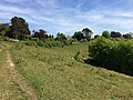
 Rodborough Common - geograph.org.uk - 1286466.jpg 640 × 480; 166 KB
-
 Rodborough Common - geograph.org.uk - 1286481.jpg 640 × 480; 185 KB
-
 Rodborough Common - geograph.org.uk - 3973923.jpg 5,475 × 3,290; 3.67 MB
-
 Rodborough Common - geograph.org.uk - 4203534.jpg 800 × 531; 137 KB
-
 Rodborough Common - geograph.org.uk - 5385261.jpg 3,264 × 2,448; 3.27 MB
-
 Rodborough Common and the Frome valley - geograph.org.uk - 1286517.jpg 640 × 480; 249 KB
-
 Rodborough Common Viewpoint - geograph.org.uk - 3897309.jpg 800 × 547; 115 KB
-
 Rodborough Common, near Stroud - geograph.org.uk - 801619.jpg 640 × 480; 129 KB
-
 Rodborough Common, near Stroud - geograph.org.uk - 801621.jpg 640 × 480; 173 KB
-
 Rodborough Common, near Stroud - geograph.org.uk - 801719.jpg 480 × 640; 172 KB
-
 Rodborough Common, near Stroud - geograph.org.uk - 801827.jpg 640 × 480; 149 KB
-
 Rodborough Common, near Stroud - geograph.org.uk - 801852.jpg 640 × 480; 161 KB
-
 Rodborough Court, Stroud - geograph.org.uk - 4706440.jpg 800 × 663; 125 KB
-
 Rodborough Fort - geograph.org.uk - 5200434.jpg 800 × 600; 77 KB
-
 Rodborough Fort - geograph.org.uk - 5779487.jpg 2,048 × 1,536; 1.3 MB
-
 Rodborough Fort - geograph.org.uk - 6394022.jpg 1,200 × 817; 1.28 MB
-

-
 Rodborough Hill - geograph.org.uk - 4649213.jpg 800 × 795; 173 KB
-
 Rodborough Hill - geograph.org.uk - 5066654.jpg 6,000 × 4,000; 3.44 MB
-
 Rodborough Hill - geograph.org.uk - 5385257.jpg 3,264 × 2,448; 3.3 MB


.jpg)


,_Lodgemore_Mills,_Stroud_-_geograph.org.uk_-_4891484.jpg)
.jpg)


.jpg)
.jpg)


