Category:Randalstown
Jump to navigation
Jump to search
Български: мини|300px|Изглед от Рандалстаун
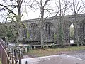
English: Randalstown is a small town in County Antrim, Northern Ireland, located between the towns of Antrim and Toome. It had a population of 4,956 people in the 2001 Census. It has a very prominent disused railway viaduct and lies beside Lough Neagh and the Shane's Castle estate. The town is bypassed by the M22 motorway with junctions at both the eastern and western ends of the town.
Français : Randalstown ( de l'irlandais: Baile Raghnail) est une petite ville dans le comté d' Antrim, en Irlande du Nord, situé entre la ville d'Antrim et Toome.
Nederlands: Randalstown is een plaats in het Noord-Ierse graafschap County Antrim. De plaats telt 4956 inwoners, en is genoemd naar Randal MacDonnell (1609-1683) 2e graaf en 1e markies van Antrim.
town in County Antrim, Northern Ireland  | |||||
| Upload media | |||||
| Instance of | |||||
|---|---|---|---|---|---|
| Location | County Antrim, Northern Ireland | ||||
| Population |
| ||||
 | |||||
Subcategories
This category has the following 2 subcategories, out of 2 total.
C
R
Media in category "Randalstown"
The following 173 files are in this category, out of 173 total.
-
 A good drying day - geograph.org.uk - 3545442.jpg 4,000 × 3,000; 4.3 MB
-
 A6 Main Street, Randalstown - geograph.org.uk - 2346853.jpg 640 × 480; 71 KB
-
 A6, Bridge Street, Randalsrown - geograph.org.uk - 2346909.jpg 640 × 480; 57 KB
-
 A6, Randalstown - geograph.org.uk - 3456046.jpg 640 × 480; 55 KB
-
 Ballygrooby Roundabout - geograph.org.uk - 3361973.jpg 2,048 × 1,536; 461 KB
-
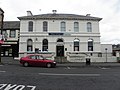
 Bank, Randalstown - geograph.org.uk - 2417511.jpg 636 × 640; 123 KB
-

-
 Brick turretted tower (18357908211).jpg 996 × 928; 549 KB
-
 Bridge Street, Randalstown - geograph.org.uk - 2346848.jpg 640 × 480; 66 KB
-
 Bridge's Project, Randalstown - geograph.org.uk - 2345556.jpg 640 × 480; 50 KB
-
 Bridge, Randalstown - geograph.org.uk - 2346913.jpg 640 × 480; 44 KB
-
 Bridges at Randalstown - geograph.org.uk - 3307553.jpg 2,500 × 1,667; 4.49 MB
-
 Bridges over the River Maine - geograph.org.uk - 3456019.jpg 640 × 254; 39 KB
-
 Budding Designs, Randalstown - geograph.org.uk - 2346820.jpg 640 × 480; 47 KB
-
 Budding Designs, Randalstown - geograph.org.uk - 3456040.jpg 640 × 480; 61 KB
-
 Carngranny level crossing - geograph.org.uk - 274643.jpg 640 × 426; 137 KB
-
 Castle Road - geograph.org.uk - 491916.jpg 640 × 475; 107 KB
-
 Castle Road, Randalstown - geograph.org.uk - 3546445.jpg 4,000 × 3,000; 4.66 MB
-
 Chimney Corner - geograph.org.uk - 3541465.jpg 3,130 × 2,061; 947 KB
-
 Clock, Randalstown - geograph.org.uk - 1624326.jpg 640 × 520; 64 KB
-
 Costcutter, Randalstown - geograph.org.uk - 2346814.jpg 640 × 480; 50 KB
-
 Costcutter, Randalstown - geograph.org.uk - 2346896.jpg 640 × 480; 43 KB
-
 Costcutter, Randalstown - geograph.org.uk - 3456033.jpg 640 × 480; 53 KB
-
 Creggan, near Randalstown - geograph.org.uk - 532895.jpg 640 × 427; 73 KB
-
 Drumsough Crossing - geograph.org.uk - 397599.jpg 640 × 426; 143 KB
-
 Elevated walkway - geograph.org.uk - 2346918.jpg 640 × 480; 44 KB
-

-
 Flush Bracket, Randalstown - geograph.org.uk - 2417516.jpg 640 × 640; 161 KB
-
-

-
 Former railway station, Randalstown - geograph.org.uk - 2346898.jpg 640 × 480; 65 KB
-
 Former school, Randalstown - geograph.org.uk - 2345358.jpg 640 × 480; 38 KB
-

-
 Galvanized bungalow bath, Randalstown - geograph.org.uk - 3455774.jpg 3,240 × 4,320; 4.88 MB
-
 Gate Lodge, Randalstown, Co. Meath - geograph.org.uk - 1281999.jpg 640 × 480; 88 KB
-
 Glenravel House, Randalstown - geograph.org.uk - 2346709.jpg 640 × 480; 55 KB
-
 Gospel Hall, Randalstown - geograph.org.uk - 2346920.jpg 640 × 480; 62 KB
-
-
 Heffron's Bar, Randalstown - geograph.org.uk - 2346819.jpg 640 × 480; 51 KB
-
 Heffron's Bar, Randalstown - geograph.org.uk - 3456037.jpg 640 × 480; 53 KB
-

-
 Information board, Randalstown - geograph.org.uk - 2346716.jpg 640 × 480; 69 KB
-
 James McKeown and Pawn Broker sign - geograph.org.uk - 3456029.jpg 640 × 480; 60 KB
-
-
 John Street, Randastown - geograph.org.uk - 2346489.jpg 640 × 480; 49 KB
-
 John Street, Randastown - geograph.org.uk - 2346495.jpg 640 × 480; 50 KB
-

-
 Kerr Group Insurance, Randalstown - geograph.org.uk - 2345494.jpg 640 × 480; 54 KB
-
 Laverty's, Randalstown - geograph.org.uk - 2346873.jpg 640 × 480; 56 KB
-
 M22 at Dunsilly (1) - geograph.org.uk - 247610.jpg 640 × 426; 128 KB
-
 M22 at Dunsilly (3) - geograph.org.uk - 274669.jpg 640 × 426; 121 KB
-
 Mace, Randalstown - geograph.org.uk - 2346503.jpg 640 × 480; 57 KB
-
 Main Street, Randalstown - geograph.org.uk - 2346861.jpg 640 × 480; 55 KB
-
 Main Street, Randalstown - geograph.org.uk - 3456021.jpg 640 × 480; 68 KB
-
 Maine Family Fashions, Randalstown - geograph.org.uk - 2346834.jpg 640 × 480; 53 KB
-
 Maine river, Randalstown - geograph.org.uk - 2346878.jpg 640 × 480; 67 KB
-
 Mallard on the Maine - geograph.org.uk - 619215.jpg 640 × 499; 107 KB
-
-
 McManus Hardware, Randalstown - geograph.org.uk - 2346858.jpg 640 × 480; 63 KB
-
 McManus Hardware, Randalstown - geograph.org.uk - 3456016.jpg 640 × 480; 76 KB
-
 Minor road nearing Randalstown - geograph.org.uk - 4048759.jpg 2,592 × 1,944; 1.23 MB
-

-
 Neillsbrook Road, Randalstown - geograph.org.uk - 2346712.jpg 640 × 480; 59 KB
-

-

-
-
 Northern Bank, Randalstown - geograph.org.uk - 2346862.jpg 640 × 480; 47 KB
-
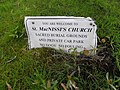 Notice, St MacNissi's Church - geograph.org.uk - 2346892.jpg 640 × 480; 88 KB
-
-
 Old house - geograph.org.uk - 3541480.jpg 4,000 × 3,000; 4.65 MB
-
 Old RC Church, Randalstown - geograph.org.uk - 2346887.jpg 640 × 480; 53 KB
-
 Old Roman Catholic Church - geograph.org.uk - 1108981.jpg 640 × 480; 45 KB
-
 Optometrist, Randalstown - geograph.org.uk - 2346870.jpg 640 × 480; 57 KB
-
 P'Hairfection, Randalstown - geograph.org.uk - 2345554.jpg 640 × 480; 44 KB
-

-
 Plaque, National School, Randalstown - geograph.org.uk - 2346905.jpg 640 × 481; 67 KB
-
 Plaque, Spar Shop - geograph.org.uk - 2345364.jpg 640 × 427; 53 KB
-
 Poly Flinder's Tea Room, Randalstown - geograph.org.uk - 2346514.jpg 640 × 480; 46 KB
-

-
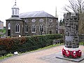
 Randalstown Church of Ireland - geograph.org.uk - 1106073.jpg 640 × 473; 79 KB
-
 Randalstown Flush Bracket - geograph.org.uk - 2136495.jpg 552 × 735; 119 KB
-
 Randalstown Flush Bracket - geograph.org.uk - 2136500.jpg 2,048 × 1,536; 938 KB
-
 Randalstown Library - geograph.org.uk - 636472.jpg 640 × 479; 78 KB
-
 Randalstown Memorial Orange Hall - geograph.org.uk - 636557.jpg 640 × 479; 65 KB
-

-
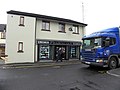
 Randalstown Pharmacies Ltd - geograph.org.uk - 2346811.jpg 640 × 480; 49 KB
-
 Randalstown Road - geograph.org.uk - 3541495.jpg 4,000 × 3,000; 4.75 MB
-
 Randalstown, County Antrim - geograph.org.uk - 2346917.jpg 640 × 480; 47 KB
-
 Randalstown, County Antrim.jpg 640 × 479; 96 KB
-
 Recreation Hall, Randalstown - geograph.org.uk - 2346885.jpg 640 × 480; 40 KB
-
 Road bridge, Randalstown - geograph.org.uk - 347191.jpg 640 × 426; 148 KB
-

-
 Shane's Castle, County Antrim - geograph.org.uk - 155426.jpg 640 × 480; 82 KB
-
 Shane's Street, Randalstown - geograph.org.uk - 2346910.jpg 640 × 480; 81 KB
-
 Shops and pubs, Randalstown - geograph.org.uk - 3456048.jpg 640 × 480; 60 KB
-
 Solo Hair Studio, Randalstown - geograph.org.uk - 2346839.jpg 640 × 480; 50 KB
-

-
-

-

-

-
 St MacNissi's Church, Randalstown - geograph.org.uk - 2346888.jpg 640 × 480; 82 KB
-
 St MacNissi's Churches, Randalstown - geograph.org.uk - 2346883.jpg 640 × 480; 47 KB
-
 St MacNissi's Parish Church hall - geograph.org.uk - 2346880.jpg 640 × 480; 65 KB
-
 Station Road, Randalstown - geograph.org.uk - 2346906.jpg 640 × 480; 52 KB
-
 The Corner house, Randalstown - geograph.org.uk - 2346821.jpg 640 × 480; 41 KB
-
 The Corner House, Randalstown - geograph.org.uk - 3456043.jpg 640 × 480; 54 KB
-
 The M22 at Ballygrooby - geograph.org.uk - 220940.jpg 640 × 426; 135 KB
-
 The M22 near Randalstown - geograph.org.uk - 235058.jpg 640 × 426; 140 KB
-

-
 The Randalstown Viaduct - geograph.org.uk - 3307565.jpg 2,304 × 1,728; 3.57 MB
-
 The River Maine at Randalstown - geograph.org.uk - 347201.jpg 640 × 426; 120 KB
-

-
 Truffles Restaurant, Randalstown - geograph.org.uk - 2346526.jpg 640 × 480; 52 KB
-
 Turret, Randalstown - geograph.org.uk - 636478.jpg 479 × 640; 151 KB
-
 Ulster Bank, Randalstown - geograph.org.uk - 2346705.jpg 640 × 480; 49 KB
-
 UTA 4 Drumsough Crossing - geograph.org.uk - 344986.jpg 640 × 426; 113 KB
-
 Vacant building, Randalstown - geograph.org.uk - 2346518.jpg 640 × 480; 45 KB
-
 Viaduct at Randalstown - geograph.org.uk - 78228.jpg 640 × 479; 173 KB
-
 Viaduct, Randalstown - geograph.org.uk - 2346845.jpg 640 × 285; 39 KB
-
 Walkway, Randalstown - geograph.org.uk - 2346914.jpg 640 × 480; 43 KB
-

-
 Welcome to Randalstown - geograph.org.uk - 4048716.jpg 2,592 × 1,944; 1.46 MB
-

-

-

-

-
 A6 near Randalstown - geograph.org.uk - 633575.jpg 640 × 479; 53 KB
-
 Castle at Randalstown - geograph.org.uk - 636475.jpg 640 × 274; 29 KB
-
 Clonboy Townland - geograph.org.uk - 634169.jpg 640 × 479; 45 KB
-
 Connaught Road - geograph.org.uk - 634190.jpg 640 × 479; 40 KB
-
 Craigmore Townland - geograph.org.uk - 634163.jpg 640 × 479; 51 KB
-
 Crossroads at Craigmore - geograph.org.uk - 634117.jpg 640 × 296; 32 KB
-
 Farr's Bay, Lough Neagh (1) - geograph.org.uk - 618383.jpg 640 × 391; 93 KB
-
 Farr's Bay, Lough Neagh (2) - geograph.org.uk - 618396.jpg 640 × 381; 87 KB
-
 Former railway viaduct at Randalstown (1) - geograph.org.uk - 347159.jpg 640 × 426; 160 KB
-
 Former railway viaduct at Randalstown (2) - geograph.org.uk - 347172.jpg 640 × 426; 130 KB
-
 Land near Randalstown - geograph.org.uk - 636482.jpg 640 × 479; 65 KB
-
 Lenagh Townland - geograph.org.uk - 636490.jpg 640 × 479; 71 KB
-
 Lenagh Townland - geograph.org.uk - 636493.jpg 640 × 479; 50 KB
-
 Lenagh Townland - geograph.org.uk - 636494.jpg 640 × 283; 34 KB
-
 Magheralane Road - geograph.org.uk - 634197.jpg 640 × 479; 38 KB
-
 Magheralane Townland - geograph.org.uk - 634188.jpg 640 × 479; 53 KB
-
 Magheralane Townland - geograph.org.uk - 634193.jpg 640 × 479; 52 KB
-
 Magheralane Townland - geograph.org.uk - 634195.jpg 640 × 479; 57 KB
-
 Magheralane Townland - geograph.org.uk - 634202.jpg 640 × 479; 58 KB
-
 Maine Integrated Primary School - geograph.org.uk - 634178.jpg 640 × 479; 54 KB
-
 Mount Shalgus Lane near Randalstown - geograph.org.uk - 618311.jpg 640 × 401; 125 KB
-
 Near Randalstown - geograph.org.uk - 633578.jpg 640 × 479; 43 KB
-
 Near Randalstown - geograph.org.uk - 634183.jpg 640 × 479; 61 KB
-
 Old cemetery at Mill Town - geograph.org.uk - 169367.jpg 640 × 436; 76 KB
-
 Plaque, Randalstown OC Church - geograph.org.uk - 636560.jpg 640 × 479; 60 KB
-
 Randalstown Central Primary School - geograph.org.uk - 636552.jpg 640 × 479; 52 KB
-
 Randalstown Church of Ireland - geograph.org.uk - 636547.jpg 640 × 605; 52 KB
-
 Randalstown First Presbyterian Church - geograph.org.uk - 636470.jpg 640 × 479; 58 KB
-
 Randalstown Free Prebyterian Church - geograph.org.uk - 636553.jpg 640 × 479; 43 KB
-
 Road at Craigmore - geograph.org.uk - 634155.jpg 640 × 479; 67 KB
-
 Road at Lenagh - geograph.org.uk - 636496.jpg 640 × 479; 51 KB
-
 Road at Magheralane - geograph.org.uk - 634196.jpg 640 × 479; 69 KB
-
 Road at Randalstown - geograph.org.uk - 634176.jpg 640 × 479; 65 KB
-
 Road at Randalstown - geograph.org.uk - 634181.jpg 640 × 479; 38 KB
-
 Road at Randalstown - geograph.org.uk - 636469.jpg 640 × 479; 70 KB
-
 Road near Randalstown - geograph.org.uk - 636484.jpg 640 × 479; 61 KB
-

-

-

-
 St Macnissi's RC Church, Randalstown - geograph.org.uk - 636480.jpg 640 × 305; 27 KB
-
 Tamlaght Townland - geograph.org.uk - 636990.jpg 640 × 479; 55 KB
-
 The Farranflugh Lane near Antrim (1) - geograph.org.uk - 274651.jpg 640 × 426; 140 KB
-
 The M22 beyond Randalstown - geograph.org.uk - 257239.jpg 640 × 426; 134 KB
-
 The Mill Burn at Drumsough - geograph.org.uk - 347150.jpg 640 × 426; 166 KB
-
 The Ramble Inn - geograph.org.uk - 636503.jpg 640 × 293; 25 KB
-
 The rooftops of Randalstown - geograph.org.uk - 619202.jpg 640 × 390; 76 KB


.jpg)


_-_geograph.org.uk_-_247610.jpg)
_-_geograph.org.uk_-_274669.jpg)


_-_geograph.org.uk_-_2346904.jpg)

_-_geograph.org.uk_-_1624603.jpg)
_-_geograph.org.uk_-_1624664.jpg)
_-_geograph.org.uk_-_1624774.jpg)


_-_geograph.org.uk_-_2345467.jpg)
_-_geograph.org.uk_-_2345475.jpg)
_-_geograph.org.uk_-_2345481.jpg)


_-_geograph.org.uk_-_618383.jpg)
_-_geograph.org.uk_-_618396.jpg)
_-_geograph.org.uk_-_347159.jpg)
_-_geograph.org.uk_-_347172.jpg)


_-_geograph.org.uk_-_274651.jpg)


