Category:Rail transport maps of Territoire de Belfort
Jump to navigation
Jump to search
Media in category "Rail transport maps of Territoire de Belfort"
The following 6 files are in this category, out of 6 total.
-
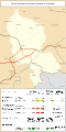
 Railway map of France - 90 - 1870 - fr - small.svg 564 × 1,126; 3.3 MB
-
 Railway map of France - 90 - 1913 - fr - small.svg 564 × 1,126; 3.39 MB
-
 Railway map of France - 90 - 1930 - fr - small.svg 564 × 1,126; 3.41 MB
-
 Railway map of France - 90 - 1980 - fr - small.svg 564 × 1,126; 3.39 MB
-
 Railway map of France - 90 - 2020 - fr - small.svg 564 × 1,126; 3.19 MB
-
 Railway map of France - 90 - animated - fr.gif 1,252 × 2,502; 3.59 MB


