Category:Rail transport in Beverley
Jump to navigation
Jump to search
Subcategories
This category has only the following subcategory.
R
Media in category "Rail transport in Beverley"
The following 16 files are in this category, out of 16 total.
-
 Autumn track IMG 7068.jpg - panoramio.jpg 1,600 × 1,046; 572 KB
-
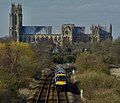
 Beverley IMG 8310 - panoramio.jpg 1,061 × 1,600; 664 KB
-
 Beverley Minster - geograph.org.uk - 540328.jpg 640 × 372; 69 KB
-
 BEVERLY FRIARY 1971.jpg 4,724 × 2,900; 7.51 MB
-
 Footbridge Over Beverley Rail Track - geograph.org.uk - 379552.jpg 480 × 640; 153 KB
-
 Friars Lane Footbridge, Beverley - geograph.org.uk - 866416.jpg 640 × 480; 354 KB
-
 Friary Lane, Beverley, c.1865 (archive ref PH-4-7) (25315771111).jpg 852 × 605; 96 KB
-
 Level Crossing - geograph.org.uk - 1102521.jpg 640 × 477; 117 KB
-
 Level Crossing near Beverley Station - geograph.org.uk - 798552.jpg 640 × 518; 91 KB
-
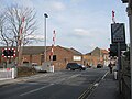
 Level Crossing on Flemingate (B1230) - geograph.org.uk - 800284.jpg 640 × 425; 87 KB
-
 Level crossing, Flemingate - geograph.org.uk - 1774951.jpg 640 × 480; 114 KB
-
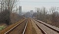
 Rail Track, Beverley - geograph.org.uk - 379543.jpg 480 × 640; 124 KB
-
 Railway at Beverley - geograph.org.uk - 1102660.jpg 480 × 640; 85 KB
-
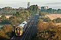
 Railway south of Beverley (geograph 6415795).jpg 1,024 × 882; 1.24 MB
-

-
 The Railway to Cottingham and Hull - geograph.org.uk - 800318.jpg 640 × 378; 104 KB


_(25315771111).jpg)


_-_geograph.org.uk_-_800284.jpg)


.jpg)

