Category:Quality images of signs in France
Jump to navigation
Jump to search
|
The images in this collection have been assessed according to Images guidelines and are considered Quality images. |
 |
Subcategories
This category has the following 5 subcategories, out of 5 total.
.
P
Q
Media in category "Quality images of signs in France"
The following 69 files are in this category, out of 69 total.
-
 14-02-02-straszburg-RalfR-012.jpg 2,848 × 4,288; 2.77 MB
-
 14-02-02-straszburg-RalfR-168.jpg 2,848 × 4,288; 2.28 MB
-
 Arrêt Bus Victor Hugo Mâcon 4.jpg 3,456 × 5,184; 5.18 MB
-
 B10a road sign in Belcastel.jpg 3,056 × 4,584; 9.22 MB
-
 Barèges 65 Repère niv. génrl Puntou 2012.jpg 4,346 × 2,964; 9.39 MB
-
 Black piste Agate in Flaine.jpg 3,304 × 2,434; 3.15 MB
-
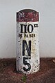 Borne Km 110 Nationale 5 Sens 4.jpg 3,456 × 5,184; 6.3 MB
-
 Cayenne panneau Dengue 2013.jpg 6,100 × 3,544; 11.68 MB
-
 Civray 86 Plaque routière Second Empire 2013.jpg 3,763 × 2,464; 7.98 MB
-
 Civray 86 Plaque-routière émaillée 2013.jpg 4,631 × 3,184; 17.14 MB
-
 Clézentaine, chapelle 06.jpg 3,456 × 2,305; 9.03 MB
-
 Col de Coux 04.jpg 2,905 × 5,315; 15.57 MB
-
 Crevasses in Deux Alpes (France).jpg 2,048 × 1,536; 1.6 MB
-
 Ducey LaManche France Château-des-Montgommery-04.jpg 5,526 × 3,684; 10.97 MB
-
 Ducey LaManche France Château-des-Montgommery-05.jpg 5,722 × 3,815; 11.63 MB
-
 Fingerpost at Pied du Mour (1).jpg 3,739 × 5,803; 13.25 MB
-
 Footpath fingerpost in Limogne-en-Quercy.jpg 3,567 × 5,351; 16.95 MB
-
 French Guiana pont du Larivot panneau.jpg 3,458 × 5,197; 10.64 MB
-
 Gare de Pleslin - Plouër 02.jpg 1,536 × 2,304; 2.06 MB
-
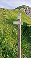
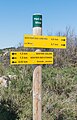
 GR10 guidepost 04.jpg 3,161 × 4,741; 11.45 MB
-
 Grenoble - le Blount.jpg 2,333 × 3,500; 1.64 MB
-
 Guadeloupe creole 2010-03-30.JPG 3,872 × 2,592; 3.86 MB
-
 Guidepost near Saleix.jpg 3,104 × 4,208; 14.22 MB
-
 Hiking sign at Col de l'Ecuell (2).jpg 3,474 × 5,449; 15.02 MB
-
 Hiking sign at La Combe.jpg 3,401 × 5,102; 11.48 MB
-
 Hiking sign at Lac de Roy.jpg 4,000 × 6,000; 13.49 MB
-
 Hiking sign at Lac des Plagnes.jpg 2,860 × 5,053; 16.34 MB
-
 Hiking sign at Le Laouet.jpg 3,073 × 5,506; 9.52 MB
-
 Hiking sign near Mary Magdelene chapel in Guirande.jpg 3,023 × 5,321; 12.29 MB
-
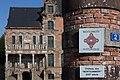
 Hotel du Cap Info Rocquebrune Cap Martin Sep23 A7C 06560.jpg 4,122 × 3,091; 8.53 MB
-
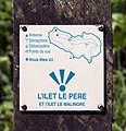 Ilet La Mère info sign.jpg 2,729 × 2,830; 6.71 MB
-
 Info Carnoles Bay Roquebrune Cap Martin Sep23 A7C 06546.jpg 4,710 × 3,140; 8.77 MB
-
 Information about the Bridge Les Pelerins 04.jpg 6,000 × 4,000; 12.31 MB
-
 La Rochebeaucourt 24 Borne Charente-Dordogne 2014.JPG 3,248 × 4,648; 14.21 MB
-
 La Rochefoucauld Enseigne géomètre 2012.jpg 4,097 × 2,840; 6.46 MB
-
 Mansle 16 Plaque routière 2014.jpg 4,417 × 3,201; 14.75 MB
-
 Marennes 17 Repère gaz haute pression 2014.JPG 2,972 × 2,972; 10.9 MB
-
 Marennes 17 Repères NGF 2013.jpg 4,928 × 3,264; 20.11 MB
-
 Marthon 16 Pannonceau licence IV 2013.jpg 2,541 × 2,900; 6.77 MB
-
 Montmoreau 16 Borne 2012.jpg 2,915 × 4,752; 8.39 MB
-
 Nonac 16 Ralentir école 2014.jpg 3,264 × 4,928; 18.03 MB
-
 Panneau Clot Melly Forcalquier 1.jpg 3,024 × 4,032; 2.5 MB
-
 Panneau direction Maisons Alfort Centre Rue Pierre Semard Maisons Alfort 2.jpg 4,032 × 3,024; 5.3 MB
-
 Panneau Direction Noisy Grand D75e Gournay Marne 2.jpg 4,032 × 3,024; 5.14 MB
-
 Panneau Le Merloux à Saint-Maurice-de-Beynost et route vers Margnolias.jpg 3,024 × 4,032; 11.73 MB
-
 Panneau plan domaine Fontainebleau.jpg 2,007 × 3,015; 5.9 MB
-
 Parc Coteaux Avron Neuilly Plaisance 14.jpg 3,024 × 4,032; 3.69 MB
-
 Paris, Metro-Station -Ménilmontant- -- 2014 -- 1382.jpg 5,235 × 3,129; 5.24 MB
-
 Petit-Bersac 24 Enseigne 2013.jpg 4,746 × 2,656; 9.21 MB
-
 Photography forbidden.jpg 3,005 × 2,152; 1.99 MB
-
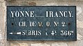 Plaque de cocher, chemin des fossés à Irancy direction Saint-Bris-le-Vineux.jpg 2,376 × 1,309; 2.32 MB
-
 Plaque pompe à incendie (Villefranche-sur-Saône, France).JPG 3,036 × 2,176; 6.03 MB
-
 Red piste Fred in Flaine.jpg 2,822 × 1,960; 2.8 MB
-
 Repère kilométrique 35.103 - Route des Échets (Mas Rillier).jpg 3,300 × 2,520; 8.48 MB
-
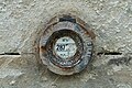
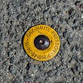
 Repère Nivellement PCK3 68 Avenue Tremblay - Paris XII (FR75) - 2021-02-21 - 1.jpg 3,024 × 4,032; 5.16 MB
-
 Repère Nivellement Porte Craffe - Nancy (FR54) - 2022-02-26 - 2.jpg 2,753 × 2,709; 2.83 MB
-
 Saint-Amant 16 Défense d'afficher 2013.jpg 4,730 × 3,085; 16.92 MB
-
 Sauzé-Vaussais 79 Plaque routière Michelin 2014.jpg 4,505 × 3,003; 13.59 MB
-
 Sign of Les Plus Beaux Villages de France in Belcastel.jpg 4,000 × 6,000; 23.61 MB
-
 Sign of Les Plus Beaux Villages de France in Brousse-le-Chateau.jpg 3,169 × 4,754; 14.98 MB
-
 Sommières-du-Clain Panneau MH&S 2014.jpg 3,096 × 4,367; 14.69 MB
-
 Soyaux 16 Enseigne notaire 2013.jpg 3,317 × 2,514; 5.45 MB
-
 Soyaux 16 Enseignes tabac 2012.jpg 2,288 × 4,936; 4.01 MB
-
 Soyaux Ens notaire2 2013.jpg 3,524 × 2,350; 4.54 MB
-
 St-Aulaye 24 Pannonceau notaire2 2013.jpg 1,903 × 2,558; 3.61 MB
-
 St-Aulaye 24 Pannonceau notaire3 2013.jpg 2,368 × 3,584; 5.58 MB
-
 Trail blaze in Nauviale 01.jpg 2,537 × 3,805; 6.47 MB
-
 Trail blaze in Nauviale 02.jpg 2,224 × 4,170; 5.46 MB
-
 Versailles, rue Pierre-de-Nolhac, repère de nivèlement.jpg 2,304 × 3,456; 12.11 MB


.jpg)


.jpg)


.jpg)


.JPG)

.jpg)
_-_2021-02-21_-_1.jpg)
_-_2022-02-26_-_2.jpg)


