Category:Presbytery of St Werburgh's Church, Birkenhead
Jump to navigation
Jump to search
| Object location | | View all coordinates using: OpenStreetMap |
|---|
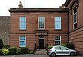
This is a category about listed building number 1282615. |
building in Birkenhead, Merseyside, England, UK  | |||||
| Upload media | |||||
| Instance of | |||||
|---|---|---|---|---|---|
| Location | Birkenhead, Wirral, Merseyside, North West England, England | ||||
| Heritage designation |
| ||||
 | |||||
Media in category "Presbytery of St Werburgh's Church, Birkenhead"
The following 2 files are in this category, out of 2 total.
-
 Presbytery of St Werburgh, Birkenhead 2018.jpg 4,790 × 3,315; 6.43 MB
-
 St Werburgh's Presbytery, Birkenhead.jpg 4,608 × 3,456; 4.6 MB
